TopoQuest Logo
Do you find TopoQuest useful?
Help keep TopoQuest running and adding new maps/features by donating!
Bitcoin:  19c7KJd3qBynnjoSw5npx9KScwjBe4ifkT
Litecoin:  LXs6TkuXGGXo1vDsWCkWVdjQX94eUKd6ui
Home View Maps Find Maps Find Places Resources & Links


Holmesville, Mississippi Topographic Map

USGS Map Title: Holmesville, MS
USGS Map MRC: 31090B3
DRG (GeoTIFF) Download: o31090b3.tif


Neighboring USGS Topographic Map Quads:


  McComb North, MS  
31090C4
 

  Pricedale, MS  
31090C3
 

  Jayess, MS  
31090C2
 

  McComb South, MS  
31090B4
 

  Holmesville, MS  
31090B3
 

  Mesa, MS  
31090B2
 

  Osyka, MS  
31090A4
 

  Progress, MS  
31090A3
 

  Tylertown, MS  
31090A2


Map MRC Location:

N32°
W91°
N32°
W90°
H8 H7 H6 H5 H4 H3 H2 H1
G8 G7 G6 G5 G4 G3 G2 G1
F8 F7 F6 F5 F4 F3 F2 F1
E8 E7 E6 E5 E4 E3 E2 E1
D8 D7 D6 D5 D4 D3 D2 D1
C8 C7 C6 C5 C4 C3 C2 C1
B8 B7 B6 B5 B4 B3 B2 B1
A8 A7 A6 A5 A4 A3 A2 A1
N31°
W91°
N31°
W90°

Holmesville, MS USGS 1:24K Topographic Map Preview:
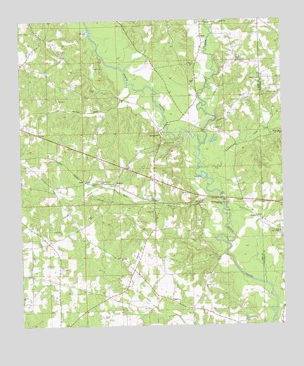
Holmesville, MS USGS Topographic Map
Click on map above to begin viewing in our Map Viewer.

This topographic map contains these locations and features:
Feature Name Type Latitude Longitude GNIS ID View Map
Alford CemeteryCemeteryN31.1485°W90.3554°710026View Map
Andrews-Bickam-Quin CemeteryCemeteryN31.1863°W90.3293°709869View Map
Bars BranchStreamN31.1741°W90.2787°666545View Map
BartoPopulated PlaceN31.1757°W90.3115°691684View Map
BeardensPopulated PlaceN31.1830°W90.3301°691688View Map
Brent CemeteryCemeteryN31.2493°W90.2790°667540View Map
Brent CemeteryCemeteryN31.2496°W90.2906°667541View Map
Brent School (historical)SchoolN31.2449°W90.3034°687616View Map
BridgesPopulated PlaceN31.2030°W90.2504°711125View Map
Brumfield CemeteryCemeteryN31.1296°W90.2965°709924View Map
Charles Young CemeteryCemeteryN31.1816°W90.3315°709888View Map
Church of ChristChurchN31.2196°W90.2526°668447View Map
ConerlyPopulated PlaceN31.1749°W90.2895°691782View Map
Conerly CemeteryCemeteryN31.1749°W90.2890°709894View Map
Conerly CemeteryCemeteryN31.1604°W90.2923°668762View Map
Connally CemeteryCemeteryN31.2260°W90.3684°709893View Map
Ellzey CemeteryCemeteryN31.1538°W90.3329°709944View Map
Gray CemeteryCemeteryN31.1266°W90.2687°670627View Map
Hardscrabble Plantation (historical)LocaleN31.1821°W90.3293°709914View Map
HM Lee Memorial CemeteryCemeteryN31.1629°W90.2509°670815View Map
HolmesvillePopulated PlaceN31.2035°W90.3087°671358View Map
Holmesville Baptist ChurchChurchN31.2049°W90.3093°687646View Map
Holmesville CemeteryCemeteryN31.1996°W90.3070°671359View Map
House of Prayer ChurchChurchN31.2194°W90.2525°2596477View Map
Howell Lake DamDamN31.2052°W90.3551°680608View Map
Kaigler CemeteryCemeteryN31.2066°W90.2887°709949View Map
Leatherwood CreekStreamN31.1849°W90.2845°672347View Map
Leatherwood School (historical)SchoolN31.2002°W90.2731°687651View Map
LeggettPopulated PlaceN31.1355°W90.3040°692000View Map
Leggett CemeteryCemeteryN31.1396°W90.3154°709877View Map
Martin CemeteryCemeteryN31.2218°W90.3390°673174View Map
Martin-McNabb CemeteryCemeteryN31.2460°W90.3443°709960View Map
Martins School (historical)SchoolN31.2174°W90.3457°687656View Map
Mount Cannon ChurchChurchN31.2327°W90.2684°673948View Map
New Holmesville (historical)Populated PlaceN31.2127°W90.3140°687663View Map
Parker Lake DamDamN31.1318°W90.3234°680588View Map
Pink Hill ChurchChurchN31.1418°W90.2881°675917View Map
Pleasant Grove ChurchChurchN31.1835°W90.3362°675991View Map
Pleasant Valley Church of God in ChristChurchN31.2261°W90.2604°676133View Map
Rills CemeteryCemeteryN31.1260°W90.3098°709990View Map
Saint James ChurchChurchN31.1524°W90.3281°677028View Map
Sibley School (historical)SchoolN31.2413°W90.3056°687680View Map
StellaPopulated PlaceN31.1841°W90.3448°692243View Map
Supervisor District 3CivilN31.2267°W90.3317°712033View Map
Thomas CemeteryCemeteryN31.2029°W90.2815°709936View Map
Topisaw CreekStreamN31.1991°W90.2890°678827View Map
VaughtsPopulated PlaceN31.1693°W90.2629°692291View Map
Walker CemeteryCemeteryN31.1288°W90.3362°679262View Map
Warner CemeteryCemeteryN31.2043°W90.3579°710013View Map
Webb CemeteryCemeteryN31.2174°W90.3565°679413View Map
Wingo CemeteryCemeteryN31.2038°W90.2509°679785View Map
Wingo CemeteryCemeteryN31.2432°W90.2879°679786View Map

Note: Coordinates in the location and feature list above are referenced to NAD83 datum.


Copyright (C) 2008-2024 Ryan Niemi / Sunset Dynamics ... All Rights Reserved