TopoQuest Logo
Do you find TopoQuest useful?
Help keep TopoQuest running and adding new maps/features by donating!
Bitcoin:  19c7KJd3qBynnjoSw5npx9KScwjBe4ifkT
Litecoin:  LXs6TkuXGGXo1vDsWCkWVdjQX94eUKd6ui
Home View Maps Find Maps Find Places Resources & Links


Osyka, Mississippi Topographic Map

USGS Map Title: Osyka, MS
USGS Map MRC: 31090A4
DRG (GeoTIFF) Download: o31090a4.tif


Neighboring USGS Topographic Map Quads:


  Lake Tangipahoa, MS  
31090B5
 

  McComb South, MS  
31090B4
 

  Holmesville, MS  
31090B3
 

  Terrys Creek, MS  
31090A5
 

  Osyka, MS  
31090A4
 

  Progress, MS  
31090A3
 

  Kentwood, LA  
30090H5
 

  Spring Creek, LA  
30090H4
 

  Mount Hermon, LA  
30090H3


Map MRC Location:

N32°
W91°
N32°
W90°
H8 H7 H6 H5 H4 H3 H2 H1
G8 G7 G6 G5 G4 G3 G2 G1
F8 F7 F6 F5 F4 F3 F2 F1
E8 E7 E6 E5 E4 E3 E2 E1
D8 D7 D6 D5 D4 D3 D2 D1
C8 C7 C6 C5 C4 C3 C2 C1
B8 B7 B6 B5 B4 B3 B2 B1
A8 A7 A6 A5 A4 A3 A2 A1
N31°
W91°
N31°
W90°

Osyka, MS USGS 1:24K Topographic Map Preview:
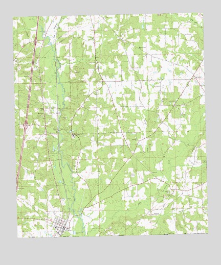
Osyka, MS USGS Topographic Map
Click on map above to begin viewing in our Map Viewer.

This topographic map contains these locations and features:
Feature Name Type Latitude Longitude GNIS ID View Map
Alton Roberts CemeteryCemeteryN31.0421°W90.4959°709868View Map
Ann Tyler CemeteryCemeteryN31.0360°W90.4095°709871View Map
Ard CemeteryCemeteryN31.0396°W90.4037°709873View Map
Ball Lake DamDamN31.0668°W90.4001°680560View Map
Bethlehem ChurchChurchN31.0541°W90.4212°666986View Map
Bluff Springs CemeteryCemeteryN31.0885°W90.3820°709879View Map
Bluff Springs ChurchChurchN31.0880°W90.3818°692653View Map
Centerville Consolidated School (historical)SchoolN31.0588°W90.4293°687618View Map
ChatawaPopulated PlaceN31.0605°W90.4723°691764View Map
Chatawa MissionChurchN31.0718°W90.4812°668355View Map
Dickey CemeteryCemeteryN31.0399°W90.4606°669262View Map
Dykes CemeteryCemeteryN31.0021°W90.4493°709899View Map
Felder CemeteryCemeteryN31.0857°W90.4904°710022View Map
Ford CemeteryCemeteryN31.0035°W90.4540°709905View Map
Forest BranchStreamN31.0257°W90.4076°670085View Map
Fulham CemeteryCemeteryN31.0808°W90.4616°709908View Map
Guiding Light CemeteryCemeteryN31.0760°W90.4031°709913View Map
Guiding Light ChurchChurchN31.0763°W90.4040°670761View Map
Hinson-Knippers CemeteryCemeteryN31.0735°W90.4484°709926View Map
Interchange 4CrossingN31.0638°W90.4934°691395View Map
Interchange 8CrossingN31.1113°W90.4857°691396View Map
Kelly Church (historical)ChurchN31.0338°W90.3887°687649View Map
Kennedy CemeteryCemeteryN31.1104°W90.4270°709951View Map
Knapp CemeteryCemeteryN31.0674°W90.4779°709952View Map
Levi TempleChurchN31.0732°W90.4301°672413View Map
Little Tangipahoa RiverStreamN31.1080°W90.4757°672695View Map
McGehee CemeteryCemeteryN31.0018°W90.4768°709919View Map
McNab CreekStreamN31.0177°W90.4195°673410View Map
McNabb CemeteryCemeteryN31.0121°W90.4045°709966View Map
Mount Calvary CemeteryCemeteryN31.0730°W90.4776°673936View Map
Mount Calvary ChurchChurchN31.0699°W90.4815°673938View Map
Mount Zion CemeteryCemeteryN31.0235°W90.4012°709967View Map
Mount Zion ChurchChurchN31.0238°W90.4007°674327View Map
New Jerusalem ChurchChurchN31.1063°W90.4187°674759View Map
OsykaPopulated PlaceN31.0068°W90.4723°675322View Map
Osyka Baptist ChurchChurchN31.0060°W90.4743°687666View Map
Osyka CemeteryCemeteryN31.0127°W90.4681°709976View Map
Osyka Elementary SchoolSchoolN31.0054°W90.4750°709977View Map
Osyka Police DepartmentBuildingN31.0062°W90.4698°2754298View Map
Osyka Post OfficePost OfficeN31.0068°W90.4708°2768720View Map
Ott Lake DamDamN31.0218°W90.4634°680551View Map
Phelps CemeteryCemeteryN31.1229°W90.3759°709979View Map
Pleasant Spring ChurchChurchN31.0985°W90.4473°676127View Map
Prescot School (historical)SchoolN31.0980°W90.4459°687671View Map
Prescott CemeteryCemeteryN31.1057°W90.4334°709902View Map
Rayborn-Easley CemeteryCemeteryN31.0405°W90.4940°709986View Map
Reeves Lake DamDamN31.1168°W90.4151°680580View Map
Rhodus CemeteryCemeteryN31.0468°W90.3987°709933View Map
Rhodus CemeteryCemeteryN31.0057°W90.4079°710008View Map
Rice CemeteryCemeteryN31.0807°W90.4918°709988View Map
Rural Osyka Volunteer Fire DepartmentBuildingN31.0050°W90.4688°2332867View Map
Saint Mary CemeteryCemeteryN31.0593°W90.4620°709993View Map
Saint Mary of the Pines AcademySchoolN31.0582°W90.4634°677140View Map
Saint Mary of the Pines Catholic ChurchChurchN31.0582°W90.4626°687678View Map
Sandifer CemeteryCemeteryN31.0121°W90.3934°710024View Map
Simmons CemeteryCemeteryN31.0380°W90.3856°709911View Map
Simmons CemeteryCemeteryN31.0257°W90.3859°710023View Map
Slade CemeteryCemeteryN31.0838°W90.4415°709997View Map
Slaven CemeteryCemeteryN31.1002°W90.3779°709998View Map
Stephens (historical)Populated PlaceN31.0752°W90.4737°710002View Map
Strickland CemeteryCemeteryN31.0174°W90.4084°709934View Map
Strickland CemeteryCemeteryN31.0752°W90.3945°678355View Map
Supervisor District 5CivilN31.0731°W90.4246°712035View Map
Tate CemeteryCemeteryN31.0016°W90.4379°710029View Map
Town of OsykaCivilN31.0072°W90.4718°2407058View Map
Varnado CemeteryCemeteryN31.0327°W90.4098°709928View Map
Varnado CemeteryCemeteryN31.0168°W90.4581°709929View Map
Varnado CemeteryCemeteryN31.0016°W90.4204°709973View Map
Varnado CemeteryCemeteryN31.0130°W90.3765°679191View Map
Varnado CemeteryCemeteryN31.0405°W90.3754°679192View Map
Wilson CemeteryCemeteryN31.1124°W90.4387°709892View Map
Wolverton CemeteryCemeteryN31.0274°W90.4745°710027View Map

Note: Coordinates in the location and feature list above are referenced to NAD83 datum.


Copyright (C) 2008-2025 Ryan Niemi / Sunset Dynamics ... All Rights Reserved