TopoQuest Logo
Do you find TopoQuest useful?
Help keep TopoQuest running and adding new maps/features by donating!
Bitcoin:  19c7KJd3qBynnjoSw5npx9KScwjBe4ifkT
Litecoin:  LXs6TkuXGGXo1vDsWCkWVdjQX94eUKd6ui
Home View Maps Find Maps Find Places Resources & Links


Honcut, California Topographic Map

USGS Map Title: Honcut, CA
USGS Map MRC: 39121C5
DRG (GeoTIFF) Download: o39121c5.tif


Neighboring USGS Topographic Map Quads:


  Biggs, CA  
39121D6
 

  Palermo, CA  
39121D5
 

  Bangor, CA  
39121D4
 

  Gridley, CA  
39121C6
 

  Honcut, CA  
39121C5
 

  Loma Rica, CA  
39121C4
 

  Sutter, CA  
39121B6
 

  Yuba City, CA  
39121B5
 

  Browns Valley, CA  
39121B4


Map MRC Location:

N40°
W122°
N40°
W121°
H8 H7 H6 H5 H4 H3 H2 H1
G8 G7 G6 G5 G4 G3 G2 G1
F8 F7 F6 F5 F4 F3 F2 F1
E8 E7 E6 E5 E4 E3 E2 E1
D8 D7 D6 D5 D4 D3 D2 D1
C8 C7 C6 C5 C4 C3 C2 C1
B8 B7 B6 B5 B4 B3 B2 B1
A8 A7 A6 A5 A4 A3 A2 A1
N39°
W122°
N39°
W121°

Honcut, CA USGS 1:24K Topographic Map Preview:
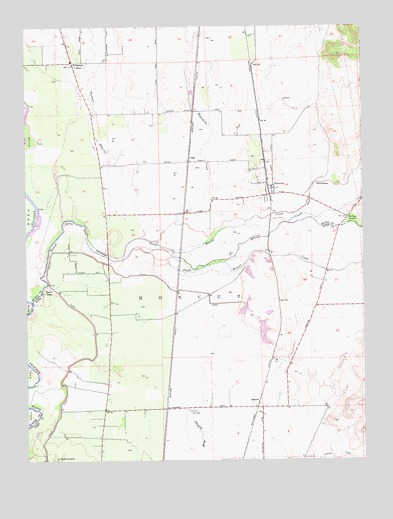
Honcut, CA USGS Topographic Map
Click on map above to begin viewing in our Map Viewer.

This topographic map contains these locations and features:
Feature Name Type Latitude Longitude GNIS ID View Map
Bliss (historical)Populated PlaceN39.2721°W121.5964°1703467View Map
Central HouseBuildingN39.3557°W121.6052°1666771View Map
Central School (historical)SchoolN39.3502°W121.6016°1666772View Map
Coombs (historical)Populated PlaceN39.2963°W121.5325°1703480View Map
CraigPopulated PlaceN39.3374°W121.5641°1658342View Map
HoncutCivilN39.2943°W121.5608°225508View Map
HoncutPopulated PlaceN39.3291°W121.5339°225509View Map
Honcut Census Designated PlaceCensusN39.3326°W121.5388°2612482View Map
Honcut CreekStreamN39.2960°W121.6238°2740525View Map
Honcut SchoolSchoolN39.3288°W121.5347°1723967View Map
Honcut School (historical)SchoolN39.2727°W121.5958°1703493View Map
La Finca OrchardsLocaleN39.2502°W121.6152°226724View Map
North Honcut CreekStreamN39.3144°W121.6034°264227View Map
North Tree Fire International Station 20 Main OperationsBuildingN39.2691°W121.5337°2621914View Map
Pacific RanchLocaleN39.2993°W121.6158°230211View Map
Prairie School (historical)SchoolN39.2607°W121.5386°1703509View Map
RamirezPopulated PlaceN39.2674°W121.5389°1659463View Map
Robinsons CornerPopulated PlaceN39.3643°W121.6080°252782View Map
Section Seven Gun ClubLocaleN39.2646°W121.5655°1654427View Map
South Honcut CreekStreamN39.3144°W121.6034°267524View Map
Wilson CreekStreamN39.3104°W121.5722°237969View Map
Wyandotte CreekStreamN39.3132°W121.5764°238208View Map
Wyman RavineValleyN39.3143°W121.5830°238215View Map

Note: Coordinates in the location and feature list above are referenced to NAD83 datum.


Copyright (C) 2008-2024 Ryan Niemi / Sunset Dynamics ... All Rights Reserved