TopoQuest Logo
Do you find TopoQuest useful?
Help keep TopoQuest running and adding new maps/features by donating!
Bitcoin:  19c7KJd3qBynnjoSw5npx9KScwjBe4ifkT
Litecoin:  LXs6TkuXGGXo1vDsWCkWVdjQX94eUKd6ui
Home View Maps Find Maps Find Places Resources & Links


Loma Rica, California Topographic Map

USGS Map Title: Loma Rica, CA
USGS Map MRC: 39121C4
DRG (GeoTIFF) Download: o39121c4.tif


Neighboring USGS Topographic Map Quads:


  Palermo, CA  
39121D5
 

  Bangor, CA  
39121D4
 

  Rackerby, CA  
39121D3
 

  Honcut, CA  
39121C5
 

  Loma Rica, CA  
39121C4
 

  Oregon House, CA  
39121C3
 

  Yuba City, CA  
39121B5
 

  Browns Valley, CA  
39121B4
 

  Smartville, CA  
39121B3


Map MRC Location:

N40°
W122°
N40°
W121°
H8 H7 H6 H5 H4 H3 H2 H1
G8 G7 G6 G5 G4 G3 G2 G1
F8 F7 F6 F5 F4 F3 F2 F1
E8 E7 E6 E5 E4 E3 E2 E1
D8 D7 D6 D5 D4 D3 D2 D1
C8 C7 C6 C5 C4 C3 C2 C1
B8 B7 B6 B5 B4 B3 B2 B1
A8 A7 A6 A5 A4 A3 A2 A1
N39°
W122°
N39°
W121°

Loma Rica, CA USGS 1:24K Topographic Map Preview:
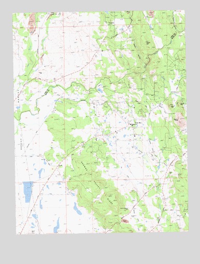
Loma Rica, CA USGS Topographic Map
Click on map above to begin viewing in our Map Viewer.

This topographic map contains these locations and features:
Feature Name Type Latitude Longitude GNIS ID View Map
Browns Valley RidgeRidgeN39.2729°W121.4361°219912View Map
Early CreekStreamN39.3346°W121.3886°241729View Map
Foothill Elementary SchoolSchoolN39.3038°W121.4144°1703486View Map
Fruitland Union SchoolLocaleN39.3107°W121.4150°223970View Map
Honcut CemeteryCemeteryN39.3410°W121.4791°225510View Map
Iowa CityPopulated PlaceN39.2916°W121.4775°252701View Map
Johnson PeakSummitN39.3210°W121.3822°1658866View Map
Kings SchoolSchoolN39.3543°W121.4380°226607View Map
Lafferty PeakSummitN39.3213°W121.3886°226762View Map
Loma RicaPopulated PlaceN39.3118°W121.4177°277544View Map
Loma Rica - Browns Valley Community Service District Fire StationBuildingN39.3133°W121.4130°2621918View Map
Loma Rica Census Designated PlaceCensusN39.3203°W121.4038°2408121View Map
Loma Rica Elementary SchoolSchoolN39.3110°W121.4172°1703499View Map
Mahle DitchCanalN39.3249°W121.4561°227949View Map
Marysville Northeast DivisionCivilN39.2675°W121.4412°1935196View Map
Nelson RavineValleyN39.3635°W121.3819°229467View Map
Olive HillPopulated PlaceN39.2882°W121.4702°1659299View Map
Olive Hill DitchCanalN39.3002°W121.4361°230006View Map
Paynes PeakSummitN39.3121°W121.3805°230429View Map
Peoria CemeteryCemeteryN39.2829°W121.3902°230505View Map
Prairie CreekStreamN39.3121°W121.4977°231023View Map
Smethurst MineMineN39.2621°W121.4166°233309View Map
Spring Valley SchoolSchoolN39.2613°W121.4186°235285View Map
Stone HouseLocaleN39.3285°W121.3836°235522View Map
SunnyslopePopulated PlaceN39.3674°W121.4319°1659924View Map
Swain HillSummitN39.3574°W121.4050°235857View Map
Swain RavineValleyN39.3449°W121.4066°235861View Map
Sweet Vengeance MineMineN39.2632°W121.4189°235891View Map
Tennessee CreekStreamN39.3396°W121.4086°236114View Map

Note: Coordinates in the location and feature list above are referenced to NAD83 datum.


Copyright (C) 2008-2024 Ryan Niemi / Sunset Dynamics ... All Rights Reserved