TopoQuest Logo
Do you find TopoQuest useful?
Help keep TopoQuest running and adding new maps/features by donating!
Bitcoin:  19c7KJd3qBynnjoSw5npx9KScwjBe4ifkT
Litecoin:  LXs6TkuXGGXo1vDsWCkWVdjQX94eUKd6ui
Home View Maps Find Maps Find Places Resources & Links


Meriden, Minnesota Topographic Map

USGS Map Title: Meriden, MN
USGS Map MRC: 44093A4
DRG (GeoTIFF) Download: o44093a4.tif


Neighboring USGS Topographic Map Quads:


  Waterville, MN  
44093B5
 

  Morristown, MN  
44093B4
 

  Medford West, MN  
44093B3
 

  Waseca, MN  
44093A5
 

  Meriden, MN  
44093A4
 

  Saco, MN  
44093A3
 

  Otisco, MN  
43093H5
 

  New Richland, MN  
43093H4
 

  Hope, MN  
43093H3


Map MRC Location:

N45°
W94°
N45°
W93°
H8 H7 H6 H5 H4 H3 H2 H1
G8 G7 G6 G5 G4 G3 G2 G1
F8 F7 F6 F5 F4 F3 F2 F1
E8 E7 E6 E5 E4 E3 E2 E1
D8 D7 D6 D5 D4 D3 D2 D1
C8 C7 C6 C5 C4 C3 C2 C1
B8 B7 B6 B5 B4 B3 B2 B1
A8 A7 A6 A5 A4 A3 A2 A1
N44°
W94°
N44°
W93°

Meriden, MN USGS 1:24K Topographic Map Preview:
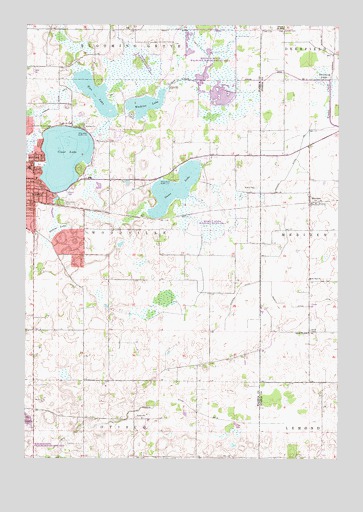
Meriden, MN USGS Topographic Map
Click on map above to begin viewing in our Map Viewer.

This topographic map contains these locations and features:
Feature Name Type Latitude Longitude GNIS ID View Map
Bradley LakeSwampN44.1105°W93.3813°640418View Map
Brase CemeteryCemeteryN44.0372°W93.3863°640440View Map
Clear LakeReservoirN44.0871°W93.4848°641298View Map
Clear Lake ParkParkN44.0847°W93.4947°2051171View Map
County Ditch Number ElevenCanalN44.1233°W93.4341°641594View Map
County Ditch Number NineCanalN44.0983°W93.4952°642365View Map
Emerson ParkParkN44.0777°W93.4947°2051174View Map
Faith United Methodist ChurchChurchN44.0808°W93.4961°2051150View Map
Findley State Wildlife Management AreaParkN44.1139°W93.4530°2051115View Map
Gaiter LakeSwampN44.0664°W93.4874°644008View Map
Goose LakeReservoirN44.0777°W93.4410°644260View Map
Grace Baptist ChurchChurchN44.0672°W93.4963°2051155View Map
Hartley Elementary SchoolSchoolN44.0833°W93.4994°2051162View Map
Judicial Ditch Number TenCanalN44.0158°W93.4361°645779View Map
Karsten CemeteryCemeteryN44.1241°W93.3969°646044View Map
Kieslers CampgroundLocaleN44.0791°W93.4794°2051180View Map
KOWO-AM (Waseca)TowerN44.0458°W93.3858°663268View Map
KOWO-FM (Waseca)TowerN44.0458°W93.3858°663357View Map
Lakeside Country ClubLocaleN44.0955°W93.4908°659872View Map
Maplewood ParkParkN44.0833°W93.4780°2051173View Map
Memorial ParkParkN44.0758°W93.4849°2051172View Map
MeridenLocaleN44.0744°W93.3849°2051250View Map
MeridenPopulated PlaceN44.0741°W93.3869°647776View Map
Meriden Post OfficePost OfficeN44.0741°W93.3869°2051251View Map
Moonan State Wildlife Management AreaParkN44.1166°W93.4183°2051114View Map
Oak ParkParkN44.0736°W93.4997°2051175View Map
Rice LakeLakeN44.1050°W93.4727°649976View Map
Saint Paul ChurchChurchN44.0519°W93.3863°650962View Map
Saint Paul's Lutheran CemeteryCemeteryN44.0516°W93.3872°2051371View Map
School Number 2098SchoolN44.0364°W93.3869°651505View Map
School Number 2142SchoolN44.1241°W93.3977°651530View Map
Southview ParkParkN44.0677°W93.4988°2051178View Map
Sportsmans ParkParkN44.0958°W93.4863°2051179View Map
Township of WoodvilleCivilN44.0631°W93.4609°666050View Map
Waseca County Waterfowl Production AreaParkN44.0368°W93.4395°2765552View Map
Waseca State Wildlife Management AreaParkN44.0666°W93.4252°2051113View Map
Watkins LakeReservoirN44.1022°W93.4526°653840View Map
Watkins Lake DamDamN44.1100°W93.4419°1777260View Map
Woodville CemeteryCemeteryN44.0736°W93.4858°654386View Map

Note: Coordinates in the location and feature list above are referenced to NAD83 datum.


Copyright (C) 2008-2025 Ryan Niemi / Sunset Dynamics ... All Rights Reserved