TopoQuest Logo
Do you find TopoQuest useful?
Help keep TopoQuest running and adding new maps/features by donating!
Bitcoin:  19c7KJd3qBynnjoSw5npx9KScwjBe4ifkT
Litecoin:  LXs6TkuXGGXo1vDsWCkWVdjQX94eUKd6ui
Home View Maps Find Maps Find Places Resources & Links


Quinns Hot Springs, Montana Topographic Map

USGS Map Title: Quinns Hot Springs, MT
USGS Map MRC: 47114C7
DRG (GeoTIFF) Download: o47114c7.tif


Neighboring USGS Topographic Map Quads:


  Plains, MT  
47114D8
 

  Paradise, MT  
47114D7
 

  Sunrise Spring, MT  
47114D6
 

  Keystone Peak, MT  
47114C8
 

  Quinns Hot Springs, MT  
47114C7
 

  Knowles, MT  
47114C6
 

  Superior, MT  
47114B8
 

  Idaho Gulch, MT  
47114B7
 

  Horsehead Peak, MT  
47114B6


Map MRC Location:

N48°
W115°
N48°
W114°
H8 H7 H6 H5 H4 H3 H2 H1
G8 G7 G6 G5 G4 G3 G2 G1
F8 F7 F6 F5 F4 F3 F2 F1
E8 E7 E6 E5 E4 E3 E2 E1
D8 D7 D6 D5 D4 D3 D2 D1
C8 C7 C6 C5 C4 C3 C2 C1
B8 B7 B6 B5 B4 B3 B2 B1
A8 A7 A6 A5 A4 A3 A2 A1
N47°
W115°
N47°
W114°

Quinns Hot Springs, MT USGS 1:24K Topographic Map Preview:
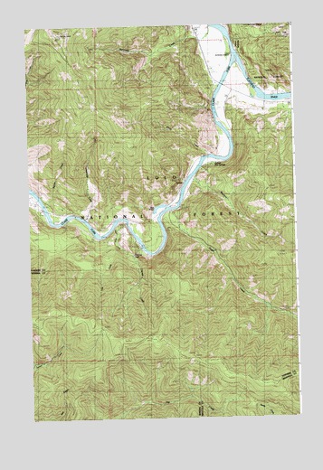
Quinns Hot Springs, MT USGS Topographic Map
Click on map above to begin viewing in our Map Viewer.

This topographic map contains these locations and features:
Feature Name Type Latitude Longitude GNIS ID View Map
Bass PondLakeN47.3174°W114.8137°807048View Map
Belle of the Hills MineMineN47.2555°W114.8565°804774View Map
Cascade CreekStreamN47.3038°W114.8218°780992View Map
Cascade Creek CampgroundLocaleN47.3038°W114.8243°780998View Map
Cascade FallsFallsN47.3021°W114.8264°794312View Map
Dillon MillsiteMineN47.2541°W114.8593°804775View Map
Dragonfly CreekStreamN47.3197°W114.8668°807047View Map
Falls CreekStreamN47.3077°W114.8432°783287View Map
Flathead RiverStreamN47.3655°W114.7762°783518View Map
Fourteenmile CreekStreamN47.3138°W114.8485°783654View Map
Hall Gulch MineMineN47.2527°W114.8593°804772View Map
HopkinsPopulated PlaceN47.2683°W114.8690°794313View Map
Hopkins MineMineN47.2694°W114.8649°785005View Map
Island City (historical)Populated PlaceN47.3610°W114.7899°1780937View Map
John TunnelTunnelN47.3349°W114.7868°785515View Map
Kennedy CreekStreamN47.3744°W114.7890°785674View Map
Much Water CreekStreamN47.3108°W114.8354°787778View Map
Pardee CampLocaleN47.2797°W114.8490°788628View Map
Patricks KnobSummitN47.3719°W114.8593°788689View Map
QuinnsPopulated PlaceN47.3247°W114.8018°789304View Map
Quinns Hot SpringsSpringN47.3294°W114.7899°789305View Map
Quinns Hot Springs ResortBuildingN47.3307°W114.7894°2681543View Map
Sheep CreekStreamN47.3330°W114.7904°790322View Map
Siegel CreekStreamN47.3163°W114.8085°790476View Map
Victor MineMineN47.2722°W114.8732°804777View Map
Wallace CreekStreamN47.3263°W114.7979°792778View Map
West Hall Gulch MineMineN47.2560°W114.8635°804773View Map

Note: Coordinates in the location and feature list above are referenced to NAD83 datum.


Copyright (C) 2008-2025 Ryan Niemi / Sunset Dynamics ... All Rights Reserved