TopoQuest Logo
Do you find TopoQuest useful?
Help keep TopoQuest running and adding new maps/features by donating!
Bitcoin:  19c7KJd3qBynnjoSw5npx9KScwjBe4ifkT
Litecoin:  LXs6TkuXGGXo1vDsWCkWVdjQX94eUKd6ui
Home View Maps Find Maps Find Places Resources & Links


Hortman, Louisiana Topographic Map

USGS Map Title: Hortman, LA
USGS Map MRC: 32093F4
DRG (GeoTIFF) Download: o32093f4.tif


Neighboring USGS Topographic Map Quads:


  Ivan, LA  
32093G5
 

  Cotton Valley, LA  
32093G4
 

  Leton, LA  
32093G3
 

  Bodcau Lake, LA  
32093F5
 

  Hortman, LA  
32093F4
 

  Minden North, LA  
32093F3
 

  Eastwood, LA  
32093E5
 

  Doyline, LA  
32093E4
 

  Minden South, LA  
32093E3


Map MRC Location:

N33°
W94°
N33°
W93°
H8 H7 H6 H5 H4 H3 H2 H1
G8 G7 G6 G5 G4 G3 G2 G1
F8 F7 F6 F5 F4 F3 F2 F1
E8 E7 E6 E5 E4 E3 E2 E1
D8 D7 D6 D5 D4 D3 D2 D1
C8 C7 C6 C5 C4 C3 C2 C1
B8 B7 B6 B5 B4 B3 B2 B1
A8 A7 A6 A5 A4 A3 A2 A1
N32°
W94°
N32°
W93°

Hortman, LA USGS 1:24K Topographic Map Preview:
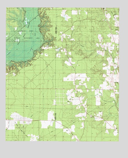
Hortman, LA USGS Topographic Map
Click on map above to begin viewing in our Map Viewer.

This topographic map contains these locations and features:
Feature Name Type Latitude Longitude GNIS ID View Map
Ambrose School (historical)SchoolN32.7076°W93.4335°544497View Map
Baten CemeteryCemeteryN32.6368°W93.3777°540788View Map
Bayou Bodcau ReservoirReservoirN32.7160°W93.4835°553420View Map
Bellevue Oil and Gas FieldOilfieldN32.6432°W93.4802°553593View Map
Bright Star SchoolSchoolN32.7151°W93.4538°533405View Map
Brushy Creek SchoolSchoolN32.6924°W93.3854°533482View Map
Edwards CemeteryCemeteryN32.7490°W93.3916°540786View Map
Growing Valley CemeteryCemeteryN32.6624°W93.4327°535433View Map
Growing Valley ChurchChurchN32.6474°W93.4066°540787View Map
Growing Valley ChurchChurchN32.6576°W93.4146°535434View Map
Growing Valley SchoolSchoolN32.6476°W93.4071°535435View Map
H G Hayes Pond DamDamN32.7385°W93.4352°556990View Map
Hires ChapelChurchN32.7440°W93.3796°535682View Map
HortmanPopulated PlaceN32.7288°W93.3774°543314View Map
Hortmans Store (historical)LocaleN32.6849°W93.4238°557075View Map
Parish Governing Authority District 5CivilN32.6823°W93.3943°1930109View Map
Pleasant Hill Church (historical)ChurchN32.7446°W93.3793°544498View Map
Pleasant Valley CemeteryCemeteryN32.6954°W93.3754°540834View Map
Pleasant Valley United Methodist ChurchChurchN32.6951°W93.3766°555687View Map
Ratcliff CemeteryCemeteryN32.6365°W93.3777°538499View Map
Whispering Pines CemeteryCemeteryN32.6804°W93.3753°540835View Map

Note: Coordinates in the location and feature list above are referenced to NAD83 datum.


Copyright (C) 2008-2024 Ryan Niemi / Sunset Dynamics ... All Rights Reserved