TopoQuest Logo
Do you find TopoQuest useful?
Help keep TopoQuest running and adding new maps/features by donating!
Bitcoin:  19c7KJd3qBynnjoSw5npx9KScwjBe4ifkT
Litecoin:  LXs6TkuXGGXo1vDsWCkWVdjQX94eUKd6ui
Home View Maps Find Maps Find Places Resources & Links


Horton, Missouri Topographic Map

USGS Map Title: Horton, MO
USGS Map MRC: 37094H3
DRG (GeoTIFF) Download: o37094h3.tif


Neighboring USGS Topographic Map Quads:


  Sprague, MO  
38094A4
 

  Rich Hill, MO  
38094A3
 

  Papinville, MO  
38094A2
 

  Metz, MO  
37094H4
 

  Horton, MO  
37094H3
 

  Harwood, MO  
37094H2
 

  Moundville, MO  
37094G4
 

  Nevada, MO  
37094G3
 

  Dederick, MO  
37094G2


Map MRC Location:

N38°
W95°
N38°
W94°
H8 H7 H6 H5 H4 H3 H2 H1
G8 G7 G6 G5 G4 G3 G2 G1
F8 F7 F6 F5 F4 F3 F2 F1
E8 E7 E6 E5 E4 E3 E2 E1
D8 D7 D6 D5 D4 D3 D2 D1
C8 C7 C6 C5 C4 C3 C2 C1
B8 B7 B6 B5 B4 B3 B2 B1
A8 A7 A6 A5 A4 A3 A2 A1
N37°
W95°
N37°
W94°

Horton, MO USGS 1:24K Topographic Map Preview:
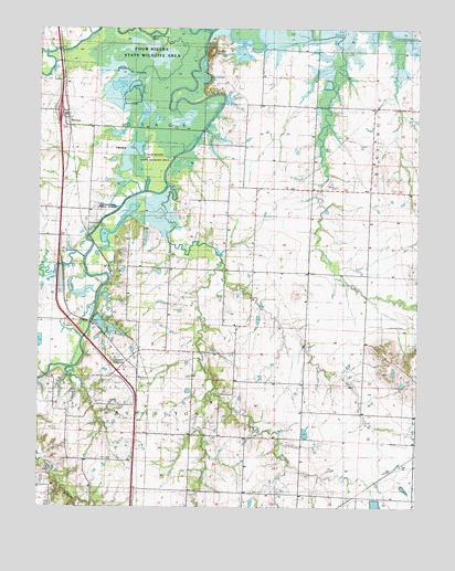
Horton, MO USGS Topographic Map
Click on map above to begin viewing in our Map Viewer.

This topographic map contains these locations and features:
Feature Name Type Latitude Longitude GNIS ID View Map
Antioch CemeteryCemeteryN37.9021°W94.3480°748200View Map
Antioch ChurchChurchN37.9020°W94.3491°748201View Map
Berea CemeteryCemeteryN37.9586°W94.2768°2572602View Map
Berea ChurchChurchN37.9586°W94.2774°713980View Map
Burr LakeLakeN37.9632°W94.3424°715092View Map
Cephas Ford Public AccessParkN37.9531°W94.3494°748202View Map
Compton JunctionLocaleN37.9106°W94.3502°748199View Map
Compton Junction Fire DistrictBuildingN37.9111°W94.3437°2621410View Map
Cottonwood BranchStreamN37.9039°W94.3166°716352View Map
Cottonwood LakeLakeN37.9758°W94.3284°716371View Map
Douglas BranchStreamN37.9400°W94.3602°717006View Map
East Fork Bee BranchStreamN37.9981°W94.2555°717275View Map
East Washington School (historical)SchoolN37.9014°W94.3502°748355View Map
Elks LakeLakeN37.9487°W94.3487°748449View Map
Ellis CemeteryCemeteryN37.8955°W94.3709°717488View Map
Green Valley School (historical)SchoolN37.9586°W94.3033°748373View Map
Horseshoe LakeLakeN37.9864°W94.3199°719864View Map
HortonPopulated PlaceN37.9748°W94.3652°729904View Map
Horton School (historical)SchoolN37.9786°W94.3705°746141View Map
Hubler LakeLakeN37.9690°W94.3424°719945View Map
Humble School (historical)SchoolN37.9534°W94.3719°748384View Map
Irrigation LakeReservoirN37.9933°W94.3090°762950View Map
KettermanPopulated PlaceN37.9584°W94.2852°739492View Map
Lone Star School (historical)SchoolN37.9270°W94.3322°748401View Map
Long LakeLakeN37.9758°W94.3376°721548View Map
Long Lower Lake DamDamN37.9250°W94.3569°762939View Map
Long Upper Lake DamDamN37.9200°W94.3519°763546View Map
Marmaton RiverStreamN37.9992°W94.3188°721891View Map
Marshall Cummins Pond (historical)LakeN37.9253°W94.2622°748406View Map
McDowell LakeReservoirN37.9250°W94.3569°762940View Map
New Pence LakeLakeN37.9198°W94.3708°723290View Map
Old Pence LakeLakeN37.9175°W94.3683°723772View Map
Old Town BranchStreamN37.9589°W94.3330°723793View Map
Spile LakeLakeN37.9780°W94.3409°726858View Map
Stearns LakeLakeN37.9852°W94.3481°727044View Map
Timber HillSummitN37.9948°W94.3177°729977View Map
Timber Hill ChurchChurchN37.9586°W94.2855°748463View Map
Timber Hill River Bend Incorporated DamDamN37.9950°W94.3086°762949View Map
Timber Hill School (historical)SchoolN37.9798°W94.2977°748464View Map
Township of OsageCivilN37.9956°W94.3380°767493View Map
Township of WashingtonCivilN37.8941°W94.3430°767497View Map
Wales Siding (historical)LocaleN37.8928°W94.3391°748472View Map
West Point School (historical)SchoolN37.9117°W94.3108°748474View Map

Note: Coordinates in the location and feature list above are referenced to NAD83 datum.


Copyright (C) 2008-2024 Ryan Niemi / Sunset Dynamics ... All Rights Reserved