TopoQuest Logo
Do you find TopoQuest useful?
Help keep TopoQuest running and adding new maps/features by donating!
Bitcoin:  19c7KJd3qBynnjoSw5npx9KScwjBe4ifkT
Litecoin:  LXs6TkuXGGXo1vDsWCkWVdjQX94eUKd6ui
Home View Maps Find Maps Find Places Resources & Links


Rich Hill, Missouri Topographic Map

USGS Map Title: Rich Hill, MO
USGS Map MRC: 38094A3
DRG (GeoTIFF) Download: o38094a3.tif


Neighboring USGS Topographic Map Quads:


  New Home, MO  
38094B4
 

  Butler South, MO  
38094B3
 

  Pleasant Gap, MO  
38094B2
 

  Sprague, MO  
38094A4
 

  Rich Hill, MO  
38094A3
 

  Papinville, MO  
38094A2
 

  Metz, MO  
37094H4
 

  Horton, MO  
37094H3
 

  Harwood, MO  
37094H2


Map MRC Location:

N39°
W95°
N39°
W94°
H8 H7 H6 H5 H4 H3 H2 H1
G8 G7 G6 G5 G4 G3 G2 G1
F8 F7 F6 F5 F4 F3 F2 F1
E8 E7 E6 E5 E4 E3 E2 E1
D8 D7 D6 D5 D4 D3 D2 D1
C8 C7 C6 C5 C4 C3 C2 C1
B8 B7 B6 B5 B4 B3 B2 B1
A8 A7 A6 A5 A4 A3 A2 A1
N38°
W95°
N38°
W94°

Rich Hill, MO USGS 1:24K Topographic Map Preview:
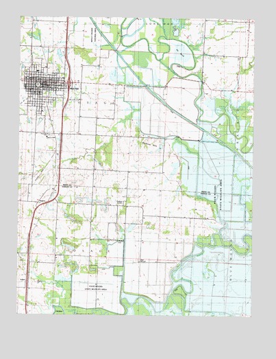
Rich Hill, MO USGS Topographic Map
Click on map above to begin viewing in our Map Viewer.

This topographic map contains these locations and features:
Feature Name Type Latitude Longitude GNIS ID View Map
ArthurPopulated PlaceN38.0131°W94.3694°713409View Map
Arthur School (historical)SchoolN38.0139°W94.3708°746136View Map
Back and Forth SloughStreamN38.0136°W94.3541°713516View Map
Bagley LakeLakeN38.1223°W94.3285°713533View Map
Bailey Gun ClubLocaleN38.0850°W94.2663°754994View Map
Bailey LakeLakeN38.0869°W94.2691°713546View Map
Baker BendBendN38.0320°W94.2516°713556View Map
Bee BranchStreamN38.0281°W94.2591°713855View Map
Beisley Lake - NorthReservoirN38.0620°W94.2917°763176View Map
Beisley Lake - SouthReservoirN38.0527°W94.2899°763117View Map
Beisley Lake North DamDamN38.0634°W94.2902°763175View Map
Beisley Lake South DamDamN38.0550°W94.2886°763116View Map
Broad Waters Muddy CreekStreamN38.0703°W94.2844°714729View Map
Carbon CenterPopulated PlaceN38.0461°W94.3219°715388View Map
Carbon Center CemeteryCemeteryN38.0499°W94.3177°2572601View Map
Church of God in ChristChurchN38.0745°W94.3597°748275View Map
City of Rich HillCivilN38.0959°W94.3633°2396361View Map
Cresap LakeLakeN38.0169°W94.2721°716486View Map
Crooked BranchStreamN38.0214°W94.2883°716508View Map
Daugherty BendBendN38.0011°W94.3386°716681View Map
Deer MoundSummitN38.0234°W94.3105°716812View Map
Diamond School (historical)SchoolN38.0386°W94.3372°729871View Map
Dollar Lake (historical)LakeN38.0881°W94.2838°748353View Map
Double BranchStreamN38.1164°W94.2944°729874View Map
Eastland LakeReservoirN38.0814°W94.3639°763339View Map
Eastland Lake DamDamN38.0817°W94.3636°763338View Map
Eggelson SloughStreamN38.0075°W94.3186°717416View Map
Four Rivers State Wildlife AreaParkN38.0084°W94.3336°748269View Map
Goose LakeLakeN38.0651°W94.2573°718595View Map
Greencastle School (historical)SchoolN38.0700°W94.3669°748374View Map
Harmony School (historical)SchoolN38.0758°W94.3601°2743796View Map
He BendBendN38.1120°W94.2902°719307View Map
Hightower CreekStreamN38.0031°W94.2874°719588View Map
Ingram Slash (historical)SwampN38.0120°W94.3377°748387View Map
Jonnum Mines (historical)MineN38.0431°W94.3155°748391View Map
Lake Lona (historical)LakeN38.0356°W94.3077°748397View Map
Maple SlashLakeN38.0850°W94.2630°721841View Map
Miller LakeReservoirN38.0704°W94.2999°762953View Map
Miller Lake DamDamN38.0717°W94.2986°762952View Map
Mission BranchStreamN38.0878°W94.2622°722461View Map
Muddy CreekStreamN38.0325°W94.2658°723032View Map
North Muddy School (historical)SchoolN38.0670°W94.3349°723483View Map
Ovid (historical)LocaleN38.1231°W94.3686°746463View Map
Ovid School (historical)SchoolN38.1220°W94.3688°748428View Map
PanamaPopulated PlaceN38.0470°W94.3550°729942View Map
Panama School (historical)SchoolN38.0467°W94.3727°748429View Map
Park PlaceParkN38.0964°W94.3669°748271View Map
Philbrick HillsRangeN38.0706°W94.3052°724286View Map
Prairie LakeLakeN38.0523°W94.2504°724869View Map
Prospect ParkParkN38.0961°W94.3550°748270View Map
Rich HillPopulated PlaceN38.0964°W94.3611°725252View Map
Rich Hill Elementary SchoolSchoolN38.1022°W94.3655°748274View Map
Rich Hill Fire DepartmentBuildingN38.0972°W94.3617°2621212View Map
Rich Hill High SchoolSchoolN38.1027°W94.3659°748273View Map
Rich Hill Memorial LibraryBuildingN38.0970°W94.3627°748272View Map
Rich Hill Police DepartmentBuildingN38.0971°W94.3616°2752350View Map
Rich Hill Post OfficePost OfficeN38.0971°W94.3631°2782635View Map
Rich Hill School (historical)SchoolN38.0992°W94.3694°746050View Map
Ripgut Prairie Natural AreaAreaN38.1175°W94.3369°748268View Map
Schooley Airport (historical)AirportN38.1014°W94.3475°758887View Map
South Slash (historical)LakeN38.0381°W94.2530°748456View Map
Stone Gate School (historical)SchoolN38.0417°W94.2858°727134View Map
Sycamore BranchStreamN38.0770°W94.2602°727401View Map
Township of OsageCivilN38.0929°W94.3602°766303View Map
West SlashLakeN38.0443°W94.2521°728627View Map
Willow BranchStreamN38.0039°W94.3530°728928View Map
Wolf Lake (historical)LakeN38.0878°W94.2922°748480View Map

Note: Coordinates in the location and feature list above are referenced to NAD83 datum.


Copyright (C) 2008-2024 Ryan Niemi / Sunset Dynamics ... All Rights Reserved