TopoQuest Logo
Do you find TopoQuest useful?
Help keep TopoQuest running and adding new maps/features by donating!
Bitcoin:  19c7KJd3qBynnjoSw5npx9KScwjBe4ifkT
Litecoin:  LXs6TkuXGGXo1vDsWCkWVdjQX94eUKd6ui
Home View Maps Find Maps Find Places Resources & Links


Hot Coffee, Mississippi Topographic Map

USGS Map Title: Hot Coffee, MS
USGS Map MRC: 31089F4
DRG (GeoTIFF) Download: o31089f4.tif


Neighboring USGS Topographic Map Quads:


  Mize, MS  
31089G5
 

  Taylorsville, MS  
31089G4
 

  Soso, MS  
31089G3
 

  Collins, MS  
31089F5
 

  Hot Coffee, MS  
31089F4
 

  Hebron, MS  
31089F3
 

  Williamsburg, MS  
31089E5
 

  Seminary, MS  
31089E4
 

  Moselle, MS  
31089E3


Map MRC Location:

N32°
W90°
N32°
W89°
H8 H7 H6 H5 H4 H3 H2 H1
G8 G7 G6 G5 G4 G3 G2 G1
F8 F7 F6 F5 F4 F3 F2 F1
E8 E7 E6 E5 E4 E3 E2 E1
D8 D7 D6 D5 D4 D3 D2 D1
C8 C7 C6 C5 C4 C3 C2 C1
B8 B7 B6 B5 B4 B3 B2 B1
A8 A7 A6 A5 A4 A3 A2 A1
N31°
W90°
N31°
W89°

Hot Coffee, MS USGS 1:24K Topographic Map Preview:
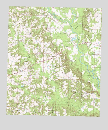
Hot Coffee, MS USGS Topographic Map
Click on map above to begin viewing in our Map Viewer.

This topographic map contains these locations and features:
Feature Name Type Latitude Longitude GNIS ID View Map
Beaver BranchStreamN31.6418°W89.4340°666693View Map
BethelPopulated PlaceN31.6507°W89.4084°710609View Map
Bethel Line School (historical)SchoolN31.6513°W89.4081°710611View Map
Bethel United Methodist ChurchChurchN31.6513°W89.4087°666909View Map
Big Lane CemeteryCemeteryN31.6435°W89.4887°667129View Map
Calhoun Baptist ChurchChurchN31.7404°W89.4431°667919View Map
Calhoun CemeteryCemeteryN31.7408°W89.4433°710621View Map
Calhoun School (historical)SchoolN31.7404°W89.4434°689824View Map
Charles Pickering Catfish Ponds DamDamN31.6918°W89.3751°680831View Map
Charles Pickering Catfish Ponds DamDamN31.6952°W89.3834°680836View Map
Charles Pickering Lake DamDamN31.6985°W89.3751°680838View Map
Clear LakeLakeN31.6779°W89.3856°668580View Map
County Line CemeteryCemeteryN31.6513°W89.3876°707340View Map
County Line ChurchChurchN31.6513°W89.3878°668868View Map
East Covington Volunteer Fire DepartmentBuildingN31.6698°W89.4415°2668076View Map
Easterling BranchStreamN31.7221°W89.4115°669620View Map
Ellzey BranchStreamN31.7093°W89.4065°669748View Map
Geiger CemeteryCemeteryN31.6402°W89.4542°670352View Map
Giger Church (historical)ChurchN31.6404°W89.4540°689833View Map
Gramtham BranchStreamN31.7210°W89.4103°670574View Map
Hatton CemeteryCemeteryN31.7268°W89.3978°671012View Map
Hebron Lodge CemeteryCemeteryN31.7104°W89.3906°707355View Map
Hoover LakeReservoirN31.7141°W89.4119°671396View Map
Hoover Lake DamDamN31.7152°W89.4151°680845View Map
HopewellPopulated PlaceN31.7182°W89.4709°710648View Map
Hopewell Missionary Baptist ChurchChurchN31.7199°W89.4706°710649View Map
Hopewell SchoolSchoolN31.7193°W89.4703°671447View Map
Horseshoe LakeLakeN31.6633°W89.3754°671503View Map
Hot CoffeeLocaleN31.7402°W89.4562°671513View Map
Jack Knight CemeteryCemeteryN31.7140°W89.3903°707359View Map
Jim Nar BranchStreamN31.6304°W89.3992°671884View Map
Keys LakeLakeN31.6581°W89.4800°672116View Map
Knight CemeteryCemeteryN31.6896°W89.4178°672202View Map
Leaf RiverPopulated PlaceN31.6724°W89.4348°710656View Map
Leaf River Baptist ChurchChurchN31.6718°W89.4370°672338View Map
Leaf River CemeteryCemeteryN31.6715°W89.4376°710657View Map
Leaf River School (historical)SchoolN31.6721°W89.4362°710658View Map
Little Station CreekStreamN31.6571°W89.4809°672691View Map
Masons CreekStreamN31.6977°W89.3984°673227View Map
Mitchell BranchStreamN31.6424°W89.4473°673703View Map
Mitchells Mill (historical)LocaleN31.6407°W89.4492°683131View Map
Mount Olive Baptist Church (historical)ChurchN31.7232°W89.3909°685540View Map
Mount Olive CemeteryCemeteryN31.7229°W89.3914°707370View Map
Negro RidgeRidgeN31.6918°W89.4334°710689View Map
Oak Grove ChurchChurchN31.7293°W89.3937°675028View Map
Oak Ridge Hall School (historical)SchoolN31.7366°W89.3931°685555View Map
Oakohay CreekStreamN31.7313°W89.4170°694245View Map
Old Hopewell CemeteryCemeteryN31.7202°W89.4709°710701View Map
Pickering CemeteryCemeteryN31.6954°W89.3820°675704View Map
ReddochsPopulated PlaceN31.7071°W89.4098°689845View Map
Reddochs BridgeBridgeN31.7074°W89.4070°689846View Map
Reddock Store (historical)LocaleN31.7116°W89.3984°685578View Map
Scruggs LakeLakeN31.6715°W89.3866°677481View Map
Shady OakPopulated PlaceN31.6938°W89.4362°710726View Map
Shady Oak ChurchChurchN31.6938°W89.4373°677601View Map
Shady Oak School (historical)SchoolN31.6938°W89.4367°710727View Map
Smith CreekStreamN31.6821°W89.3920°677926View Map
Speed CemeteryCemeteryN31.6543°W89.4820°678047View Map
Speed LakeLakeN31.6775°W89.3932°678048View Map
Speed School (historical)SchoolN31.6313°W89.4512°689848View Map
SpeedtownPopulated PlaceN31.6307°W89.4431°710731View Map
Station CreekStreamN31.6463°W89.4301°678250View Map
Station CreekPopulated PlaceN31.6779°W89.4834°710732View Map
Station Creek (historical)LocaleN31.6424°W89.4501°683132View Map
Station Creek Missionary Baptist ChurchChurchN31.6785°W89.4851°678251View Map
Station Creek School (historical)SchoolN31.6788°W89.4840°710733View Map
Supervisor District 5CivilN31.7224°W89.4753°711837View Map
UnionPopulated PlaceN31.7377°W89.4903°710737View Map
Union Baptist ChurchChurchN31.7385°W89.4876°679049View Map
Union CemeteryCemeteryN31.7388°W89.4870°710739View Map
Wade Town (historical)LocaleN31.6849°W89.4623°710741View Map
Welch Post Office (historical)Post OfficeN31.6293°W89.4084°713032View Map
Willow Grove Baptist ChurchChurchN31.6302°W89.4848°679737View Map
Willow Grove CemeteryCemeteryN31.6307°W89.4845°710750View Map
Willow Grove School (historical)SchoolN31.6324°W89.4812°689853View Map
WillowtownPopulated PlaceN31.6321°W89.4751°710751View Map

Note: Coordinates in the location and feature list above are referenced to NAD83 datum.


Copyright (C) 2008-2024 Ryan Niemi / Sunset Dynamics ... All Rights Reserved