TopoQuest Logo
Do you find TopoQuest useful?
Help keep TopoQuest running and adding new maps/features by donating!
Bitcoin:  19c7KJd3qBynnjoSw5npx9KScwjBe4ifkT
Litecoin:  LXs6TkuXGGXo1vDsWCkWVdjQX94eUKd6ui
Home View Maps Find Maps Find Places Resources & Links


Seminary, Mississippi Topographic Map

USGS Map Title: Seminary, MS
USGS Map MRC: 31089E4
DRG (GeoTIFF) Download: o31089e4.tif


Neighboring USGS Topographic Map Quads:


  Collins, MS  
31089F5
 

  Hot Coffee, MS  
31089F4
 

  Hebron, MS  
31089F3
 

  Williamsburg, MS  
31089E5
 

  Seminary, MS  
31089E4
 

  Moselle, MS  
31089E3
 

  Sumrall, MS  
31089D5
 

  Sanford, MS  
31089D4
 

  Eastabuchie, MS  
31089D3


Map MRC Location:

N32°
W90°
N32°
W89°
H8 H7 H6 H5 H4 H3 H2 H1
G8 G7 G6 G5 G4 G3 G2 G1
F8 F7 F6 F5 F4 F3 F2 F1
E8 E7 E6 E5 E4 E3 E2 E1
D8 D7 D6 D5 D4 D3 D2 D1
C8 C7 C6 C5 C4 C3 C2 C1
B8 B7 B6 B5 B4 B3 B2 B1
A8 A7 A6 A5 A4 A3 A2 A1
N31°
W90°
N31°
W89°

Seminary, MS USGS 1:24K Topographic Map Preview:
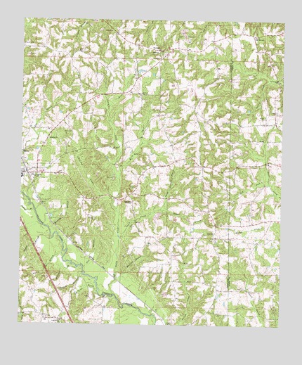
Seminary, MS USGS Topographic Map
Click on map above to begin viewing in our Map Viewer.

This topographic map contains these locations and features:
Feature Name Type Latitude Longitude GNIS ID View Map
BethelPopulated PlaceN31.5404°W89.4065°710607View Map
Bethel Baptist ChurchChurchN31.5379°W89.4076°666907View Map
Bethel CemeteryCemeteryN31.5388°W89.4076°710608View Map
Bethel CemeteryCemeteryN31.6018°W89.4081°710610View Map
Birdie BranchStreamN31.5129°W89.4626°667180View Map
Brownie BranchStreamN31.5229°W89.4731°667633View Map
Bryan School (historical)SchoolN31.5879°W89.4431°710620View Map
Bullock CemeteryCemeteryN31.5004°W89.4278°667782View Map
Crosby CemeteryCemeteryN31.5432°W89.4651°668960View Map
Curry CreekStreamN31.5121°W89.4553°669026View Map
Double BranchStreamN31.5468°W89.4934°669343View Map
EminencePopulated PlaceN31.6129°W89.4340°691842View Map
Eminence CemeteryCemeteryN31.6113°W89.4339°710636View Map
Eminence CemeteryCemeteryN31.6101°W89.4333°710637View Map
Eminence School (historical)SchoolN31.6132°W89.4165°689832View Map
Eminence United Methodist ChurchChurchN31.6096°W89.4337°669765View Map
GandsiPopulated PlaceN31.5707°W89.4990°691878View Map
Jessie Sanford BranchStreamN31.5471°W89.4337°671867View Map
Jesus Name TabernacleChurchN31.5504°W89.4467°671874View Map
Katie Post Office (historical)Post OfficeN31.6107°W89.4312°713030View Map
KellyPopulated PlaceN31.5877°W89.4445°710651View Map
Kelly CemeteryCemeteryN31.5885°W89.4345°672085View Map
Kelly CreekStreamN31.5599°W89.4531°672087View Map
King BranchStreamN31.5893°W89.4587°672141View Map
Lebanon Baptist ChurchChurchN31.5952°W89.4426°672352View Map
Lebanon CemeteryCemeteryN31.5949°W89.4431°710659View Map
Longview ChurchChurchN31.6121°W89.4348°672860View Map
Lower ProngStreamN31.5354°W89.4520°672921View Map
Lowery Creek Baptist ChurchChurchN31.6010°W89.3770°672929View Map
Manasco BranchStreamN31.5210°W89.4542°673109View Map
Military BranchStreamN31.5382°W89.4862°673574View Map
Mooney BranchStreamN31.5216°W89.4701°673768View Map
Moore CemeteryCemeteryN31.5793°W89.4762°673774View Map
Morgan FieldAirportN31.5452°W89.3841°2676407View Map
MoscosPopulated PlaceN31.6052°W89.4876°710675View Map
Moscos CemeteryCemeteryN31.6040°W89.4842°710676View Map
Moscos School (historical)SchoolN31.6032°W89.4834°710677View Map
Mount Tabor Holiness Church (historical)ChurchN31.5291°W89.4462°710687View Map
Mount Tabor School (historical)SchoolN31.5368°W89.4140°710688View Map
Napier Mill (historical)LocaleN31.5502°W89.4556°689839View Map
Neeley BranchStreamN31.5274°W89.4795°674541View Map
Oak BoweryPopulated PlaceN31.6193°W89.3892°692116View Map
Oak Grove Line School (historical)SchoolN31.5043°W89.4017°710696View Map
Padgett BranchStreamN31.5471°W89.4337°675376View Map
Pickering (historical)LocaleN31.5202°W89.4567°689842View Map
Pickering School (historical)SchoolN31.5360°W89.4612°689843View Map
Pine Ridge School (historical)SchoolN31.5343°W89.3862°685567View Map
Sanctified ChurchChurchN31.5763°W89.4873°677316View Map
Sanford Lookout TowerTowerN31.5038°W89.4892°711309View Map
SeminaryPopulated PlaceN31.5624°W89.4976°677510View Map
Seminary Attendance CenterSchoolN31.5610°W89.4995°710720View Map
Seminary Baptist ChurchChurchN31.5638°W89.4945°710721View Map
Seminary FallsFallsN31.5532°W89.4995°710722View Map
Seminary Fire DepartmentBuildingN31.5621°W89.4999°2667781View Map
Seminary Post OfficePost OfficeN31.5627°W89.4985°2768788View Map
Seminary Presbyterian Church (historical)ChurchN31.5621°W89.4945°710724View Map
Seminary Town Police DepartmentBuildingN31.5621°W89.5000°2754288View Map
Shop BranchStreamN31.5235°W89.4701°677735View Map
Sitka Post Office (historical)Post OfficeN31.6168°W89.4084°713031View Map
Speed CemeteryCemeteryN31.6127°W89.4734°678046View Map
Supervisor District 2CivilN31.5039°W89.4877°711834View Map
Taylor BranchStreamN31.5354°W89.4851°678583View Map
Town of SeminaryCivilN31.5581°W89.4987°2407312View Map
UnionPopulated PlaceN31.5024°W89.4809°710736View Map
Union Baptist ChurchChurchN31.5018°W89.4806°679117View Map
Union CemeteryCemeteryN31.5026°W89.4799°708649View Map
Union Senior CemeteryCemeteryN31.5015°W89.4797°710738View Map
Walters CemeteryCemeteryN31.5854°W89.3834°679308View Map
Walton School (historical)SchoolN31.5027°W89.4881°689851View Map
West ForkStreamN31.5579°W89.3809°679484View Map
Williamson CemeteryCemeteryN31.6148°W89.4998°679725View Map
Wolfpen BranchStreamN31.5499°W89.4565°679826View Map
Zion Seminary College (historical)SchoolN31.5610°W89.4990°710752View Map

Note: Coordinates in the location and feature list above are referenced to NAD83 datum.


Copyright (C) 2008-2025 Ryan Niemi / Sunset Dynamics ... All Rights Reserved