TopoQuest Logo
Do you find TopoQuest useful?
Help keep TopoQuest running and adding new maps/features by donating!
Bitcoin:  19c7KJd3qBynnjoSw5npx9KScwjBe4ifkT
Litecoin:  LXs6TkuXGGXo1vDsWCkWVdjQX94eUKd6ui
Home View Maps Find Maps Find Places Resources & Links


Huckins School, Montana Topographic Map

USGS Map Title: Huckins School, MT
USGS Map MRC: 45105B6
DRG (GeoTIFF) Download: o45105b6.tif


Neighboring USGS Topographic Map Quads:


  Hodsdon Flats, MT  
45105C7
 

  Yarger Butte, MT  
45105C6
 

  Lonesome Peak, MT  
45105C5
 

  Bloom Creek, MT  
45105B7
 

  Huckins School, MT  
45105B6
 

  Baldy Peak, MT  
45105B5
 

  Moorhead, MT  
45105A7
 

  Three Bar Ranch, MT  
45105A6
 

  Bay Horse, MT  
45105A5


Map MRC Location:

N46°
W106°
N46°
W105°
H8 H7 H6 H5 H4 H3 H2 H1
G8 G7 G6 G5 G4 G3 G2 G1
F8 F7 F6 F5 F4 F3 F2 F1
E8 E7 E6 E5 E4 E3 E2 E1
D8 D7 D6 D5 D4 D3 D2 D1
C8 C7 C6 C5 C4 C3 C2 C1
B8 B7 B6 B5 B4 B3 B2 B1
A8 A7 A6 A5 A4 A3 A2 A1
N45°
W106°
N45°
W105°

Huckins School, MT USGS 1:24K Topographic Map Preview:
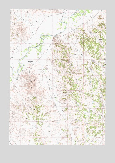
Huckins School, MT USGS Topographic Map
Click on map above to begin viewing in our Map Viewer.

This topographic map contains these locations and features:
Feature Name Type Latitude Longitude GNIS ID View Map
05N49E14CBBA01 WellWellN45.2250°W105.6922°808497View Map
07S49E12AD__01 WellWellN45.2400°W105.6547°808545View Map
07S49E16CDDC01 WellWellN45.2183°W105.7267°808471View Map
07S49E20AD__01 WellWellN45.2114°W105.7361°808434View Map
07S49E20ADCC01 WellWellN45.2114°W105.7397°808435View Map
07S49E21DA__01 WellWellN45.2092°W105.7178°808430View Map
07S49E23CD__01 WellWellN45.2044°W105.6847°808414View Map
07S49E24DACC01 WellWellN45.2083°W105.6594°808429View Map
07S49E25BCAD01 WellWellN45.1992°W105.6714°808398View Map
07S49E27AD__01 WellWellN45.1986°W105.6978°808396View Map
07S49E28DAAC01 WellWellN45.1953°W105.7167°808385View Map
07S49E32ACC_01 WellWellN45.1825°W105.7444°808333View Map
07S49E35CCCB01 WellWellN45.1769°W105.6942°808316View Map
08S49E04CDBB01 WellWellN45.1636°W105.7306°808252View Map
08S49E20BD__01 WellWellN45.1264°W105.7486°808058View Map
08S49E21AA__01 WellWellN45.1286°W105.7164°808065View Map
Bay Horse CreekStreamN45.2172°W105.7097°768565View Map
Buttermilk CreekStreamN45.2283°W105.6844°769456View Map
Coal Bank CreekStreamN45.1689°W105.6897°769951View Map
Crooked CreekStreamN45.1639°W105.6872°1689966View Map
Daily CreekStreamN45.2322°W105.6644°770427View Map
East Pinto CreekStreamN45.2278°W105.7183°771098View Map
Ellis CanyonValleyN45.1461°W105.6892°1689965View Map
Eureka ReservoirReservoirN45.1617°W105.6672°796473View Map
Eureka Reservoir West Dike DamDamN45.1617°W105.6672°796472View Map
Fire CreekStreamN45.2428°W105.6792°771366View Map
Hell CreekStreamN45.1825°W105.7478°772323View Map
Huckins Number 2 DamDamN45.1833°W105.6439°796835View Map
Huckins School (historical)SchoolN45.2011°W105.7256°772598View Map
Kelly DrawValleyN45.1530°W105.6775°772968View Map
Leitner CreekStreamN45.1792°W105.7450°1689967View Map
Lone Tree CreekStreamN45.1978°W105.7286°773589View Map
Miller CreekStreamN45.2350°W105.6503°774242View Map
Pinto CreekStreamN45.2264°W105.7103°788928View Map
Reder DamDamN45.1617°W105.6672°798808View Map
Tibbets CreekStreamN45.2175°W105.7375°1689968View Map
Traub Number 1 DamDamN45.1350°W105.6489°796836View Map
Traub Number 2 DamDamN45.1467°W105.6839°796832View Map
United States Number 2 DamDamN45.1633°W105.6622°796831View Map

Note: Coordinates in the location and feature list above are referenced to NAD83 datum.


Copyright (C) 2008-2025 Ryan Niemi / Sunset Dynamics ... All Rights Reserved