TopoQuest Logo
Do you find TopoQuest useful?
Help keep TopoQuest running and adding new maps/features by donating!
Bitcoin:  19c7KJd3qBynnjoSw5npx9KScwjBe4ifkT
Litecoin:  LXs6TkuXGGXo1vDsWCkWVdjQX94eUKd6ui
Home View Maps Find Maps Find Places Resources & Links


Bloom Creek, Montana Topographic Map

USGS Map Title: Bloom Creek, MT
USGS Map MRC: 45105B7
DRG (GeoTIFF) Download: o45105b7.tif


Neighboring USGS Topographic Map Quads:


  Phillips Butte, MT  
45105C8
 

  Hodsdon Flats, MT  
45105C7
 

  Yarger Butte, MT  
45105C6
 

  Sayle, MT  
45105B8
 

  Bloom Creek, MT  
45105B7
 

  Huckins School, MT  
45105B6
 

  Bradshaw Creek, MT  
45105A8
 

  Moorhead, MT  
45105A7
 

  Three Bar Ranch, MT  
45105A6


Map MRC Location:

N46°
W106°
N46°
W105°
H8 H7 H6 H5 H4 H3 H2 H1
G8 G7 G6 G5 G4 G3 G2 G1
F8 F7 F6 F5 F4 F3 F2 F1
E8 E7 E6 E5 E4 E3 E2 E1
D8 D7 D6 D5 D4 D3 D2 D1
C8 C7 C6 C5 C4 C3 C2 C1
B8 B7 B6 B5 B4 B3 B2 B1
A8 A7 A6 A5 A4 A3 A2 A1
N45°
W106°
N45°
W105°

Bloom Creek, MT USGS 1:24K Topographic Map Preview:
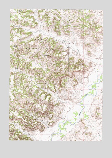
Bloom Creek, MT USGS Topographic Map
Click on map above to begin viewing in our Map Viewer.

This topographic map contains these locations and features:
Feature Name Type Latitude Longitude GNIS ID View Map
07S48E15ACAB01 WellWellN45.2278°W105.8239°808505View Map
07S48E24BCDB01 WellWellN45.2117°W105.7944°808437View Map
07S49E31DDAB01 WellWellN45.1775°W105.7583°808317View Map
07S49E32CCDA01 WellWellN45.1758°W105.7517°808314View Map
08S48E12AACA01 WellWellN45.1578°W105.7795°808219View Map
08S48E13BDDD01 WellWellN45.1383°W105.7875°808130View Map
08S48E16CCBB01 WellWellN45.1339°W105.8564°808101View Map
08S49E06AD__01 WellWellN45.1689°W105.7583°808281View Map
Basin CreekStreamN45.1855°W105.7700°1689970View Map
Bloom CreekStreamN45.1972°W105.7531°780129View Map
Bull ReservoirReservoirN45.2492°W105.8282°780579View Map
Clay ReservoirReservoirN45.2059°W105.8293°781343View Map
Dry CreekStreamN45.1622°W105.7575°1690001View Map
Dunning ReservoirReservoirN45.2142°W105.8700°782712View Map
Dutch GulchValleyN45.1358°W105.8214°782728View Map
Garst CreekStreamN45.1780°W105.7733°1689969View Map
Maverick ProngStreamN45.2153°W105.7872°786941View Map
North Fork Bloom CreekStreamN45.2292°W105.8325°788100View Map
Plum CreekStreamN45.1450°W105.7978°789003View Map
Plum Creek ReservoirReservoirN45.1919°W105.8685°789005View Map
Plum DamDamN45.1683°W105.7889°796682View Map
Rimrock ReservoirReservoirN45.2473°W105.8637°789594View Map
South Fork Bloom CreekStreamN45.2289°W105.8325°790911View Map
Spring CreekStreamN45.1258°W105.8378°791236View Map
Swope ReservoirReservoirN45.1977°W105.8336°791830View Map
Three Bar CreekStreamN45.1580°W105.7742°792116View Map
Wolf Den SpringSpringN45.1930°W105.8675°793458View Map

Note: Coordinates in the location and feature list above are referenced to NAD83 datum.


Copyright (C) 2008-2025 Ryan Niemi / Sunset Dynamics ... All Rights Reserved