TopoQuest Logo
Do you find TopoQuest useful?
Help keep TopoQuest running and adding new maps/features by donating!
Bitcoin:  19c7KJd3qBynnjoSw5npx9KScwjBe4ifkT
Litecoin:  LXs6TkuXGGXo1vDsWCkWVdjQX94eUKd6ui
Home View Maps Find Maps Find Places Resources & Links


Huckleberry Mountain, California Topographic Map

USGS Map Title: Huckleberry Mountain, CA
USGS Map MRC: 41123F3
DRG (GeoTIFF) Download: o41123f3.tif


Neighboring USGS Topographic Map Quads:


  Happy Camp, CA  
41123G4
 

  Slater Butte, CA  
41123G3
 

  Seiad Valley, CA  
41123G2
 

  Clear Creek, CA  
41123F4
 

  Huckleberry Mountain, CA  
41123F3
 

  Grider Valley, CA  
41123F2
 

  Ukonom Mountain, CA  
41123E4
 

  Ukonom Lake, CA  
41123E3
 

  Marble Mountain, CA  
41123E2


Map MRC Location:

N42°
W124°
N42°
W123°
H8 H7 H6 H5 H4 H3 H2 H1
G8 G7 G6 G5 G4 G3 G2 G1
F8 F7 F6 F5 F4 F3 F2 F1
E8 E7 E6 E5 E4 E3 E2 E1
D8 D7 D6 D5 D4 D3 D2 D1
C8 C7 C6 C5 C4 C3 C2 C1
B8 B7 B6 B5 B4 B3 B2 B1
A8 A7 A6 A5 A4 A3 A2 A1
N41°
W124°
N41°
W123°

Huckleberry Mountain, CA USGS 1:24K Topographic Map Preview:
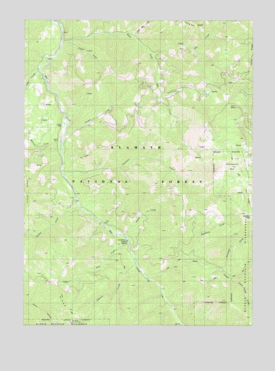
Huckleberry Mountain, CA USGS Topographic Map
Click on map above to begin viewing in our Map Viewer.

This topographic map contains these locations and features:
Feature Name Type Latitude Longitude GNIS ID View Map
Bear CreekStreamN41.6440°W123.3073°256650View Map
Bishop CreekStreamN41.6746°W123.3467°257089View Map
Buckhorn CreekStreamN41.6512°W123.2862°257614View Map
Buckhorn MountainSummitN41.6732°W123.2501°257622View Map
Buckhorn SpringSpringN41.6703°W123.2520°257627View Map
Cold SpringSpringN41.7150°W123.2598°258553View Map
Copper CreekStreamN41.7407°W123.3523°258701View Map
Cougar CreekStreamN41.7018°W123.3539°258779View Map
Doolittle CreekStreamN41.6871°W123.3542°259487View Map
East Fork Elk CreekStreamN41.7410°W123.3556°259731View Map
Green ValleyValleyN41.6432°W123.2617°260868View Map
Green Valley CreekStreamN41.6443°W123.2628°1664799View Map
Happy Camp DivisionCivilN41.7450°W123.3351°1935129View Map
HoskinPopulated PlaceN41.7087°W123.3634°1657393View Map
Huckleberry MountainSummitN41.6904°W123.2620°261593View Map
Johnson CreekStreamN41.6532°W123.3162°261972View Map
Lick CreekStreamN41.6582°W123.3181°262438View Map
Little Elk CreekStreamN41.7429°W123.3164°1664800View Map
Malone CreekStreamN41.6990°W123.3551°263135View Map
NorcrossLocaleN41.6474°W123.3114°277181View Map
Snowshoe CreekStreamN41.6482°W123.2684°267336View Map
Stanza CreekStreamN41.6610°W123.3214°267678View Map
Sulphur SpringSpringN41.6586°W123.3194°267907View Map
Sulphur Springs CampgroundLocaleN41.6590°W123.3203°277180View Map
Titus RidgeRidgeN41.6512°W123.3678°268304View Map
Turner MineMineN41.7371°W123.3420°277188View Map
Twin CreeksStreamN41.7298°W123.3684°268517View Map
Upper Elk CreekStreamN41.7360°W123.3067°1657432View Map

Note: Coordinates in the location and feature list above are referenced to NAD83 datum.


Copyright (C) 2008-2024 Ryan Niemi / Sunset Dynamics ... All Rights Reserved