TopoQuest Logo
Do you find TopoQuest useful?
Help keep TopoQuest running and adding new maps/features by donating!
Bitcoin:  19c7KJd3qBynnjoSw5npx9KScwjBe4ifkT
Litecoin:  LXs6TkuXGGXo1vDsWCkWVdjQX94eUKd6ui
Home View Maps Find Maps Find Places Resources & Links


Philo, California Topographic Map

USGS Map Title: Philo, CA
USGS Map MRC: 39123A4
DRG (GeoTIFF) Download: o39123a4.tif


Neighboring USGS Topographic Map Quads:


  Navarro, CA  
39123B5
 

  Bailey Ridge, CA  
39123B4
 

  Orrs Springs, CA  
39123B3
 

  Cold Spring, CA  
39123A5
 

  Philo, CA  
39123A4
 

  Boonville, CA  
39123A3
 

  Eureka Hill, CA  
38123H5
 

  Zeni Ridge, CA  
38123H4
 

  Ornbaun Valley, CA  
38123H3


Map MRC Location:

N40°
W124°
N40°
W123°
H8 H7 H6 H5 H4 H3 H2 H1
G8 G7 G6 G5 G4 G3 G2 G1
F8 F7 F6 F5 F4 F3 F2 F1
E8 E7 E6 E5 E4 E3 E2 E1
D8 D7 D6 D5 D4 D3 D2 D1
C8 C7 C6 C5 C4 C3 C2 C1
B8 B7 B6 B5 B4 B3 B2 B1
A8 A7 A6 A5 A4 A3 A2 A1
N39°
W124°
N39°
W123°

Philo, CA USGS 1:24K Topographic Map Preview:
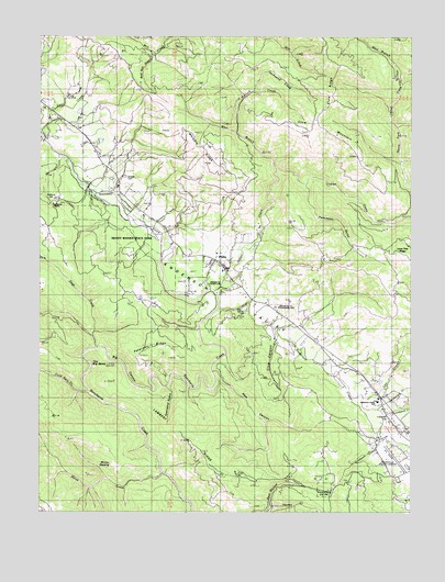
Philo, CA USGS Topographic Map
Click on map above to begin viewing in our Map Viewer.

This topographic map contains these locations and features:
Feature Name Type Latitude Longitude GNIS ID View Map
Anderson CreekStreamN39.0530°W123.4411°233415View Map
Anderson ValleyValleyN39.0866°W123.4795°218272View Map
Anderson Valley Elementary SchoolSchoolN39.0296°W123.3872°218274View Map
Anderson Valley Historical MuseumBuildingN39.0299°W123.3858°1724145View Map
Anderson Valley Junior - Senior High SchoolSchoolN39.0121°W123.3751°218273View Map
Anderson Valley Volunteer Fire Department Station 742BuildingN39.0648°W123.4400°2622207View Map
Anderson Valley Volunteer Fire StationBuildingN39.0834°W123.4739°2622245View Map
Big CanyonValleyN39.0343°W123.4589°219145View Map
Big Hendy GroveWoodsN39.0707°W123.4636°1724152View Map
Boonville AirportAirportN39.0110°W123.3795°1653275View Map
Bullock CreekStreamN39.1002°W123.4342°220135View Map
Christine JunctionLocaleN39.0905°W123.4789°1724170View Map
Clow CanyonValleyN39.0463°W123.4197°221264View Map
Clow MountainSummitN39.1005°W123.4058°221265View Map
Clow RidgeRidgeN39.1105°W123.4033°221266View Map
Cold Springs CreekStreamN39.0318°W123.4839°233698View Map
Con CreekStreamN39.0293°W123.3903°1662293View Map
Con Creek SchoolSchoolN39.0296°W123.3839°221437View Map
Creek ItalianStreamN39.0432°W123.4811°253654View Map
Dago CreekStreamN39.0430°W123.4822°253196View Map
Evergreen CemeteryCemeteryN39.0254°W123.3831°223297View Map
Faulkner County ParkParkN39.0049°W123.4047°223411View Map
Gowan CreekStreamN39.0752°W123.4611°224369View Map
Graveyard CreekStreamN39.0252°W123.3839°224511View Map
Gschwend CreekStreamN39.1107°W123.4286°224691View Map
Hagemann RanchLocaleN39.0752°W123.4995°224775View Map
Ham CanyonValleyN39.0371°W123.4422°224824View Map
Hendy GrovePopulated PlaceN39.0768°W123.4636°1653042View Map
Hendy Woods State ParkParkN39.0710°W123.4664°225173View Map
Highland RanchLocaleN39.0541°W123.4622°1653045View Map
Honey CreekStreamN39.0016°W123.4220°225514View Map
Horse CreekStreamN39.0099°W123.4586°234032View Map
Indian CreekStreamN39.0580°W123.4422°225867View Map
Indian Creek County ParkParkN39.0602°W123.4361°1662301View Map
Lambert RidgeRidgeN39.0199°W123.4517°226836View Map
Little Hendy GroveWoodsN39.0791°W123.4761°1724210View Map
Mendocino County Community SchoolSchoolN39.0543°W123.4222°253197View Map
Murray OpeningFlatN39.0113°W123.4742°229364View Map
Ornbaun CreekStreamN39.0221°W123.3833°230099View Map
Parkinson GulchValleyN39.0855°W123.4108°230359View Map
Peterson RidgeRidgeN39.0421°W123.4622°230575View Map
Philbrick MillPopulated PlaceN39.0821°W123.4953°1659379View Map
PhiloPopulated PlaceN39.0657°W123.4450°1659380View Map
Philo Census Designated PlaceCensusN39.0657°W123.4453°2628777View Map
Philo Post OfficePost OfficeN39.0660°W123.4405°2760045View Map
Rancheria Continuation High SchoolSchoolN39.0293°W123.3882°2516077View Map
Rancheria CreekStreamN39.0535°W123.4403°234534View Map
Rays ResortLocaleN39.0574°W123.4514°1653096View Map
Red Hill GulchValleyN39.1207°W123.4631°231335View Map
Saint John CanyonValleyN39.0918°W123.3786°232172View Map
Sherman GulchValleyN39.1013°W123.3800°232972View Map
Shields CemeteryCemeteryN39.0879°W123.4721°232992View Map
The Big BendBendN39.0407°W123.4822°236147View Map
Township GulchValleyN39.0330°W123.4581°236490View Map
Tumbling Mc'D' RanchLocaleN39.0516°W123.4420°1724259View Map
Unicorn SchoolSchoolN39.0691°W123.4403°2516040View Map
Van Zandts ResortLocaleN39.0513°W123.4381°1653125View Map
West Branch Indian CreekStreamN39.0896°W123.4200°237430View Map
West Branch North Fork Indian CreekStreamN39.1132°W123.3786°237434View Map
Whipple RanchLocaleN39.0963°W123.4442°1653128View Map
Whipple RidgeRidgeN39.0943°W123.4439°237606View Map
Witherell CreekStreamN39.0268°W123.3861°238081View Map

Note: Coordinates in the location and feature list above are referenced to NAD83 datum.


Copyright (C) 2008-2024 Ryan Niemi / Sunset Dynamics ... All Rights Reserved