TopoQuest Logo
Do you find TopoQuest useful?
Help keep TopoQuest running and adding new maps/features by donating!
Bitcoin:  19c7KJd3qBynnjoSw5npx9KScwjBe4ifkT
Litecoin:  LXs6TkuXGGXo1vDsWCkWVdjQX94eUKd6ui
Home View Maps Find Maps Find Places Resources & Links


Boonville, California Topographic Map

USGS Map Title: Boonville, CA
USGS Map MRC: 39123A3
DRG (GeoTIFF) Download: o39123a3.tif


Neighboring USGS Topographic Map Quads:


  Bailey Ridge, CA  
39123B4
 

  Orrs Springs, CA  
39123B3
 

  Ukiah, CA  
39123B2
 

  Philo, CA  
39123A4
 

  Boonville, CA  
39123A3
 

  Elledge Peak, CA  
39123A2
 

  Zeni Ridge, CA  
38123H4
 

  Ornbaun Valley, CA  
38123H3
 

  Yorkville, CA  
38123H2


Map MRC Location:

N40°
W124°
N40°
W123°
H8 H7 H6 H5 H4 H3 H2 H1
G8 G7 G6 G5 G4 G3 G2 G1
F8 F7 F6 F5 F4 F3 F2 F1
E8 E7 E6 E5 E4 E3 E2 E1
D8 D7 D6 D5 D4 D3 D2 D1
C8 C7 C6 C5 C4 C3 C2 C1
B8 B7 B6 B5 B4 B3 B2 B1
A8 A7 A6 A5 A4 A3 A2 A1
N39°
W124°
N39°
W123°

Boonville, CA USGS 1:24K Topographic Map Preview:
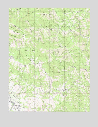
Boonville, CA USGS Topographic Map
Click on map above to begin viewing in our Map Viewer.

This topographic map contains these locations and features:
Feature Name Type Latitude Longitude GNIS ID View Map
Anderson Valley Volunteer Fire Department Station 741BuildingN39.0071°W123.3649°2621992View Map
Barkshed OpeningFlatN39.0730°W123.3464°218673View Map
Bell ValleyBasinN39.0263°W123.2914°218995View Map
Bell Valley RanchLocaleN39.0263°W123.2908°1652987View Map
Big OpeningFlatN39.0724°W123.3370°219225View Map
Black Oak RidgeRidgeN39.0605°W123.3395°219391View Map
BoonvillePopulated PlaceN39.0091°W123.3661°1658110View Map
Boonville Census Designated PlaceCensusN39.0115°W123.3740°2628712View Map
Boonville Post OfficePost OfficeN39.0081°W123.3666°2760021View Map
Casabonne PeakSummitN39.0785°W123.2897°1658229View Map
China GateGapN39.0988°W123.3275°221034View Map
Cow MountainSummitN39.0930°W123.3539°1658329View Map
Cow SpringSpringN39.0896°W123.3520°221710View Map
Donelly CreekStreamN39.0146°W123.3689°222496View Map
Goat RidgeRidgeN39.0996°W123.3145°224246View Map
Green TreesLocaleN39.0563°W123.3292°224569View Map
Gut CreekStreamN39.0760°W123.3328°224748View Map
Jakes OpeningFlatN39.0496°W123.2895°226116View Map
Laurel SpringSpringN39.0366°W123.3192°253199View Map
Lone Tree RidgeRidgeN39.0571°W123.3595°227530View Map
Middle RidgeRidgeN39.0938°W123.3608°228613View Map
Mill CreekStreamN39.0099°W123.3703°228688View Map
North Fork Indian CreekStreamN39.0777°W123.3742°229684View Map
North RidgeRidgeN39.1063°W123.3450°229750View Map
Robinson CreekStreamN39.0096°W123.3695°231688View Map
Rocky RidgeRidgeN39.1180°W123.3200°231794View Map
Sherman RidgeRidgeN39.1021°W123.3614°232977View Map
Shoemake OpeningGapN39.0793°W123.2939°233040View Map
Skunk CreekStreamN39.1138°W123.2739°233207View Map
Soda CreekStreamN39.0043°W123.3520°234821View Map
Soda SpringSpringN39.0232°W123.3153°234838View Map
Soda SpringsPopulated PlaceN39.0241°W123.3158°1653114View Map
South Branch Robinson CreekStreamN39.0882°W123.2528°234940View Map
South RidgeRidgeN39.0980°W123.3431°235105View Map
Stambaugh RanchLocaleN39.0988°W123.2661°1653115View Map

Note: Coordinates in the location and feature list above are referenced to NAD83 datum.


Copyright (C) 2008-2024 Ryan Niemi / Sunset Dynamics ... All Rights Reserved