TopoQuest Logo
Do you find TopoQuest useful?
Help keep TopoQuest running and adding new maps/features by donating!
Bitcoin:  19c7KJd3qBynnjoSw5npx9KScwjBe4ifkT
Litecoin:  LXs6TkuXGGXo1vDsWCkWVdjQX94eUKd6ui
Home View Maps Find Maps Find Places Resources & Links


Iconium, Iowa Topographic Map

USGS Map Title: Iconium, IA
USGS Map MRC: 40092H8
DRG (GeoTIFF) Download: o40092h8.tif


Neighboring USGS Topographic Map Quads:


  Weller, IA  
41093A1
 

  Hiteman, IA  
41092A8
 

  Albia, IA  
41092A7
 

  Melrose, IA  
40093H1
 

  Iconium, IA  
40092H8
 

  Moravia, IA  
40092H7
 

  Plano, IA  
40093G1
 

  Mystic, IA  
40092G8
 

  Hiattsville, IA  
40092G7


Map MRC Location:

N41°
W93°
N41°
W92°
H8 H7 H6 H5 H4 H3 H2 H1
G8 G7 G6 G5 G4 G3 G2 G1
F8 F7 F6 F5 F4 F3 F2 F1
E8 E7 E6 E5 E4 E3 E2 E1
D8 D7 D6 D5 D4 D3 D2 D1
C8 C7 C6 C5 C4 C3 C2 C1
B8 B7 B6 B5 B4 B3 B2 B1
A8 A7 A6 A5 A4 A3 A2 A1
N40°
W93°
N40°
W92°

Iconium, IA USGS 1:24K Topographic Map Preview:
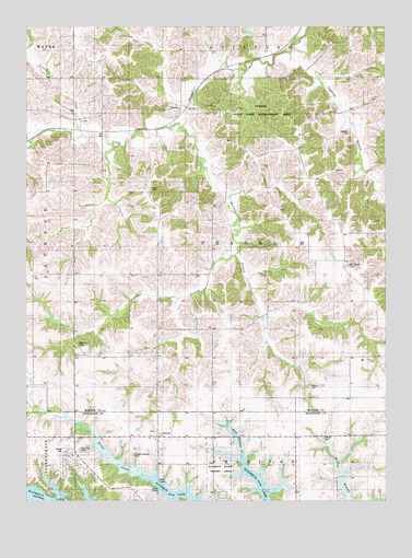
Iconium, IA USGS Topographic Map
Click on map above to begin viewing in our Map Viewer.

This topographic map contains these locations and features:
Feature Name Type Latitude Longitude GNIS ID View Map
Brandon CemeteryCemeteryN40.9164°W92.9812°1823312View Map
Brush SchoolSchoolN40.8881°W92.8888°454895View Map
Contrary CreekStreamN40.9714°W92.9802°455580View Map
Derby CemeteryCemeteryN40.9577°W92.9560°1823315View Map
Hayes School Number 5SchoolN40.9128°W92.9985°465837View Map
IconiumPopulated PlaceN40.8914°W92.9552°457742View Map
Iconium CemeteryCemeteryN40.8932°W92.9550°1970317View Map
Iconium Post Office (historical)Post OfficeN40.8914°W92.9552°1970153View Map
Inghram BranchStreamN40.9947°W92.9071°457814View Map
Inghram CemeteryCemeteryN40.9725°W92.8879°1823316View Map
La Mar SchoolSchoolN40.9533°W92.9555°458154View Map
Moffatt BranchStreamN40.9395°W92.9280°1823313View Map
Mormon BranchStreamN40.9733°W92.9463°459233View Map
Mormon BranchStreamN40.8942°W92.9121°459234View Map
Mount Carmel CemeteryCemeteryN40.9370°W92.8880°1823314View Map
North Mount Carmel SchoolSchoolN40.9606°W92.9010°459608View Map
Rathbun State Resort AreaParkN40.8797°W92.9321°1823311View Map
Salem CemeteryCemeteryN40.8917°W92.8969°1823309View Map
Salem ChurchChurchN40.8914°W92.8985°461362View Map
South Mount Carmel SchoolSchoolN40.9383°W92.8977°461794View Map
Township of FranklinCivilN40.9426°W92.9262°467860View Map
TyronePopulated PlaceN40.9778°W92.9466°462410View Map
Tyrone (historical)LocaleN40.9778°W92.9466°1970336View Map
Tyrone Post Office (historical)Post OfficeN40.9778°W92.9466°1970337View Map
Tyrone State Game Management AreaParkN40.9792°W92.9196°1823317View Map
Vance SchoolSchoolN40.9972°W92.9252°462541View Map
Vosburg SchoolSchoolN40.9197°W92.9541°462595View Map
Welch CemeteryCemeteryN40.9047°W92.9010°1823310View Map
West Point SchoolSchoolN40.9136°W92.9083°462902View Map

Note: Coordinates in the location and feature list above are referenced to NAD83 datum.


Copyright (C) 2008-2025 Ryan Niemi / Sunset Dynamics ... All Rights Reserved