TopoQuest Logo
Do you find TopoQuest useful?
Help keep TopoQuest running and adding new maps/features by donating!
Bitcoin:  19c7KJd3qBynnjoSw5npx9KScwjBe4ifkT
Litecoin:  LXs6TkuXGGXo1vDsWCkWVdjQX94eUKd6ui
Home View Maps Find Maps Find Places Resources & Links


Melrose, Iowa Topographic Map

USGS Map Title: Melrose, IA
USGS Map MRC: 40093H1
DRG (GeoTIFF) Download: o40093h1.tif


Neighboring USGS Topographic Map Quads:


  Olmitz, IA  
41093A2
 

  Weller, IA  
41093A1
 

  Hiteman, IA  
41092A8
 

  Russell, IA  
40093H2
 

  Melrose, IA  
40093H1
 

  Iconium, IA  
40092H8
 

  Confidence, IA  
40093G2
 

  Plano, IA  
40093G1
 

  Mystic, IA  
40092G8


Map MRC Location:

N41°
W94°
N41°
W93°
H8 H7 H6 H5 H4 H3 H2 H1
G8 G7 G6 G5 G4 G3 G2 G1
F8 F7 F6 F5 F4 F3 F2 F1
E8 E7 E6 E5 E4 E3 E2 E1
D8 D7 D6 D5 D4 D3 D2 D1
C8 C7 C6 C5 C4 C3 C2 C1
B8 B7 B6 B5 B4 B3 B2 B1
A8 A7 A6 A5 A4 A3 A2 A1
N40°
W94°
N40°
W93°

Melrose, IA USGS 1:24K Topographic Map Preview:
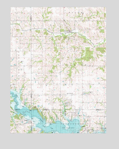
Melrose, IA USGS Topographic Map
Click on map above to begin viewing in our Map Viewer.

This topographic map contains these locations and features:
Feature Name Type Latitude Longitude GNIS ID View Map
Bee BranchStreamN40.9622°W93.0158°454475View Map
Blarney Stone ParkParkN40.9761°W93.0505°1970416View Map
Bleubaugh CreekStreamN40.9708°W93.0669°1823306View Map
Bridgeview Recreation AreaParkN40.8764°W93.0141°1823303View Map
Bunker Hill SchoolSchoolN40.8844°W93.1158°454983View Map
City of MelroseCivilN40.9790°W93.0508°2395089View Map
Evans CemeteryCemeteryN40.9016°W93.0949°456408View Map
Grady CemeteryCemeteryN40.9937°W93.0320°1823308View Map
Greenvale SchoolSchoolN40.9422°W93.1152°457125View Map
Greenville CemeteryCemeteryN40.9461°W93.1114°1823305View Map
Greenville Post Office (historical)Post OfficeN40.9422°W93.1080°1970580View Map
Hazel Point SchoolSchoolN40.9356°W93.0799°457365View Map
Honey CreekStreamN40.9167°W93.1246°457609View Map
Jackoak SchoolSchoolN40.9786°W93.0033°457883View Map
Johnson CemeteryCemeteryN40.8833°W93.0974°1970296View Map
MelroseLocaleN40.9744°W93.0494°1970423View Map
MelrosePopulated PlaceN40.9761°W93.0505°458957View Map
Melrose Community HallBuildingN40.9761°W93.0505°1970418View Map
Melrose Fire DepartmentBuildingN40.9758°W93.0474°1970419View Map
Melrose Methodist CemeteryCemeteryN40.9750°W93.0502°1970436View Map
Melrose Post OfficePost OfficeN40.9761°W93.0505°1970417View Map
Milledgeville CemeteryCemeteryN40.8805°W93.0313°457497View Map
Mound SchoolSchoolN40.9722°W93.1177°459269View Map
Mount Calvary CemeteryCemeteryN40.9687°W93.0510°1823307View Map
Murphys Landing Strip (historical)AirportN40.9142°W93.0474°1823304View Map
New Providence Baptist ChurchChurchN40.9761°W93.0505°1970420View Map
Osprey Post Office (historical)Post OfficeN40.9111°W93.0691°1970330View Map
Osprey SchoolSchoolN40.9142°W93.0802°459909View Map
Pleasant Grove SchoolSchoolN40.9214°W93.1227°460231View Map
Pleasant Hill SchoolSchoolN40.8897°W93.0224°460266View Map
Prairie Center SchoolSchoolN40.9131°W93.0421°460388View Map
Rathbun State Wildlife AreaParkN40.8992°W93.0983°1823302View Map
Saint Patricks Catholic ChurchChurchN40.9761°W93.0505°1970422View Map
Tater Hill SchoolSchoolN40.8914°W93.0602°462182View Map
Tick Ridge SchoolSchoolN40.9428°W93.0033°462239View Map
Township of JacksonCivilN40.9424°W93.0409°468111View Map

Note: Coordinates in the location and feature list above are referenced to NAD83 datum.


Copyright (C) 2008-2025 Ryan Niemi / Sunset Dynamics ... All Rights Reserved