TopoQuest Logo
Do you find TopoQuest useful?
Help keep TopoQuest running and adding new maps/features by donating!
Bitcoin:  19c7KJd3qBynnjoSw5npx9KScwjBe4ifkT
Litecoin:  LXs6TkuXGGXo1vDsWCkWVdjQX94eUKd6ui
Home View Maps Find Maps Find Places Resources & Links


Indian Springs, Indiana Topographic Map

USGS Map Title: Indian Springs, IN
USGS Map MRC: 38086G7
DRG (GeoTIFF) Download: o38086g7.tif


Neighboring USGS Topographic Map Quads:


  Scotland, IN  
38086H8
 

  Koleen, IN  
38086H7
 

  Owensburg, IN  
38086H6
 

  Odon, IN  
38086G8
 

  Indian Springs, IN  
38086G7
 

  Williams, IN  
38086G6
 

  Loogootee, IN  
38086F8
 

  Shoals, IN  
38086F7
 

  Huron, IN  
38086F6


Map MRC Location:

N39°
W87°
N39°
W86°
H8 H7 H6 H5 H4 H3 H2 H1
G8 G7 G6 G5 G4 G3 G2 G1
F8 F7 F6 F5 F4 F3 F2 F1
E8 E7 E6 E5 E4 E3 E2 E1
D8 D7 D6 D5 D4 D3 D2 D1
C8 C7 C6 C5 C4 C3 C2 C1
B8 B7 B6 B5 B4 B3 B2 B1
A8 A7 A6 A5 A4 A3 A2 A1
N38°
W87°
N38°
W86°

Indian Springs, IN USGS 1:24K Topographic Map Preview:
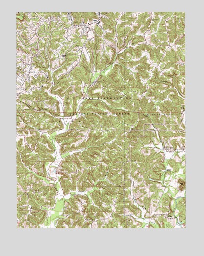
Indian Springs, IN USGS Topographic Map
Click on map above to begin viewing in our Map Viewer.

This topographic map contains these locations and features:
Feature Name Type Latitude Longitude GNIS ID View Map
Bear HillSummitN38.7762°W86.7508°450661View Map
Blankenship CemeteryCemeteryN38.8350°W86.8156°431179View Map
Boggs Creek CemeteryCemeteryN38.7959°W86.8403°431292View Map
Bridges CemeteryCemeteryN38.8198°W86.7739°431519View Map
Brock CemeteryCemeteryN38.8567°W86.7894°431551View Map
CalePopulated PlaceN38.7959°W86.7514°449812View Map
Carr CemeteryCemeteryN38.8412°W86.8192°432167View Map
Dye Post Office (historical)Post OfficeN38.7984°W86.8436°453020View Map
Gobbler KnobSummitN38.8500°W86.8419°435141View Map
Goldsberry HollowValleyN38.7675°W86.8395°435161View Map
Henry CemeteryCemeteryN38.7820°W86.8322°436029View Map
Holt CemeteryCemeteryN38.8428°W86.8725°436342View Map
Indian SpringsPopulated PlaceN38.7964°W86.7650°436782View Map
Johnson HollowValleyN38.8248°W86.7501°437060View Map
Little Hickory Ridge CemeteryCemeteryN38.7881°W86.7947°438067View Map
Naval Surface Warfare Center CraneMilitaryN38.7503°W86.7924°2511951View Map
Opossum HollowValleyN38.7558°W86.7818°440668View Map
Pigeon RidgeRidgeN38.7631°W86.8653°441120View Map
Pleasant Grove CemeteryCemeteryN38.8706°W86.7744°441245View Map
Poss CreekStreamN38.7537°W86.7769°451362View Map
Salem CemeteryCemeteryN38.8692°W86.8333°442881View Map
Sulphur CreekStreamN38.7837°W86.7639°451524View Map
Sulphur SpringsSpringN38.7832°W86.7644°444381View Map
Township of PerryCivilN38.7835°W86.8651°452422View Map
Trinity SpringsSpringN38.7569°W86.7552°448387View Map
Trinity SpringsSpringN38.7573°W86.7644°444910View Map
Turkey CreekStreamN38.8098°W86.8372°444966View Map
Waggoner CemeteryCemeteryN38.8734°W86.8117°445346View Map
Wards CemeteryCemeteryN38.8073°W86.7908°445469View Map
West Union CemeteryCemeteryN38.7548°W86.8203°445820View Map

Note: Coordinates in the location and feature list above are referenced to NAD83 datum.


Copyright (C) 2008-2024 Ryan Niemi / Sunset Dynamics ... All Rights Reserved