TopoQuest Logo
Do you find TopoQuest useful?
Help keep TopoQuest running and adding new maps/features by donating!
Bitcoin:  19c7KJd3qBynnjoSw5npx9KScwjBe4ifkT
Litecoin:  LXs6TkuXGGXo1vDsWCkWVdjQX94eUKd6ui
Home View Maps Find Maps Find Places Resources & Links


James City, Pennsylvania Topographic Map

USGS Map Title: James City, PA
USGS Map MRC: 41078E7
DRG (GeoTIFF) Download: o41078e7.tif


Neighboring USGS Topographic Map Quads:


  Ludlow, PA  
41078F8
 

  Kane, PA  
41078F7
 

  Mount Jewett, PA  
41078F6
 

  Russell City, PA  
41078E8
 

  James City, PA  
41078E7
 

  Wilcox, PA  
41078E6
 

  Hallton, PA  
41078D8
 

  Portland Mills, PA  
41078D7
 

  Ridgway, PA  
41078D6


Map MRC Location:

N42°
W79°
N42°
W78°
H8 H7 H6 H5 H4 H3 H2 H1
G8 G7 G6 G5 G4 G3 G2 G1
F8 F7 F6 F5 F4 F3 F2 F1
E8 E7 E6 E5 E4 E3 E2 E1
D8 D7 D6 D5 D4 D3 D2 D1
C8 C7 C6 C5 C4 C3 C2 C1
B8 B7 B6 B5 B4 B3 B2 B1
A8 A7 A6 A5 A4 A3 A2 A1
N41°
W79°
N41°
W78°

James City, PA USGS 1:24K Topographic Map Preview:
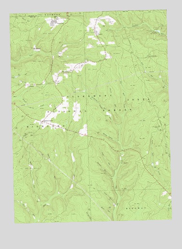
James City, PA USGS Topographic Map
Click on map above to begin viewing in our Map Viewer.

This topographic map contains these locations and features:
Feature Name Type Latitude Longitude GNIS ID View Map
Ben Hur CampLocaleN41.5342°W78.7867°1209414View Map
Black Cherry Interpretive TrailTrailN41.6117°W78.7664°1210499View Map
Bunts RunStreamN41.5053°W78.7956°1209459View Map
Bush HollowValleyN41.5476°W78.7914°1209464View Map
CarlsonPopulated PlaceN41.5840°W78.8392°1209480View Map
CCC Camp (historical)LocaleN41.5609°W78.8536°1210291View Map
Cherry RunStreamN41.5623°W78.7867°1209498View Map
Durant City JunctionLocaleN41.6159°W78.8064°1210293View Map
Ellithorpe RunStreamN41.5567°W78.7898°1209595View Map
HanleyLocaleN41.5412°W78.8706°1214198View Map
Hanley Fire TowerTowerN41.5415°W78.8734°1213060View Map
Highland CornersPopulated PlaceN41.5603°W78.8509°1209672View Map
Highland Township Volunteer Fire Department Company 8BuildingN41.6208°W78.8383°2645284View Map
James CityPopulated PlaceN41.6201°W78.8389°1209704View Map
James City Census Designated PlaceCensusN41.6180°W78.8443°2630017View Map
James City Post OfficePost OfficeN41.6199°W78.8403°2779928View Map
Kane Experimental ForestParkN41.5984°W78.7645°1210479View Map
Kane Experimental Forest HeadquartersLocaleN41.5976°W78.7659°1209719View Map
La MontLocaleN41.6017°W78.8359°1210292View Map
LamontPopulated PlaceN41.6123°W78.8070°1209745View Map
Maple RunStreamN41.5117°W78.8503°1209794View Map
McKinleyPopulated PlaceN41.6034°W78.8550°1209808View Map
Mill Creek Loop Hiking TrailTrailN41.5740°W78.7831°1210493View Map
NansenPopulated PlaceN41.5823°W78.8628°1209849View Map
Pigeon RunStreamN41.5170°W78.8403°1209886View Map
Pine RunStreamN41.5090°W78.7939°1209892View Map
Pine RunStreamN41.5026°W78.8575°1209895View Map
Silver Creek CampLocaleN41.5556°W78.7586°1209984View Map
Slide RunStreamN41.5278°W78.7942°1209991View Map
Spencer RunStreamN41.5262°W78.7948°1210005View Map
Twin Lakes Recreation AreaParkN41.6115°W78.7553°1210066View Map

Note: Coordinates in the location and feature list above are referenced to NAD83 datum.


Copyright (C) 2008-2024 Ryan Niemi / Sunset Dynamics ... All Rights Reserved