TopoQuest Logo
Do you find TopoQuest useful?
Help keep TopoQuest running and adding new maps/features by donating!
Bitcoin:  19c7KJd3qBynnjoSw5npx9KScwjBe4ifkT
Litecoin:  LXs6TkuXGGXo1vDsWCkWVdjQX94eUKd6ui
Home View Maps Find Maps Find Places Resources & Links


Ludlow, Pennsylvania Topographic Map

USGS Map Title: Ludlow, PA
USGS Map MRC: 41078F8
DRG (GeoTIFF) Download: o41078f8.tif


Neighboring USGS Topographic Map Quads:


  Clarendon, PA  
41079G1
 

  Cornplanter Bridge, PA  
41078G8
 

  Westline, PA  
41078G7
 

  Sheffield, PA  
41079F1
 

  Ludlow, PA  
41078F8
 

  Kane, PA  
41078F7
 

  Lynch, PA  
41079E1
 

  Russell City, PA  
41078E8
 

  James City, PA  
41078E7


Map MRC Location:

N42°
W79°
N42°
W78°
H8 H7 H6 H5 H4 H3 H2 H1
G8 G7 G6 G5 G4 G3 G2 G1
F8 F7 F6 F5 F4 F3 F2 F1
E8 E7 E6 E5 E4 E3 E2 E1
D8 D7 D6 D5 D4 D3 D2 D1
C8 C7 C6 C5 C4 C3 C2 C1
B8 B7 B6 B5 B4 B3 B2 B1
A8 A7 A6 A5 A4 A3 A2 A1
N41°
W79°
N41°
W78°

Ludlow, PA USGS 1:24K Topographic Map Preview:
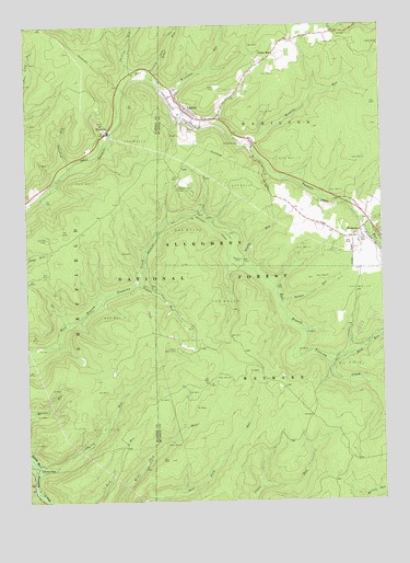
Ludlow, PA USGS Topographic Map
Click on map above to begin viewing in our Map Viewer.

This topographic map contains these locations and features:
Feature Name Type Latitude Longitude GNIS ID View Map
Bloody RunStreamN41.6884°W78.9245°1210150View Map
Cherry RunLocaleN41.6342°W78.9964°1210267View Map
Cherry RunPopulated PlaceN41.6342°W78.9964°1210153View Map
Cherry RunStreamN41.6351°W78.9975°1210154View Map
County Line RunStreamN41.7378°W78.9559°1210159View Map
Gibbs HillPopulated PlaceN41.7426°W78.9125°1210176View Map
Hoffman Farm CampLocaleN41.7070°W78.9464°1210180View Map
LudlowPopulated PlaceN41.7284°W78.9434°1210188View Map
Ludlow Post OfficePost OfficeN41.7334°W78.9477°2779784View Map
Ludlow School (historical)SchoolN41.7256°W78.9356°1210400View Map
Ludlow Volunteer Fire DepartmentBuildingN41.7257°W78.9450°2644901View Map
Moriah CemeteryCemeteryN41.7236°W78.9433°1210195View Map
Negro RunStreamN41.6976°W78.8789°1210371View Map
Phillips RunStreamN41.7370°W78.9636°1210201View Map
Pigeon RunStreamN41.6831°W78.9603°1210202View Map
Rock RunStreamN41.6612°W78.8945°1209935View Map
RoystonePopulated PlaceN41.7223°W78.9706°1210206View Map
Roystone RunStreamN41.7123°W78.9839°1210207View Map
Sheffield Lookout TowerTowerN41.6945°W78.9928°1212132View Map
Thomas RunStreamN41.6776°W78.9103°1210219View Map
Tionesta Natural AreaParkN41.6440°W78.9373°1210480View Map
Tionesta Scenic AreaParkN41.6648°W78.9498°1210223View Map
WetmorePopulated PlaceN41.6951°W78.8756°1210228View Map
Wildcat Recreation SiteLocaleN41.7198°W78.9220°1213077View Map
Wildcat RunStreamN41.7192°W78.9203°1210229View Map
Windfall RunStreamN41.7331°W78.9500°1210232View Map

Note: Coordinates in the location and feature list above are referenced to NAD83 datum.


Copyright (C) 2008-2024 Ryan Niemi / Sunset Dynamics ... All Rights Reserved