TopoQuest Logo
Do you find TopoQuest useful?
Help keep TopoQuest running and adding new maps/features by donating!
Bitcoin:  19c7KJd3qBynnjoSw5npx9KScwjBe4ifkT
Litecoin:  LXs6TkuXGGXo1vDsWCkWVdjQX94eUKd6ui
Home View Maps Find Maps Find Places Resources & Links


Russell City, Pennsylvania Topographic Map

USGS Map Title: Russell City, PA
USGS Map MRC: 41078E8
DRG (GeoTIFF) Download: o41078e8.tif


Neighboring USGS Topographic Map Quads:


  Sheffield, PA  
41079F1
 

  Ludlow, PA  
41078F8
 

  Kane, PA  
41078F7
 

  Lynch, PA  
41079E1
 

  Russell City, PA  
41078E8
 

  James City, PA  
41078E7
 

  Marienville East, PA  
41079D1
 

  Hallton, PA  
41078D8
 

  Portland Mills, PA  
41078D7


Map MRC Location:

N42°
W79°
N42°
W78°
H8 H7 H6 H5 H4 H3 H2 H1
G8 G7 G6 G5 G4 G3 G2 G1
F8 F7 F6 F5 F4 F3 F2 F1
E8 E7 E6 E5 E4 E3 E2 E1
D8 D7 D6 D5 D4 D3 D2 D1
C8 C7 C6 C5 C4 C3 C2 C1
B8 B7 B6 B5 B4 B3 B2 B1
A8 A7 A6 A5 A4 A3 A2 A1
N41°
W79°
N41°
W78°

Russell City, PA USGS 1:24K Topographic Map Preview:
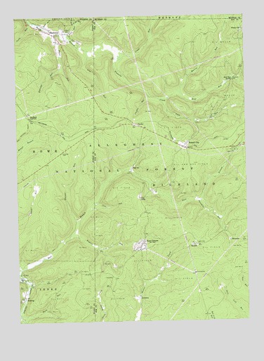
Russell City, PA USGS Topographic Map
Click on map above to begin viewing in our Map Viewer.

This topographic map contains these locations and features:
Feature Name Type Latitude Longitude GNIS ID View Map
Bank RunStreamN41.5015°W78.9986°1209396View Map
Bogus RunStreamN41.6198°W78.9803°1209440View Map
BrookstonPopulated PlaceN41.6176°W78.9784°1209446View Map
ChaffeePopulated PlaceN41.5803°W78.9339°1209488View Map
Chaffee RunStreamN41.5926°W78.9270°1209489View Map
Coon RunStreamN41.5915°W78.9225°1209528View Map
CorduroyPopulated PlaceN41.5098°W78.9345°1209531View Map
Crane RunStreamN41.6112°W78.9439°1210161View Map
DeYoung Post Office (historical)Post OfficeN41.5715°W78.9081°1210349View Map
DunringPopulated PlaceN41.5101°W78.9975°1210166View Map
East Branch Spring CreekStreamN41.5198°W78.9998°1209583View Map
East Fork RunStreamN41.6220°W78.9673°1210170View Map
Eldridge RunStreamN41.6045°W78.9745°1209591View Map
Fork RunStreamN41.6162°W78.9711°1209609View Map
Four CornersPopulated PlaceN41.5295°W78.9334°1209611View Map
Hi-La Fish Rearing PoolReservoirN41.5595°W78.9320°1210490View Map
Iron RunStreamN41.6120°W78.9606°1209693View Map
Martin RunStreamN41.5940°W78.9100°1210190View Map
Pigs EarPopulated PlaceN41.5634°W78.9370°1209888View Map
Pine CampLocaleN41.5506°W78.9334°1209379View Map
Pine RunStreamN41.5487°W78.9567°1209893View Map
Rock RunStreamN41.6203°W78.9836°1209934View Map
Russell CityPopulated PlaceN41.5715°W78.9086°1209944View Map
SackettPopulated PlaceN41.5315°W78.9036°1209947View Map
Sheffield JunctionPopulated PlaceN41.5834°W78.9914°1209972View Map
ThreemilePopulated PlaceN41.5331°W78.8839°1210035View Map
Threemile RunStreamN41.5498°W78.8998°1210036View Map
Township of HighlandCivilN41.5379°W78.8866°1216400View Map
Tuttle RunStreamN41.6228°W78.9911°1210065View Map
Twin Lakes TrailTrailN41.5876°W78.8825°1210412View Map
Wagner RunStreamN41.5365°W78.9695°1210077View Map
Warner RunStreamN41.5423°W78.9667°1210082View Map
West Fork RunStreamN41.6223°W78.9675°1210097View Map
Windy CityPopulated PlaceN41.6190°W78.8759°1210128View Map
Wolf RunStreamN41.5934°W78.9098°1210136View Map
Wolf Run SpringSpringN41.5987°W78.8817°1210138View Map

Note: Coordinates in the location and feature list above are referenced to NAD83 datum.


Copyright (C) 2008-2025 Ryan Niemi / Sunset Dynamics ... All Rights Reserved