TopoQuest Logo
Do you find TopoQuest useful?
Help keep TopoQuest running and adding new maps/features by donating!
Bitcoin:  19c7KJd3qBynnjoSw5npx9KScwjBe4ifkT
Litecoin:  LXs6TkuXGGXo1vDsWCkWVdjQX94eUKd6ui
Home View Maps Find Maps Find Places Resources & Links


Hallton, Pennsylvania Topographic Map

USGS Map Title: Hallton, PA
USGS Map MRC: 41078D8
DRG (GeoTIFF) Download: o41078d8.tif


Neighboring USGS Topographic Map Quads:


  Lynch, PA  
41079E1
 

  Russell City, PA  
41078E8
 

  James City, PA  
41078E7
 

  Marienville East, PA  
41079D1
 

  Hallton, PA  
41078D8
 

  Portland Mills, PA  
41078D7
 

  Sigel, PA  
41079C1
 

  Munderf, PA  
41078C8
 

  Carman, PA  
41078C7


Map MRC Location:

N42°
W79°
N42°
W78°
H8 H7 H6 H5 H4 H3 H2 H1
G8 G7 G6 G5 G4 G3 G2 G1
F8 F7 F6 F5 F4 F3 F2 F1
E8 E7 E6 E5 E4 E3 E2 E1
D8 D7 D6 D5 D4 D3 D2 D1
C8 C7 C6 C5 C4 C3 C2 C1
B8 B7 B6 B5 B4 B3 B2 B1
A8 A7 A6 A5 A4 A3 A2 A1
N41°
W79°
N41°
W78°

Hallton, PA USGS 1:24K Topographic Map Preview:
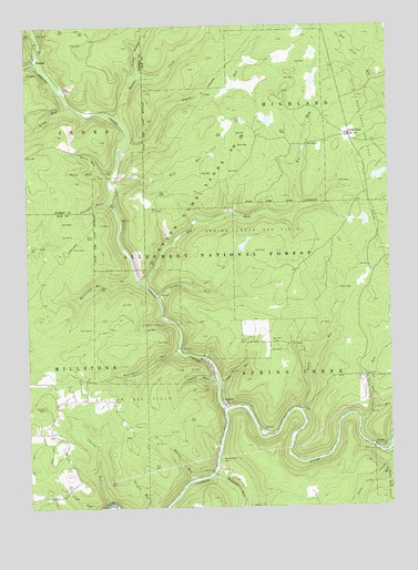
Hallton, PA USGS Topographic Map
Click on map above to begin viewing in our Map Viewer.

This topographic map contains these locations and features:
Feature Name Type Latitude Longitude GNIS ID View Map
ArroyoPopulated PlaceN41.3909°W78.8803°1202988View Map
Beech Bottom RunStreamN41.3892°W78.8750°1209410View Map
Belvidere RunStreamN41.4165°W78.9475°1198411View Map
Beuhler CornerPopulated PlaceN41.4078°W78.8845°1210471View Map
Big RunStreamN41.4331°W78.9606°1198433View Map
Church RunStreamN41.3765°W78.9734°1198569View Map
Cole RunStreamN41.3998°W78.8811°1198590View Map
Crow RunStreamN41.3981°W78.8859°1198624View Map
Elliott RunStreamN41.3826°W78.9436°1198705View Map
HalltonPopulated PlaceN41.4020°W78.9323°1198853View Map
Hallton Gas FieldOilfieldN41.4023°W78.9659°1198854View Map
Hill RunStreamN41.4601°W78.9695°1198889View Map
Hunter CreekStreamN41.4759°W78.9664°1209684View Map
Irwin RunStreamN41.4001°W78.9053°1198929View Map
Irwins MillsLocaleN41.4006°W78.9056°1202251View Map
Kemp RunStreamN41.4801°W78.9848°1198967View Map
Lake City RunStreamN41.3892°W78.8761°1209742View Map
Lappin RunStreamN41.4076°W78.9339°1198997View Map
Little Crow RunStreamN41.4081°W78.9328°1199050View Map
Little Hunter CreekStreamN41.4884°W78.9600°1210187View Map
Little RunStreamN41.4303°W78.9542°1199061View Map
Maxwell RunStreamN41.3845°W78.9348°1209801View Map
Maxwell Run CemeteryCemeteryN41.3876°W78.9334°1199123View Map
McClellan RunStreamN41.4353°W78.9625°1199127View Map
Millstone High SchoolSchoolN41.3873°W78.9856°1201227View Map
Owls NestPopulated PlaceN41.4715°W78.8875°1199263View Map
ParrishPopulated PlaceN41.4915°W78.9967°1199278View Map
Pearsall RunStreamN41.4548°W78.9700°1209055View Map
Pigeon RunStreamN41.4690°W78.9639°1199300View Map
Raven RunStreamN41.4634°W78.9739°1199358View Map
Spring CreekStreamN41.4006°W78.9325°1210212View Map
Spring Creek Gas FieldOilfieldN41.4459°W78.9125°1199584View Map
State Game Lands Number 28ParkN41.4581°W78.9389°1199600View Map
Steep RunStreamN41.4612°W78.9700°1199614View Map
Township of Spring CreekCivilN41.3906°W78.8801°1216406View Map
Wolf RunStreamN41.4906°W78.9953°1199809View Map
Woodchuck RunStreamN41.4515°W78.9300°1200857View Map
Zimmerman Fire TowerTowerN41.4012°W78.9945°1201226View Map

Note: Coordinates in the location and feature list above are referenced to NAD83 datum.


Copyright (C) 2008-2025 Ryan Niemi / Sunset Dynamics ... All Rights Reserved