TopoQuest Logo
Do you find TopoQuest useful?
Help keep TopoQuest running and adding new maps/features by donating!
Bitcoin:  19c7KJd3qBynnjoSw5npx9KScwjBe4ifkT
Litecoin:  LXs6TkuXGGXo1vDsWCkWVdjQX94eUKd6ui
Home View Maps Find Maps Find Places Resources & Links


Jamestown, Missouri Topographic Map

USGS Map Title: Jamestown, MO
USGS Map MRC: 38092G4
DRG (GeoTIFF) Download: o38092g4.tif


Neighboring USGS Topographic Map Quads:


  Rocheport, MO  
38092H5
 

  Huntsdale, MO  
38092H4
 

  Columbia, MO  
38092H3
 

  Prairie Home, MO  
38092G5
 

  Jamestown, MO  
38092G4
 

  Ashland, MO  
38092G3
 

  California North, MO  
38092F5
 

  Centertown NW, MO  
38092F4
 

  Hartsburg, MO  
38092F3


Map MRC Location:

N39°
W93°
N39°
W92°
H8 H7 H6 H5 H4 H3 H2 H1
G8 G7 G6 G5 G4 G3 G2 G1
F8 F7 F6 F5 F4 F3 F2 F1
E8 E7 E6 E5 E4 E3 E2 E1
D8 D7 D6 D5 D4 D3 D2 D1
C8 C7 C6 C5 C4 C3 C2 C1
B8 B7 B6 B5 B4 B3 B2 B1
A8 A7 A6 A5 A4 A3 A2 A1
N38°
W93°
N38°
W92°

Jamestown, MO USGS 1:24K Topographic Map Preview:
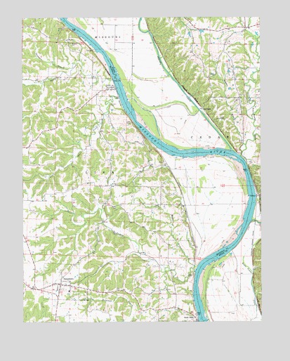
Jamestown, MO USGS Topographic Map
Click on map above to begin viewing in our Map Viewer.

This topographic map contains these locations and features:
Feature Name Type Latitude Longitude GNIS ID View Map
Acton School (historical)SchoolN38.7767°W92.3886°759407View Map
Bethel CemeteryCemeteryN38.7976°W92.4510°714031View Map
Bethel School (historical)SchoolN38.7981°W92.4282°743616View Map
Cave SpringsSpringN38.7595°W92.4663°715554View Map
Cofer CemeteryCemeteryN38.7634°W92.4516°716066View Map
Cunningham School (historical)SchoolN38.8415°W92.3858°759408View Map
EasleyPopulated PlaceN38.8017°W92.3760°717248View Map
Factory CreekStreamN38.7711°W92.4102°717718View Map
Hickam CemeteryCemeteryN38.8393°W92.4537°719417View Map
JamestownPopulated PlaceN38.7656°W92.4807°720255View Map
Jamestown C-1 Elementary SchoolSchoolN38.7626°W92.4762°2571126View Map
Jamestown C-1 High SchoolSchoolN38.7633°W92.4761°2571127View Map
Jamestown Post OfficePost OfficeN38.7658°W92.4807°2782678View Map
Jamestown Rural Fire Protection DistrictBuildingN38.7644°W92.4870°2620749View Map
Jamestown Rural Fire Protection DistrictBuildingN38.7648°W92.4773°2621654View Map
Little Bonne Femme CreekStreamN38.8181°W92.3855°721163View Map
Little Splice CreekStreamN38.8420°W92.4494°721322View Map
LupusPopulated PlaceN38.8461°W92.4532°721677View Map
Lupus BendBendN38.8494°W92.4517°2118175View Map
Maupin BranchStreamN38.7728°W92.4116°721986View Map
Mayhan BranchStreamN38.8225°W92.3832°722014View Map
Mount Zion ChurchChurchN38.8064°W92.4505°722956View Map
Nashville (historical)Populated PlaceN38.8203°W92.3981°759390View Map
Oakland School (historical)SchoolN38.8000°W92.4741°743635View Map
Perche CreekStreamN38.8206°W92.3905°729365View Map
Pettigrew CemeteryCemeteryN38.8645°W92.4749°724266View Map
Plow Boy BendBendN38.8272°W92.4336°2118176View Map
ProvidencePopulated PlaceN38.8375°W92.4055°741175View Map
Providence BendBendN38.8186°W92.3925°2118177View Map
Roche Percée Natural ArchArchN38.8553°W92.4235°2025284View Map
Smackout (historical)LocaleN38.8019°W92.3767°743425View Map
Smith Hatchery LakeReservoirN38.8450°W92.3935°761859View Map
Smith Hatchery Lake DamDamN38.8450°W92.3935°761858View Map
Splice CreekStreamN38.8495°W92.4527°726864View Map
Thompson BranchStreamN38.8545°W92.4741°727591View Map
Town of JamestownCivilN38.7667°W92.4802°2397011View Map
Town of LupusCivilN38.8460°W92.4540°2396728View Map
Township of LinnCivilN38.7922°W92.4840°767032View Map
Township of Rock BridgeCivilN38.8639°W92.3846°2045044View Map
Warren School (historical)SchoolN38.8717°W92.4130°759410View Map
Woodbine Lake DamDamN38.8684°W92.4119°764319View Map

Note: Coordinates in the location and feature list above are referenced to NAD83 datum.


Copyright (C) 2008-2024 Ryan Niemi / Sunset Dynamics ... All Rights Reserved