TopoQuest Logo
Do you find TopoQuest useful?
Help keep TopoQuest running and adding new maps/features by donating!
Bitcoin:  19c7KJd3qBynnjoSw5npx9KScwjBe4ifkT
Litecoin:  LXs6TkuXGGXo1vDsWCkWVdjQX94eUKd6ui
Home View Maps Find Maps Find Places Resources & Links


Centertown NW, Missouri Topographic Map

USGS Map Title: Centertown NW, MO
USGS Map MRC: 38092F4
DRG (GeoTIFF) Download: o38092f4.tif


Neighboring USGS Topographic Map Quads:


  Prairie Home, MO  
38092G5
 

  Jamestown, MO  
38092G4
 

  Ashland, MO  
38092G3
 

  California North, MO  
38092F5
 

  Centertown NW, MO  
38092F4
 

  Hartsburg, MO  
38092F3
 

  California South, MO  
38092E5
 

  Russellville, MO  
38092E4
 

  Lohman, MO  
38092E3


Map MRC Location:

N39°
W93°
N39°
W92°
H8 H7 H6 H5 H4 H3 H2 H1
G8 G7 G6 G5 G4 G3 G2 G1
F8 F7 F6 F5 F4 F3 F2 F1
E8 E7 E6 E5 E4 E3 E2 E1
D8 D7 D6 D5 D4 D3 D2 D1
C8 C7 C6 C5 C4 C3 C2 C1
B8 B7 B6 B5 B4 B3 B2 B1
A8 A7 A6 A5 A4 A3 A2 A1
N38°
W93°
N38°
W92°

Centertown NW, MO USGS 1:24K Topographic Map Preview:
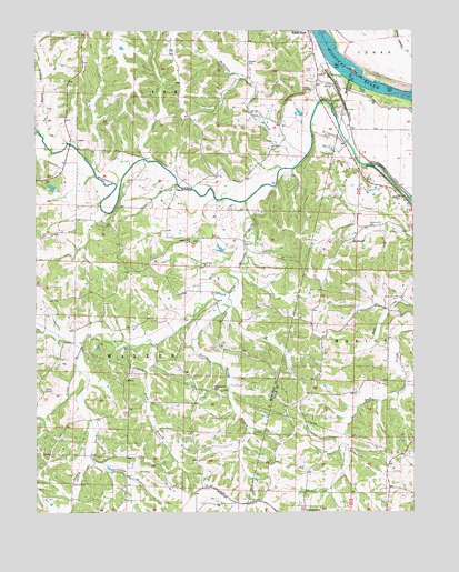
Centertown NW, MO USGS Topographic Map
Click on map above to begin viewing in our Map Viewer.

This topographic map contains these locations and features:
Feature Name Type Latitude Longitude GNIS ID View Map
BaconPopulated PlaceN38.7086°W92.4535°740650View Map
Chapel CemeteryCemeteryN38.7417°W92.4291°715724View Map
Chapel Church (historical)ChurchN38.7414°W92.4294°742282View Map
Cook CemeteryCemeteryN38.7395°W92.4082°716221View Map
Eldorado School (historical)SchoolN38.6728°W92.4877°742290View Map
Fairview School (historical)SchoolN38.7486°W92.4249°742281View Map
Haldiman BranchStreamN38.7148°W92.4138°718987View Map
Harlan School (historical)SchoolN38.6328°W92.4887°742293View Map
Hauck BranchStreamN38.7236°W92.4985°719213View Map
Hills Chapel (historical)ChurchN38.6795°W92.4774°742288View Map
Howe BranchStreamN38.6678°W92.4605°719925View Map
Jenkins Lake DamDamN38.6517°W92.4735°765458View Map
KTXY-FM (Jefferson City)TowerN38.6384°W92.4949°759165View Map
Lebanon CemeteryCemeteryN38.6322°W92.4891°720872View Map
Little Moniteau CreekStreamN38.7053°W92.4305°721274View Map
Lone Star School (historical)SchoolN38.7239°W92.4449°742283View Map
Longan Lake DamDamN38.7100°W92.4935°763916View Map
Marion CemeteryCemeteryN38.7064°W92.3788°721866View Map
Marion School (historical)SchoolN38.6992°W92.3899°742287View Map
Mayhugh Lake DamDamN38.6684°W92.4669°765459View Map
Mud Creek School (historical)SchoolN38.6784°W92.3849°742289View Map
Mulberry School (historical)SchoolN38.7348°W92.4680°743632View Map
New Hope ChurchChurchN38.6956°W92.3944°723255View Map
Pleasant Valley School (historical)SchoolN38.7050°W92.4869°742285View Map
Regional West Fire Protection District Station 4BuildingN38.6993°W92.3899°2620610View Map
Richward W Cook Junior DamDamN38.6917°W92.4385°763612View Map
Rock Creek School (historical)SchoolN38.6559°W92.3930°742292View Map
Sandy HookPopulated PlaceN38.7484°W92.4085°729390View Map
Shiloh ChurchChurchN38.6953°W92.4491°726373View Map
Shiloh School (historical)SchoolN38.6953°W92.4505°742286View Map
Shull CemeteryCemeteryN38.7297°W92.3974°726422View Map
Steinhauer BranchStreamN38.6381°W92.4816°727060View Map
String CreekStreamN38.6634°W92.4869°727181View Map
Sweetwater CemeteryCemeteryN38.6567°W92.4413°727386View Map
Turtle Spring BranchStreamN38.6784°W92.4357°727916View Map
Union School (historical)SchoolN38.6578°W92.4416°742291View Map
Wingate FordLocaleN38.7167°W92.4641°742284View Map

Note: Coordinates in the location and feature list above are referenced to NAD83 datum.


Copyright (C) 2008-2025 Ryan Niemi / Sunset Dynamics ... All Rights Reserved