TopoQuest Logo
Do you find TopoQuest useful?
Help keep TopoQuest running and adding new maps/features by donating!
Bitcoin:  19c7KJd3qBynnjoSw5npx9KScwjBe4ifkT
Litecoin:  LXs6TkuXGGXo1vDsWCkWVdjQX94eUKd6ui
Home View Maps Find Maps Find Places Resources & Links


Prairie Home, Missouri Topographic Map

USGS Map Title: Prairie Home, MO
USGS Map MRC: 38092G5
DRG (GeoTIFF) Download: o38092g5.tif


Neighboring USGS Topographic Map Quads:


  Boonville, MO  
38092H6
 

  Rocheport, MO  
38092H5
 

  Huntsdale, MO  
38092H4
 

  Lone Elm, MO  
38092G6
 

  Prairie Home, MO  
38092G5
 

  Jamestown, MO  
38092G4
 

  Clarksburg, MO  
38092F6
 

  California North, MO  
38092F5
 

  Centertown NW, MO  
38092F4


Map MRC Location:

N39°
W93°
N39°
W92°
H8 H7 H6 H5 H4 H3 H2 H1
G8 G7 G6 G5 G4 G3 G2 G1
F8 F7 F6 F5 F4 F3 F2 F1
E8 E7 E6 E5 E4 E3 E2 E1
D8 D7 D6 D5 D4 D3 D2 D1
C8 C7 C6 C5 C4 C3 C2 C1
B8 B7 B6 B5 B4 B3 B2 B1
A8 A7 A6 A5 A4 A3 A2 A1
N38°
W93°
N38°
W92°

Prairie Home, MO USGS 1:24K Topographic Map Preview:
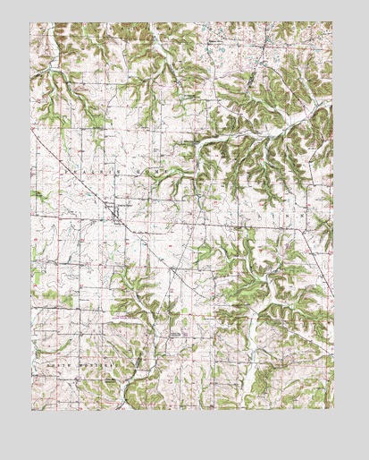
Prairie Home, MO USGS Topographic Map
Click on map above to begin viewing in our Map Viewer.

This topographic map contains these locations and features:
Feature Name Type Latitude Longitude GNIS ID View Map
Carlos School (historical)SchoolN38.8011°W92.5530°743618View Map
CedronPopulated PlaceN38.7736°W92.5677°740532View Map
Cedron School (historical)SchoolN38.7739°W92.5682°715623View Map
City of Prairie HomeCivilN38.8136°W92.5906°2396267View Map
Elliott School (historical)SchoolN38.7531°W92.5505°743621View Map
Felder School (historical)SchoolN38.7597°W92.5949°717878View Map
Felder School (historical)SchoolN38.7739°W92.5741°743624View Map
Garman CemeteryCemeteryN38.7792°W92.5493°718346View Map
Harris CemeteryCemeteryN38.7859°W92.6052°719146View Map
Hickory Flat School (historical)SchoolN38.7978°W92.5216°743627View Map
KMIZ-TV (Columbia)TowerN38.7748°W92.5563°759309View Map
North Carolina School (historical)SchoolN38.7503°W92.5274°743633View Map
Pleasant GrovePopulated PlaceN38.8686°W92.5519°741159View Map
Prairie HomePopulated PlaceN38.8131°W92.5905°724867View Map
Prairie Home Elementary SchoolSchoolN38.8159°W92.5947°2571135View Map
Prairie Home High SchoolSchoolN38.8159°W92.5947°2571136View Map
Prairie Home Post OfficePost OfficeN38.8131°W92.5905°2782683View Map
Prairie Home Rural Fire StationBuildingN38.8136°W92.5903°2621000View Map
Prairie Home State Wildlife AreaParkN38.7734°W92.5813°742862View Map
Providence CemeteryCemeteryN38.8406°W92.5952°724964View Map
Providence School (historical)SchoolN38.8456°W92.5946°743838View Map
RenfroPopulated PlaceN38.8614°W92.5074°740533View Map
Robison CemeteryCemeteryN38.8336°W92.5743°725423View Map
Robison School (historical)SchoolN38.8320°W92.5677°743839View Map
Saint Peters ChurchChurchN38.8506°W92.5571°725893View Map
Splice Creek ChurchChurchN38.8359°W92.5571°726865View Map
Splice Creek School (historical)SchoolN38.8428°W92.5157°743644View Map
Township of Prairie HomeCivilN38.8295°W92.5996°766537View Map
Union ChurchChurchN38.7567°W92.5041°727993View Map

Note: Coordinates in the location and feature list above are referenced to NAD83 datum.


Copyright (C) 2008-2024 Ryan Niemi / Sunset Dynamics ... All Rights Reserved