TopoQuest Logo
Do you find TopoQuest useful?
Help keep TopoQuest running and adding new maps/features by donating!
Bitcoin:  19c7KJd3qBynnjoSw5npx9KScwjBe4ifkT
Litecoin:  LXs6TkuXGGXo1vDsWCkWVdjQX94eUKd6ui
Home View Maps Find Maps Find Places Resources & Links


Jay Bird Springs, Georgia Topographic Map

USGS Map Title: Jay Bird Springs, GA
USGS Map MRC: 32083B1
DRG (GeoTIFF) Download: o32083b1.tif


Neighboring USGS Topographic Map Quads:


  Yonkers, GA  
32083C2
 

  Cadwell, GA  
32083C1
 

  Five Points, GA  
32082C8
 

  Eastman, GA  
32083B2
 

  Jay Bird Springs, GA  
32083B1
 

  McRae NW, GA  
32082B8
 

  Lake Cypress, GA  
32083A2
 

  Milan, GA  
32083A1
 

  McRae, GA  
32082A8


Map MRC Location:

N33°
W84°
N33°
W83°
H8 H7 H6 H5 H4 H3 H2 H1
G8 G7 G6 G5 G4 G3 G2 G1
F8 F7 F6 F5 F4 F3 F2 F1
E8 E7 E6 E5 E4 E3 E2 E1
D8 D7 D6 D5 D4 D3 D2 D1
C8 C7 C6 C5 C4 C3 C2 C1
B8 B7 B6 B5 B4 B3 B2 B1
A8 A7 A6 A5 A4 A3 A2 A1
N32°
W84°
N32°
W83°

Jay Bird Springs, GA USGS 1:24K Topographic Map Preview:
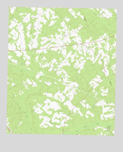
Jay Bird Springs, GA USGS Topographic Map
Click on map above to begin viewing in our Map Viewer.

This topographic map contains these locations and features:
Feature Name Type Latitude Longitude GNIS ID View Map
Bethlehem ChurchChurchN32.2399°W83.0974°354668View Map
Big BranchStreamN32.2327°W83.0001°311339View Map
Cranford DamDamN32.2068°W83.0832°336236View Map
Cranford LakeReservoirN32.2074°W83.0821°336237View Map
Crossroads Volunteer Fire DepartmentBuildingN32.2147°W83.0473°2604398View Map
Ebenezer ChurchChurchN32.1480°W83.0649°313828View Map
Granny BranchStreamN32.1899°W83.1093°314771View Map
Hopewell ChurchChurchN32.2307°W83.0926°315649View Map
Jay Bird SpringsPopulated PlaceN32.1313°W83.0054°316057View Map
Jay Bird SpringsSpringN32.1335°W83.0046°316058View Map
Jaybird Springs ChurchChurchN32.1268°W83.0082°348130View Map
Kelley Pond DamDamN32.1368°W83.0582°336240View Map
Kelly PondReservoirN32.1366°W83.0607°336241View Map
Lake DestinyReservoirN32.2183°W83.0991°341202View Map
Lake Destiny DamDamN32.2168°W83.1032°341201View Map
Little CreekStreamN32.1782°W83.0888°317006View Map
Lovely Grove ChurchChurchN32.1941°W83.1057°317444View Map
Lowry PondReservoirN32.1922°W83.0705°341204View Map
Lowry Pond DamDamN32.1902°W83.0715°341203View Map
McMillan CemeteryCemeteryN32.1254°W83.0032°348134View Map
New Union ChurchChurchN32.2221°W83.0596°319553View Map
Parkerson Baptist ChurchChurchN32.1477°W83.0929°320234View Map
Parkerson Baptist Church CemeteryCemeteryN32.1477°W83.0934°2710858View Map
PittsPopulated PlaceN32.1591°W83.0379°348139View Map
Poplar Spring ChurchChurchN32.1721°W83.1182°321033View Map
Reedy BranchStreamN32.2143°W83.1032°321444View Map
Rock BranchStreamN32.1430°W83.0201°321706View Map
Rock Branch ChurchChurchN32.1685°W83.0301°321713View Map
Ryals CemeteryCemeteryN32.1910°W83.0138°322026View Map
SaundersPopulated PlaceN32.2121°W83.0621°348145View Map
South Atlantic-Gulf Region - 2-digit Hydrologic Unit Code - 03AreaN32.1478°W83.0063°2730133View Map
Taylor CemeteryCemeteryN32.2124°W83.0593°323944View Map
Westbrook (historical)Populated PlaceN32.2441°W83.0013°346644View Map

Note: Coordinates in the location and feature list above are referenced to NAD83 datum.


Copyright (C) 2008-2025 Ryan Niemi / Sunset Dynamics ... All Rights Reserved