TopoQuest Logo
Do you find TopoQuest useful?
Help keep TopoQuest running and adding new maps/features by donating!
Bitcoin:  19c7KJd3qBynnjoSw5npx9KScwjBe4ifkT
Litecoin:  LXs6TkuXGGXo1vDsWCkWVdjQX94eUKd6ui
Home View Maps Find Maps Find Places Resources & Links


Yonkers, Georgia Topographic Map

USGS Map Title: Yonkers, GA
USGS Map MRC: 32083C2
DRG (GeoTIFF) Download: o32083c2.tif


Neighboring USGS Topographic Map Quads:


  Cochran, GA  
32083D3
 

  Chester, GA  
32083D2
 

  Dexter, GA  
32083D1
 

  Empire, GA  
32083C3
 

  Yonkers, GA  
32083C2
 

  Cadwell, GA  
32083C1
 

  West of Eastman, GA  
32083B3
 

  Eastman, GA  
32083B2
 

  Jay Bird Springs, GA  
32083B1


Map MRC Location:

N33°
W84°
N33°
W83°
H8 H7 H6 H5 H4 H3 H2 H1
G8 G7 G6 G5 G4 G3 G2 G1
F8 F7 F6 F5 F4 F3 F2 F1
E8 E7 E6 E5 E4 E3 E2 E1
D8 D7 D6 D5 D4 D3 D2 D1
C8 C7 C6 C5 C4 C3 C2 C1
B8 B7 B6 B5 B4 B3 B2 B1
A8 A7 A6 A5 A4 A3 A2 A1
N32°
W84°
N32°
W83°

Yonkers, GA USGS 1:24K Topographic Map Preview:
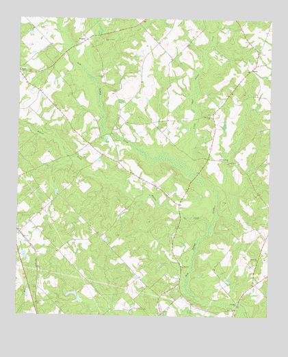
Yonkers, GA USGS Topographic Map
Click on map above to begin viewing in our Map Viewer.

This topographic map contains these locations and features:
Feature Name Type Latitude Longitude GNIS ID View Map
Bethel ChurchChurchN32.3152°W83.2004°354597View Map
BryantPopulated PlaceN32.3538°W83.1346°326200View Map
Chester DivisionCivilN32.3695°W83.2010°1936176View Map
Douglas CemeteryCemeteryN32.3499°W83.2082°313594View Map
Giddens Gift ChurchChurchN32.2746°W83.1301°314584View Map
Gresston ChurchChurchN32.2868°W83.2471°348128View Map
Lister CemeteryCemeteryN32.3441°W83.2024°316924View Map
Little Gum Swamp CreekStreamN32.3138°W83.1632°317078View Map
Long PondReservoirN32.2652°W83.1451°341224View Map
Long Pond DamDamN32.2652°W83.1432°341223View Map
Milton Tripp LakeReservoirN32.2732°W83.2441°340245View Map
Ocmulgee ChurchChurchN32.2563°W83.1404°319891View Map
Pine Level ChurchChurchN32.3346°W83.1552°320629View Map
Pleasant Hill ChurchChurchN32.2713°W83.1677°320883View Map
Rogers-Darsey CemeteryCemeteryN32.3657°W83.2077°321878View Map
Thankful ChurchChurchN32.3649°W83.2204°348147View Map
Tripp Dam EastDamN32.2585°W83.2199°341219View Map
Tripp Pond EastReservoirN32.2593°W83.2217°341220View Map
Tripp Pond WestReservoirN32.2597°W83.2442°341222View Map
Tripp Pond West DamDamN32.2585°W83.2449°341221View Map
Walton CreekStreamN32.2891°W83.1546°324826View Map
Welcome Friend ChurchChurchN32.3154°W83.1457°324980View Map
Wilton Tripp DamDamN32.2735°W83.2449°340244View Map
YonkersPopulated PlaceN32.3663°W83.2165°333483View Map

Note: Coordinates in the location and feature list above are referenced to NAD83 datum.


Copyright (C) 2008-2025 Ryan Niemi / Sunset Dynamics ... All Rights Reserved