TopoQuest Logo
Do you find TopoQuest useful?
Help keep TopoQuest running and adding new maps/features by donating!
Bitcoin:  19c7KJd3qBynnjoSw5npx9KScwjBe4ifkT
Litecoin:  LXs6TkuXGGXo1vDsWCkWVdjQX94eUKd6ui
Home View Maps Find Maps Find Places Resources & Links


Johns, North Carolina Topographic Map

USGS Map Title: Johns, NC
USGS Map MRC: 34079F4
DRG (GeoTIFF) Download: o34079f4.tif


Neighboring USGS Topographic Map Quads:


  Gibson, NC  
34079G5
 

  Laurinburg, NC  
34079G4
 

  Wakulla, NC  
34079G3
 

  McColl, SC  
34079F5
 

  Johns, NC  
34079F4
 

  Maxton, NC  
34079F3
 

  Clio, SC  
34079E5
 

  Minturn, SC  
34079E4
 

  Rowland, NC  
34079E3


Map MRC Location:

N35°
W80°
N35°
W79°
H8 H7 H6 H5 H4 H3 H2 H1
G8 G7 G6 G5 G4 G3 G2 G1
F8 F7 F6 F5 F4 F3 F2 F1
E8 E7 E6 E5 E4 E3 E2 E1
D8 D7 D6 D5 D4 D3 D2 D1
C8 C7 C6 C5 C4 C3 C2 C1
B8 B7 B6 B5 B4 B3 B2 B1
A8 A7 A6 A5 A4 A3 A2 A1
N34°
W80°
N34°
W79°

Johns, NC USGS 1:24K Topographic Map Preview:
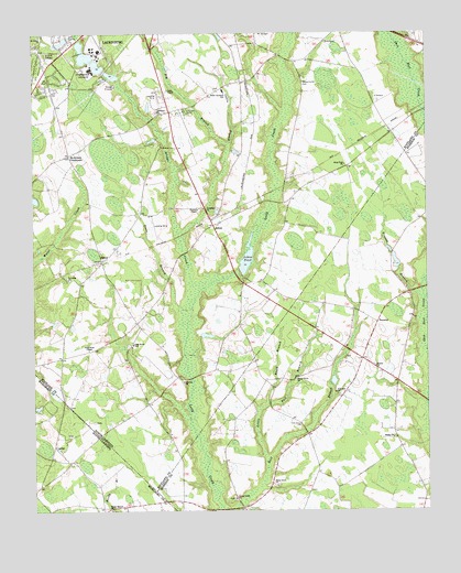
Johns, NC USGS Topographic Map
Click on map above to begin viewing in our Map Viewer.

This topographic map contains these locations and features:
Feature Name Type Latitude Longitude GNIS ID View Map
Big BranchStreamN34.7210°W79.4381°981357View Map
Black BranchStreamN34.6529°W79.4262°981511View Map
Bridge CreekStreamN34.6835°W79.4492°979987View Map
Cabin BranchStreamN34.6979°W79.4525°982379View Map
Caledonia ChurchChurchN34.7296°W79.4603°982419View Map
Camelin AcresPopulated PlaceN34.7329°W79.4317°1005383View Map
Eastover EstatesPopulated PlaceN34.7488°W79.4637°1005388View Map
Edgeland ParkPopulated PlaceN34.7363°W79.4964°1005385View Map
Frazier BranchStreamN34.6807°W79.3767°985372View Map
Good News ChapelChurchN34.6674°W79.4823°985792View Map
Grey Pond ChurchChurchN34.7154°W79.4006°986141View Map
Hasion ChurchChurchN34.6629°W79.3912°986482View Map
HastyPopulated PlaceN34.6904°W79.4781°986484View Map
Hunters ChapelChurchN34.7038°W79.4475°987258View Map
Jerusalem ChurchChurchN34.7043°W79.4456°987582View Map
JohnsPopulated PlaceN34.6999°W79.4428°987643View Map
Johns PondReservoirN34.6912°W79.4319°987647View Map
Johns Pond DamDamN34.6885°W79.4348°998109View Map
Jones ChapelChurchN34.7352°W79.4570°987730View Map
Leach Creek ChurchChurchN34.6282°W79.4362°988245View Map
Little Bull BranchStreamN34.6388°W79.4262°988563View Map
MaclandPopulated PlaceN34.7385°W79.4914°1005386View Map
Maxton Southeastern Rural Volunteer Fire DepartmentBuildingN34.6565°W79.3799°2639267View Map
McArthur CrossroadsPopulated PlaceN34.7182°W79.4881°989524View Map
McKenzie Acres EastPopulated PlaceN34.7335°W79.4581°1005387View Map
Oak Grove SchoolSchoolN34.6688°W79.4681°991412View Map
Piney Grove ChurchChurchN34.6316°W79.4228°992335View Map
Plains ChurchChurchN34.6441°W79.3859°992443View Map
Reedy Branch ChurchChurchN34.6254°W79.4756°1225811View Map
Saint Andrews CollegeSchoolN34.7407°W79.4814°993859View Map
Saint Andrews College LakeReservoirN34.7391°W79.4745°998116View Map
Saint Andrews College Lake DamDamN34.7385°W79.4731°998117View Map
Saint Lukes ChurchChurchN34.6857°W79.4887°993985View Map
Saint Lukes ChurchChurchN34.7493°W79.4975°993986View Map
Shady Grove ChurchChurchN34.6596°W79.4170°994538View Map
Smyrna ChurchChurchN34.6588°W79.4523°995027View Map
South Scotland SchoolSchoolN34.7349°W79.4398°995214View Map
Steer BranchStreamN34.6768°W79.4531°995460View Map
Stewartsville CemeteryCemeteryN34.7382°W79.4134°995507View Map
Stewartsville Volunteer Fire DepartmentBuildingN34.7003°W79.4425°2639465View Map
Sunny AcresPopulated PlaceN34.7435°W79.4950°1005382View Map
Sycamore Lane Middle SchoolSchoolN34.7496°W79.4820°1007024View Map
Township of StewartsvilleCivilN34.7372°W79.4395°1027189View Map
TurnoutLocaleN34.6743°W79.3909°996367View Map
Whispering Pines Number TwoPopulated PlaceN34.7346°W79.4914°1005384View Map
Zion Hill ChurchChurchN34.6560°W79.4042°997794View Map

Note: Coordinates in the location and feature list above are referenced to NAD83 datum.


Copyright (C) 2008-2024 Ryan Niemi / Sunset Dynamics ... All Rights Reserved