TopoQuest Logo
Do you find TopoQuest useful?
Help keep TopoQuest running and adding new maps/features by donating!
Bitcoin:  19c7KJd3qBynnjoSw5npx9KScwjBe4ifkT
Litecoin:  LXs6TkuXGGXo1vDsWCkWVdjQX94eUKd6ui
Home View Maps Find Maps Find Places Resources & Links


Johnson Corner, Georgia Topographic Map

USGS Map Title: Johnson Corner, GA
USGS Map MRC: 32082A3
DRG (GeoTIFF) Download: o32082a3.tif


Neighboring USGS Topographic Map Quads:


  Vidalia, GA  
32082B4
 

  Lyons, GA  
32082B3
 

  Ohoopee, GA  
32082B2
 

  Alston, GA  
32082A4
 

  Johnson Corner, GA  
32082A3
 

  Reidsville West, GA  
32082A2
 

  Grays Landing, GA  
31082H4
 

  Baxley NE, GA  
31082H3
 

  Altamaha, GA  
31082H2


Map MRC Location:

N33°
W83°
N33°
W82°
H8 H7 H6 H5 H4 H3 H2 H1
G8 G7 G6 G5 G4 G3 G2 G1
F8 F7 F6 F5 F4 F3 F2 F1
E8 E7 E6 E5 E4 E3 E2 E1
D8 D7 D6 D5 D4 D3 D2 D1
C8 C7 C6 C5 C4 C3 C2 C1
B8 B7 B6 B5 B4 B3 B2 B1
A8 A7 A6 A5 A4 A3 A2 A1
N32°
W83°
N32°
W82°

Johnson Corner, GA USGS 1:24K Topographic Map Preview:
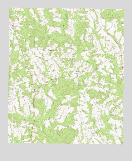
Johnson Corner, GA USGS Topographic Map
Click on map above to begin viewing in our Map Viewer.

This topographic map contains these locations and features:
Feature Name Type Latitude Longitude GNIS ID View Map
Bill Brown DamDamN32.0385°W82.2898°341147View Map
Bill Brown LakeReservoirN32.0393°W82.2901°341148View Map
Cainy Ford BridgeBridgeN32.0202°W82.3465°345161View Map
Cato DamDamN32.1185°W82.3682°341145View Map
Cato LakeReservoirN32.1187°W82.3691°341146View Map
Cedar Crossing DivisionCivilN32.0139°W82.3447°1936592View Map
Clark LakeReservoirN32.0090°W82.2567°340365View Map
Clark Lake DamDamN32.0085°W82.2565°340364View Map
Cobb Creek CemeteryCemeteryN32.0207°W82.3446°312786View Map
Cobb Creek ChurchChurchN32.0210°W82.3457°345169View Map
Coward Lake DamDamN32.0485°W82.3648°340360View Map
Cowart LakeReservoirN32.0491°W82.3661°340361View Map
Edmonds ChurchChurchN32.0696°W82.2810°355644View Map
Hardens ChapelChurchN32.0596°W82.3240°356169View Map
Inman Creek ChurchChurchN32.0113°W82.2793°315928View Map
John Currie DamDamN32.0202°W82.2932°341149View Map
John Currie LakeReservoirN32.0217°W82.2950°341150View Map
Johnson CornerPopulated PlaceN32.0652°W82.3012°332107View Map
Johnson Corner School (historical)SchoolN32.0530°W82.2982°345187View Map
Knight BridgeBridgeN32.0938°W82.3073°345188View Map
Little Rocky CreekStreamN32.0944°W82.3087°317176View Map
Live Oak ChurchChurchN32.0294°W82.2648°317254View Map
New BranchPopulated PlaceN32.0821°W82.2515°332480View Map
New Branch ChurchChurchN32.0688°W82.2512°345199View Map
New Branch School (historical)SchoolN32.0827°W82.2515°345200View Map
New Branch Volunteer Fire DepartmentBuildingN32.0833°W82.2516°2603723View Map
Odom CemeteryCemeteryN32.0488°W82.3629°319904View Map
Open CreekStreamN32.0107°W82.3373°320075View Map
Parker School (historical)SchoolN32.0491°W82.3482°345203View Map
Partin BridgeBridgeN32.0699°W82.2821°345204View Map
Partin CemeteryCemeteryN32.0441°W82.3696°320252View Map
Pittman CemeteryCemeteryN32.0863°W82.2915°320760View Map
Rocky Creek ChurchChurchN32.0907°W82.3076°321831View Map
Saint Matthews ChurchChurchN32.0863°W82.3260°322219View Map
Sapp LakeReservoirN32.0822°W82.3621°341626View Map
Sapp Lake DamDamN32.0835°W82.3632°341625View Map
South ThompsonPopulated PlaceN32.1082°W82.3707°326523View Map
South Thompson ChurchChurchN32.1049°W82.3732°345213View Map
South Thompson Volunteer Fire DepartmentBuildingN32.1069°W82.3728°2604771View Map
Spring Hill ChurchChurchN32.0707°W82.3557°323419View Map
Tar BridgeBridgeN32.0599°W82.2640°345216View Map
Toombs CentralPopulated PlaceN32.0474°W82.3479°326556View Map
Toombs Central Elementary SchoolSchoolN32.0496°W82.3465°345219View Map
Toombs CountyCivilN32.1217°W82.3313°345220View Map
Wright Number Two Pond DamDamN32.1235°W82.3132°337269View Map

Note: Coordinates in the location and feature list above are referenced to NAD83 datum.


Copyright (C) 2008-2025 Ryan Niemi / Sunset Dynamics ... All Rights Reserved