TopoQuest Logo
Do you find TopoQuest useful?
Help keep TopoQuest running and adding new maps/features by donating!
Bitcoin:  19c7KJd3qBynnjoSw5npx9KScwjBe4ifkT
Litecoin:  LXs6TkuXGGXo1vDsWCkWVdjQX94eUKd6ui
Home View Maps Find Maps Find Places Resources & Links


Baltzer, Mississippi Topographic Map

USGS Map Title: Baltzer, MS
USGS Map MRC: 33090H5
DRG (GeoTIFF) Download: o33090h5.tif


Neighboring USGS Topographic Map Quads:


  Duncan, MS  
34090A6
 

  Mattson, MS  
34090A5
 

  Tutwiler, MS  
34090A4
 

  Mound Bayou, MS  
33090H6
 

  Baltzer, MS  
33090H5
 

  Rome, MS  
33090H4
 

  Merigold, MS  
33090G6
 

  Drew, MS  
33090G5
 

  Brooks, MS  
33090G4


Map MRC Location:

N34°
W91°
N34°
W90°
H8 H7 H6 H5 H4 H3 H2 H1
G8 G7 G6 G5 G4 G3 G2 G1
F8 F7 F6 F5 F4 F3 F2 F1
E8 E7 E6 E5 E4 E3 E2 E1
D8 D7 D6 D5 D4 D3 D2 D1
C8 C7 C6 C5 C4 C3 C2 C1
B8 B7 B6 B5 B4 B3 B2 B1
A8 A7 A6 A5 A4 A3 A2 A1
N33°
W91°
N33°
W90°

Baltzer, MS USGS 1:24K Topographic Map Preview:
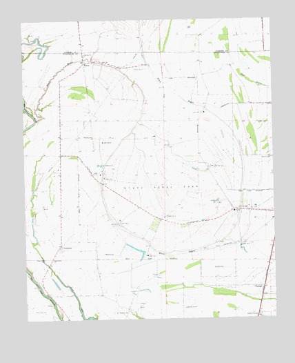
Baltzer, MS USGS Topographic Map
Click on map above to begin viewing in our Map Viewer.

This topographic map contains these locations and features:
Feature Name Type Latitude Longitude GNIS ID View Map
BaltzerPopulated PlaceN33.9821°W90.5948°666498View Map
Black BayouStreamN33.9584°W90.6190°667200View Map
Black Bayou School (historical)SchoolN33.9646°W90.6070°686472View Map
Boisy School (historical)SchoolN33.9798°W90.5770°686476View Map
Church of GodChurchN33.9423°W90.5020°668473View Map
FitzhughPopulated PlaceN33.8884°W90.5087°670003View Map
Floyd Haney Pond DamDamN33.9918°W90.5118°682430View Map
Goldfield PlantationLocaleN33.8765°W90.5090°670459View Map
LombardyPopulated PlaceN33.9057°W90.6070°672778View Map
Lombardy School (historical)SchoolN33.9190°W90.6062°686540View Map
Mount Olive CemeteryCemeteryN33.9859°W90.5954°674116View Map
New Jerusalem ChurchChurchN33.8779°W90.5743°674763View Map
North Mount Olive ChurchChurchN33.8798°W90.5451°674952View Map
Pilgrim Rest CemeteryCemeteryN33.9009°W90.6156°675739View Map
Pilgrim Rest ChurchChurchN33.9007°W90.6112°675760View Map
Saint Paul CemeteryCemeteryN33.9571°W90.5026°677180View Map
Shady Grove CemeteryCemeteryN33.8787°W90.6209°677547View Map
Sid Dodd Plantation (historical)LocaleN33.9793°W90.5945°707771View Map
Sid Dodd School (historical)SchoolN33.9482°W90.6062°686607View Map
Skiff LakeLakeN33.9918°W90.5865°689354View Map
State Penal Camp Farm Number 5LocaleN33.9051°W90.5168°678243View Map
State Penal Camp Farm Number 7LocaleN33.9340°W90.5857°678245View Map
State Penal Farm Camp Number 10LocaleN33.9387°W90.5312°678237View Map
State Penal Farm Camp Number 11LocaleN33.9618°W90.5354°678238View Map
State Penal Farm Camp Number 12LocaleN33.9357°W90.5876°678239View Map
State Penal Farm Camp Number 2LocaleN33.9204°W90.5134°678240View Map
State Penal Farm Camp Number 3LocaleN33.9021°W90.5643°678241View Map
State Penal Farm Camp Number 4LocaleN33.9154°W90.5784°678242View Map
State Penal Farm Camp Number 6LocaleN33.9176°W90.5545°678244View Map
State Penal Farm Camp Number 8LocaleN33.9490°W90.5865°678246View Map
State Penal Farm Camp Number 9LocaleN33.9396°W90.5859°678247View Map
Zion Travel Church (historical)ChurchN33.9804°W90.5762°686626View Map

Note: Coordinates in the location and feature list above are referenced to NAD83 datum.


Copyright (C) 2008-2025 Ryan Niemi / Sunset Dynamics ... All Rights Reserved