TopoQuest Logo
Do you find TopoQuest useful?
Help keep TopoQuest running and adding new maps/features by donating!
Bitcoin:  19c7KJd3qBynnjoSw5npx9KScwjBe4ifkT
Litecoin:  LXs6TkuXGGXo1vDsWCkWVdjQX94eUKd6ui
Home View Maps Find Maps Find Places Resources & Links


Pearl West, Illinois Topographic Map

USGS Map Title: Pearl West, IL
USGS Map MRC: 39090D6
DRG (GeoTIFF) Download: o39090d6.tif


Neighboring USGS Topographic Map Quads:


  Pittsfield, IL  
39090E7
 

  Milton, IL  
39090E6
 

  Bedford, IL  
39090E5
 

  Pleasant Hill East, IL  
39090D7
 

  Pearl West, IL  
39090D6
 

  Pearl East, IL  
39090D5
 

  Annada, MO  
39090C7
 

  Pleasant Dale Valley, IL  
39090C6
 

  Kampsville, IL  
39090C5


Map MRC Location:

N40°
W91°
N40°
W90°
H8 H7 H6 H5 H4 H3 H2 H1
G8 G7 G6 G5 G4 G3 G2 G1
F8 F7 F6 F5 F4 F3 F2 F1
E8 E7 E6 E5 E4 E3 E2 E1
D8 D7 D6 D5 D4 D3 D2 D1
C8 C7 C6 C5 C4 C3 C2 C1
B8 B7 B6 B5 B4 B3 B2 B1
A8 A7 A6 A5 A4 A3 A2 A1
N39°
W91°
N39°
W90°

Pearl West, IL USGS 1:24K Topographic Map Preview:
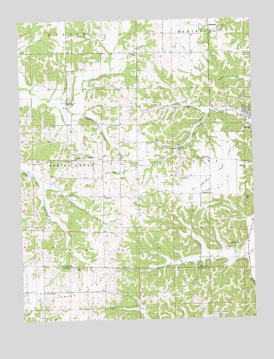
Pearl West, IL USGS Topographic Map
Click on map above to begin viewing in our Map Viewer.

This topographic map contains these locations and features:
Feature Name Type Latitude Longitude GNIS ID View Map
Bee CreekPopulated PlaceN39.4003°W90.6360°404088View Map
Bunn Airport (historical)AirportN39.3931°W90.7237°427596View Map
Byerton School (historical)SchoolN39.3812°W90.7151°405313View Map
East Prong Spring CreekStreamN39.4300°W90.7387°407689View Map
Farmers RidgeRidgeN39.3828°W90.7235°408283View Map
Farmers Ridge ChurchChurchN39.3867°W90.7379°408284View Map
Gasville School (historical)SchoolN39.4400°W90.6273°408929View Map
Green Pond CemeteryCemeteryN39.4959°W90.6415°1852477View Map
GreenpondPopulated PlaceN39.4953°W90.6429°422757View Map
Hess CemeteryCemeteryN39.4345°W90.6626°1725392View Map
Humphreys CemeteryCemeteryN39.4064°W90.6329°410684View Map
Kessinger CemeteryCemeteryN39.4275°W90.6529°1725404View Map
Little Blue CreekStreamN39.4631°W90.7279°1725406View Map
Little Miller CemeteryCemeteryN39.4378°W90.6285°1725407View Map
Lost CreekStreamN39.4270°W90.6587°412643View Map
McConnell CemeteryCemeteryN39.3967°W90.7210°1748308View Map
Miller CemeteryCemeteryN39.4250°W90.6304°413576View Map
Mississippi Valley Service CampLocaleN39.4653°W90.7246°1725414View Map
Nebraska School (historical)SchoolN39.4264°W90.7054°414332View Map
Old PearlPopulated PlaceN39.4417°W90.6482°423038View Map
Old Pearl PrairieFlatN39.4381°W90.6412°415039View Map
PearlPopulated PlaceN39.4598°W90.6260°415490View Map
Pearl Post OfficePost OfficeN39.4600°W90.6277°2788197View Map
Rock Hill School (historical)SchoolN39.4656°W90.7251°416816View Map
Silkwood CreekStreamN39.4634°W90.7282°1725449View Map
South Prong Spring CreekStreamN39.4300°W90.7387°418819View Map
StrautPopulated PlaceN39.4434°W90.7060°423212View Map
Tick RidgeRidgeN39.4562°W90.6873°1725461View Map
Tick Ridge School (historical)SchoolN39.4645°W90.6918°419712View Map
Township of PearlCivilN39.4426°W90.6484°429539View Map
Township of Spring CreekCivilN39.4425°W90.7437°429785View Map
Twin CulvertLocaleN39.4464°W90.6637°1725464View Map
Twin Culvert Cave Nature PreserveParkN39.4459°W90.6640°2009650View Map

Note: Coordinates in the location and feature list above are referenced to NAD83 datum.


Copyright (C) 2008-2024 Ryan Niemi / Sunset Dynamics ... All Rights Reserved