TopoQuest Logo
Do you find TopoQuest useful?
Help keep TopoQuest running and adding new maps/features by donating!
Bitcoin:  19c7KJd3qBynnjoSw5npx9KScwjBe4ifkT
Litecoin:  LXs6TkuXGGXo1vDsWCkWVdjQX94eUKd6ui
Home View Maps Find Maps Find Places Resources & Links


McLeod, Montana Topographic Map

USGS Map Title: McLeod, MT
USGS Map MRC: 45110F1
DRG (GeoTIFF) Download: o45110f1.tif


Neighboring USGS Topographic Map Quads:


  Kelly Hills, MT  
45110G2
 

  Carney, MT  
45110G1
 

  Big Timber, MT  
45109G8
 

  Springdale, MT  
45110F2
 

  McLeod, MT  
45110F1
 

  Ross Canyon, MT  
45109F8
 

  McLeod Basin, MT  
45110E2
 

  Enos Mountain, MT  
45110E1
 

  Sliderock Mountain, MT  
45109E8


Map MRC Location:

N46°
W111°
N46°
W110°
H8 H7 H6 H5 H4 H3 H2 H1
G8 G7 G6 G5 G4 G3 G2 G1
F8 F7 F6 F5 F4 F3 F2 F1
E8 E7 E6 E5 E4 E3 E2 E1
D8 D7 D6 D5 D4 D3 D2 D1
C8 C7 C6 C5 C4 C3 C2 C1
B8 B7 B6 B5 B4 B3 B2 B1
A8 A7 A6 A5 A4 A3 A2 A1
N45°
W111°
N45°
W110°

McLeod, MT USGS 1:24K Topographic Map Preview:
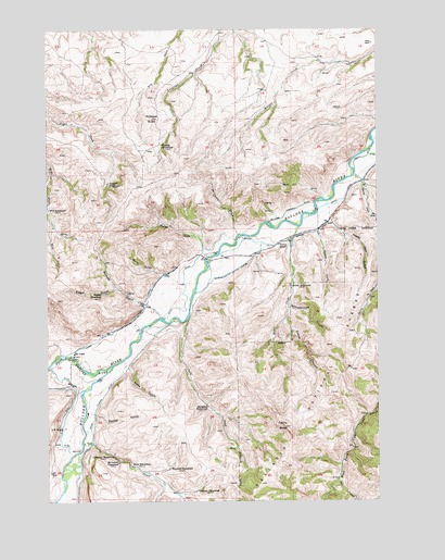
McLeod, MT USGS Topographic Map
Click on map above to begin viewing in our Map Viewer.

This topographic map contains these locations and features:
Feature Name Type Latitude Longitude GNIS ID View Map
01S14E21DCCD01 WellWellN45.7260°W110.0013°811445View Map
01S14E28ABBD01 WellWellN45.7247°W110.0005°811437View Map
01S14E28BABB01 SpringSpringN45.7244°W110.0057°811435View Map
01S14E32CADB01 WellWellN45.7016°W110.0252°811255View Map
02S13E01ACDB01 WellWellN45.6908°W110.0621°811161View Map
02S13E01BACA01 WellWellN45.6952°W110.0680°811203View Map
02S13E01BDDD01 WellWellN45.6899°W110.0657°811160View Map
02S13E01DBBC01 WellWellN45.6883°W110.0641°811150View Map
02S13E10DCDA01 WellWellN45.6697°W110.1027°810989View Map
02S13E11BBBC01 SpringSpringN45.6800°W110.0954°811078View Map
02S13E11CDCC01 WellWellN45.6705°W110.0907°811000View Map
02S13E15AABB01 WellWellN45.6677°W110.1002°810972View Map
02S13E15BAAA01 WellWellN45.6677°W110.1071°810973View Map
02S13E15BBCD01 WellWellN45.6647°W110.1149°810941View Map
02S13E15BCBB01 WellWellN45.6660°W110.1146°810956View Map
02S13E15CAAC01 WellWellN45.6597°W110.1082°810895View Map
02S13E15CABB01 WellWellN45.6605°W110.1113°810902View Map
02S14E05CBCB01 SpringSpringN45.6874°W110.0332°811134View Map
02S14E06AABB01 WellWellN45.6963°W110.0374°811211View Map
02S14E06AADA01 WellWellN45.6944°W110.0338°811196View Map
Antelope ButteSummitN45.7263°W110.0855°779060View Map
Barn GulchValleyN45.6852°W110.0821°779369View Map
Blanchard HomesteadLocaleN45.6333°W110.0796°780091View Map
Bohee CreekStreamN45.6977°W110.0302°780194View Map
Boulder Forks Fishing Access SiteLocaleN45.6574°W110.1085°1744499View Map
Boulder Forks Recreation AreaLocaleN45.6605°W110.1088°794444View Map
Broughton HomesteadLocaleN45.6499°W110.0649°780439View Map
Carpenter HomesteadLocaleN45.6369°W110.1007°780965View Map
Castle ButteSummitN45.6447°W110.0360°781011View Map
Castle CreekStreamN45.6730°W110.0727°781014View Map
Cherry CreekStreamN45.6988°W110.0007°781187View Map
Conant CreekStreamN45.6966°W110.0232°781556View Map
Corker CanyonValleyN45.6730°W110.0355°781670View Map
Decker GulchValleyN45.6480°W110.1080°782184View Map
Dore CreekStreamN45.6305°W110.0163°782490View Map
Dutton HomesteadLocaleN45.6819°W110.0335°782741View Map
Dutton School (historical)SchoolN45.6930°W110.0377°782742View Map
Edgar GulchValleyN45.6810°W110.0991°782982View Map
Fort McLeod (historical)LocaleN45.6638°W110.1119°1743399View Map
Fuller DrawValleyN45.6913°W110.0657°783784View Map
Happy Jack GulchValleyN45.6994°W110.0182°784541View Map
Hoyseth HomesteadLocaleN45.7188°W110.0819°785123View Map
Kline HomesteadLocaleN45.6341°W110.0935°785795View Map
L W RanchLocaleN45.6447°W110.1205°785863View Map
Loasby DitchCanalN45.6719°W110.0955°786405View Map
Mc Comb Campbell DitchCanalN45.7010°W110.0352°786973View Map
McComb DrawValleyN45.6977°W110.0552°787010View Map
McConnell HomesteadLocaleN45.6352°W110.0991°786974View Map
McLeodPopulated PlaceN45.6627°W110.1160°786978View Map
McLeod Post OfficePost OfficeN45.6632°W110.1159°1743432View Map
McLeod ResortLocaleN45.6624°W110.1132°1743469View Map
McLeod SchoolSchoolN45.6624°W110.1160°1743404View Map
Michael DitchCanalN45.6935°W110.0455°787207View Map
Michael GulchValleyN45.6772°W110.0894°787208View Map
Miles Flower DitchCanalN45.6463°W110.1085°787344View Map
Miles GulchValleyN45.6602°W110.0952°787345View Map
Schmidelkoffer Dutton Vogers DitchCanalN45.6855°W110.0560°790123View Map
Schoolhouse GulchValleyN45.6763°W110.0341°790129View Map
Seaforth HomesteadLocaleN45.7091°W110.1021°790169View Map
Smoot DitchCanalN45.7047°W110.0138°790750View Map
Susie CreekStreamN45.6405°W110.1124°791745View Map
Thurman HomesteadLocaleN45.6277°W110.0688°792155View Map
Wagner HomesteadLocaleN45.6799°W110.1052°792747View Map
West Boulder RiverStreamN45.6608°W110.1013°792954View Map
Wild HomesteadLocaleN45.7022°W110.1246°793288View Map

Note: Coordinates in the location and feature list above are referenced to NAD83 datum.


Copyright (C) 2008-2025 Ryan Niemi / Sunset Dynamics ... All Rights Reserved