TopoQuest Logo
Do you find TopoQuest useful?
Help keep TopoQuest running and adding new maps/features by donating!
Bitcoin:  19c7KJd3qBynnjoSw5npx9KScwjBe4ifkT
Litecoin:  LXs6TkuXGGXo1vDsWCkWVdjQX94eUKd6ui
Home View Maps Find Maps Find Places Resources & Links


Kenduskeag, Maine Topographic Map

USGS Map Title: Kenduskeag, ME
USGS Map MRC: 44068H8
DRG (GeoTIFF) Download: o44068h8.tif


Neighboring USGS Topographic Map Quads:


  Charleston, ME  
45069A1
 

  Bradford, ME  
45068A8
 

  South Lagrange, ME  
45068A7
 

  West Corinth, ME  
44069H1
 

  Kenduskeag, ME  
44068H8
 

  Pushaw Lake, ME  
44068H7
 

  Carmel, ME  
44069G1
 

  Hermon, ME  
44068G8
 

  Bangor, ME  
44068G7


Map MRC Location:

N45°
W69°
N45°
W68°
H8 H7 H6 H5 H4 H3 H2 H1
G8 G7 G6 G5 G4 G3 G2 G1
F8 F7 F6 F5 F4 F3 F2 F1
E8 E7 E6 E5 E4 E3 E2 E1
D8 D7 D6 D5 D4 D3 D2 D1
C8 C7 C6 C5 C4 C3 C2 C1
B8 B7 B6 B5 B4 B3 B2 B1
A8 A7 A6 A5 A4 A3 A2 A1
N44°
W69°
N44°
W68°

Kenduskeag, ME USGS 1:24K Topographic Map Preview:
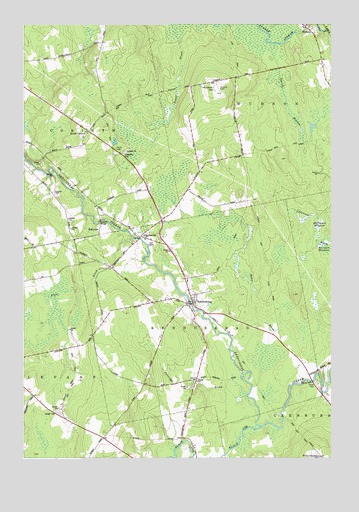
Kenduskeag, ME USGS Topographic Map
Click on map above to begin viewing in our Map Viewer.

This topographic map contains these locations and features:
Feature Name Type Latitude Longitude GNIS ID View Map
Baker BrookStreamN44.8956°W68.9067°561455View Map
Beaver MeadowStreamN44.9945°W68.8984°561934View Map
Black StreamStreamN44.8840°W68.9028°562514View Map
Case Memorial LibraryBuildingN44.9193°W68.9324°1913385View Map
Evergreen CemeteryCemeteryN44.9626°W68.9591°565973View Map
Glenburn Fire Department Station 23BuildingN44.8756°W68.8797°2552961View Map
Halfmoon MeadowSwampN44.9415°W68.8800°567462View Map
HigginsvillePopulated PlaceN44.9387°W68.9531°568008View Map
Hilltop CemeteryCemeteryN44.9499°W68.9862°2736922View Map
Hudson Elementary SchoolSchoolN44.9884°W68.8789°2738074View Map
Hudson HillSummitN44.9814°W68.9221°568433View Map
Hudson Volunteer Fire DepartmentBuildingN44.9982°W68.8824°2553138View Map
KenduskeagPopulated PlaceN44.9195°W68.9317°569097View Map
Kenduskeag Elementary SchoolSchoolN44.9262°W68.9332°1913639View Map
Kenduskeag Post OfficePost OfficeN44.9223°W68.9325°2768907View Map
Kenduskeag Volunteer Fire DepartmentBuildingN44.9225°W68.9326°2553067View Map
Levant Fire and Rescue DepartmentBuildingN44.8814°W68.9678°2552934View Map
Partridge BrookStreamN44.8898°W68.9053°573024View Map
Penobscot Valley Church of ChristChurchN44.9987°W68.8856°1913816View Map
Piper BrookStreamN44.9381°W68.9550°573441View Map
Robbins Field (historical)AirportN44.9820°W68.9217°1913841View Map
RobyvillePopulated PlaceN44.9409°W68.9695°579661View Map
Robyville BridgeBridgeN44.9434°W68.9686°1913842View Map
South CorinthPopulated PlaceN44.9690°W68.9739°579713View Map
Town of HudsonCivilN44.9973°W68.8830°582527View Map
Town of KenduskeagCivilN44.9159°W68.9279°582538View Map
Town of LevantCivilN44.8865°W68.9977°582553View Map
Waughn CemeteryCemeteryN44.8881°W68.9867°577907View Map
West GlenburnPopulated PlaceN44.8753°W68.8792°578147View Map

Note: Coordinates in the location and feature list above are referenced to NAD83 datum.


Copyright (C) 2008-2024 Ryan Niemi / Sunset Dynamics ... All Rights Reserved