TopoQuest Logo
Do you find TopoQuest useful?
Help keep TopoQuest running and adding new maps/features by donating!
Bitcoin:  19c7KJd3qBynnjoSw5npx9KScwjBe4ifkT
Litecoin:  LXs6TkuXGGXo1vDsWCkWVdjQX94eUKd6ui
Home View Maps Find Maps Find Places Resources & Links


West Corinth, Maine Topographic Map

USGS Map Title: West Corinth, ME
USGS Map MRC: 44069H1
DRG (GeoTIFF) Download: o44069h1.tif


Neighboring USGS Topographic Map Quads:


  Garland, ME  
45069A2
 

  Charleston, ME  
45069A1
 

  Bradford, ME  
45068A8
 

  Stetson, ME  
44069H2
 

  West Corinth, ME  
44069H1
 

  Kenduskeag, ME  
44068H8
 

  Plymouth, ME  
44069G2
 

  Carmel, ME  
44069G1
 

  Hermon, ME  
44068G8


Map MRC Location:

N45°
W70°
N45°
W69°
H8 H7 H6 H5 H4 H3 H2 H1
G8 G7 G6 G5 G4 G3 G2 G1
F8 F7 F6 F5 F4 F3 F2 F1
E8 E7 E6 E5 E4 E3 E2 E1
D8 D7 D6 D5 D4 D3 D2 D1
C8 C7 C6 C5 C4 C3 C2 C1
B8 B7 B6 B5 B4 B3 B2 B1
A8 A7 A6 A5 A4 A3 A2 A1
N44°
W70°
N44°
W69°

West Corinth, ME USGS 1:24K Topographic Map Preview:
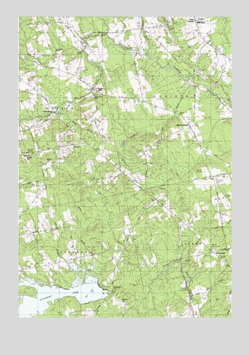
West Corinth, ME USGS Topographic Map
Click on map above to begin viewing in our Map Viewer.

This topographic map contains these locations and features:
Feature Name Type Latitude Longitude GNIS ID View Map
Allen StreamStreamN44.9923°W69.0723°561200View Map
Boutell CemeteryCemeteryN44.9599°W69.0310°562786View Map
Bragg CemeteryCemeteryN44.9426°W69.1209°562878View Map
Central High SchoolSchoolN44.9979°W69.0193°1913389View Map
Central Middle SchoolSchoolN44.9969°W69.0177°2738076View Map
Corinthian CemeteryCemeteryN44.9951°W69.0375°564364View Map
Crooked BrookStreamN44.9848°W69.0487°564551View Map
East ExeterPopulated PlaceN44.9609°W69.1014°565607View Map
Eaton HillSummitN44.9405°W69.1096°1913491View Map
Exeter MillsPopulated PlaceN44.9701°W69.0787°579305View Map
Exeter Mills CemeteryCemeteryN44.9665°W69.0807°1913510View Map
French StreamStreamN44.9859°W69.0845°566577View Map
Harveys PondLakeN44.9006°W69.0293°567728View Map
Lucas CemeteryCemeteryN44.9337°W69.0056°1913674View Map
McGregor MillPopulated PlaceN44.9865°W69.0539°579512View Map
Morison Memorial SchoolSchoolN44.9989°W69.0189°1913716View Map
Mount Pleasant CemeteryCemeteryN44.8876°W69.0701°571778View Map
No Exeter CemeteryCemeteryN44.9978°W69.0978°572203View Map
North American Family Institute Stetson Ranch SchoolSchoolN44.8780°W69.0949°2738236View Map
Osgood CemeteryCemeteryN44.9982°W69.1074°2736934View Map
Page CemeteryCemeteryN44.9284°W69.0420°572917View Map
Pierre Paul BrookStreamN44.9726°W69.0187°573323View Map
Pleasant LakeLakeN44.8847°W69.1049°573492View Map
Stetson Elementary SchoolSchoolN44.8977°W69.1066°2737973View Map
Terra B & B AirportAirportN44.9308°W69.0089°582171View Map
Tibbets CemeteryCemeteryN44.9465°W69.0928°577088View Map
Town of CorinthCivilN44.9805°W69.0107°582420View Map
Town of StetsonCivilN44.8759°W69.1114°582746View Map
West CorinthPopulated PlaceN44.9542°W69.0237°579813View Map
West LevantPopulated PlaceN44.9026°W69.0109°579819View Map
West Levant Church of GodChurchN44.9031°W69.0106°1913979View Map

Note: Coordinates in the location and feature list above are referenced to NAD83 datum.


Copyright (C) 2008-2025 Ryan Niemi / Sunset Dynamics ... All Rights Reserved