TopoQuest Logo
Do you find TopoQuest useful?
Help keep TopoQuest running and adding new maps/features by donating!
Bitcoin:  19c7KJd3qBynnjoSw5npx9KScwjBe4ifkT
Litecoin:  LXs6TkuXGGXo1vDsWCkWVdjQX94eUKd6ui
Home View Maps Find Maps Find Places Resources & Links


Quam Lake, Minnesota Topographic Map

USGS Map Title: Quam Lake, MN
USGS Map MRC: 45095H6
DRG (GeoTIFF) Download: o45095h6.tif


Neighboring USGS Topographic Map Quads:


  Ashby, MN  
46095A7
 

  Evansville, MN  
46095A6
 

  Millerville, MN  
46095A5
 

  Erdahl, MN  
45095H7
 

  Quam Lake, MN  
45095H6
 

  Brandon, MN  
45095H5
 

  Hoffman, MN  
45095G7
 

  Kensington, MN  
45095G6
 

  Farwell, MN  
45095G5


Map MRC Location:

N46°
W96°
N46°
W95°
H8 H7 H6 H5 H4 H3 H2 H1
G8 G7 G6 G5 G4 G3 G2 G1
F8 F7 F6 F5 F4 F3 F2 F1
E8 E7 E6 E5 E4 E3 E2 E1
D8 D7 D6 D5 D4 D3 D2 D1
C8 C7 C6 C5 C4 C3 C2 C1
B8 B7 B6 B5 B4 B3 B2 B1
A8 A7 A6 A5 A4 A3 A2 A1
N45°
W96°
N45°
W95°

Quam Lake, MN USGS 1:24K Topographic Map Preview:
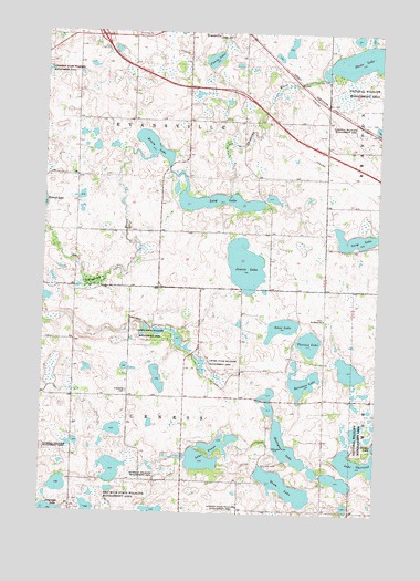
Quam Lake, MN USGS Topographic Map
Click on map above to begin viewing in our Map Viewer.

This topographic map contains these locations and features:
Feature Name Type Latitude Longitude GNIS ID View Map
Amos LakeLakeN45.9234°W95.6610°639333View Map
Barsness LakeLakeN45.9098°W95.6528°639654View Map
Chippewa River Fish Barrier DamDamN45.9500°W95.7203°1777192View Map
Erwin LakeLakeN45.9705°W95.7101°643408View Map
Fanny LakeLakeN45.9930°W95.6879°643558View Map
Frykesende CemeteryCemeteryN45.9066°W95.7184°643981View Map
Holl LakeLakeN45.8862°W95.7228°2778665View Map
Holleque LakeReservoirN45.8838°W95.6390°645088View Map
Interchange 82CrossingN45.9992°W95.7253°2069847View Map
Jennie LakeLakeN45.9396°W95.6750°645622View Map
Jennie Lake Flowage Fish Barrier DamDamN45.9216°W95.7253°1777191View Map
Lake ThorstadLakeN45.8882°W95.6299°653181View Map
Lake VenusLakeN45.8929°W95.6830°653629View Map
Long LakeLakeN45.9477°W95.6286°647115View Map
Long LakeLakeN45.9559°W95.6855°647071View Map
Minister Lake DamDamN45.9116°W95.6253°1776194View Map
Quam LakeLakeN45.8822°W95.6589°649768View Map
Red Rock State Wildlife Management AreaParkN45.8766°W95.7309°649882View Map
Saint Petri CemeteryCemeteryN45.9258°W95.6447°2069664View Map
Saint Petrie ChurchChurchN45.9255°W95.6453°651041View Map
Stowe LakeLakeN45.9937°W95.6294°652706View Map
Thorson LakeLakeN45.9194°W95.6505°653177View Map
Township of EvansvilleCivilN45.9763°W95.7077°664116View Map
Township of UrnessCivilN45.8903°W95.6965°665844View Map
Urness State Wildlife Management AreaParkN45.9213°W95.7100°653579View Map

Note: Coordinates in the location and feature list above are referenced to NAD83 datum.


Copyright (C) 2008-2024 Ryan Niemi / Sunset Dynamics ... All Rights Reserved