TopoQuest Logo
Do you find TopoQuest useful?
Help keep TopoQuest running and adding new maps/features by donating!
Bitcoin:  19c7KJd3qBynnjoSw5npx9KScwjBe4ifkT
Litecoin:  LXs6TkuXGGXo1vDsWCkWVdjQX94eUKd6ui
Home View Maps Find Maps Find Places Resources & Links


Erdahl, Minnesota Topographic Map

USGS Map Title: Erdahl, MN
USGS Map MRC: 45095H7
DRG (GeoTIFF) Download: o45095h7.tif


Neighboring USGS Topographic Map Quads:


  Fourmile Lake, MN  
46095A8
 

  Ashby, MN  
46095A7
 

  Evansville, MN  
46095A6
 

  Elbow Lake, MN  
45095H8
 

  Erdahl, MN  
45095H7
 

  Quam Lake, MN  
45095H6
 

  Patchen Lake, MN  
45095G8
 

  Hoffman, MN  
45095G7
 

  Kensington, MN  
45095G6


Map MRC Location:

N46°
W96°
N46°
W95°
H8 H7 H6 H5 H4 H3 H2 H1
G8 G7 G6 G5 G4 G3 G2 G1
F8 F7 F6 F5 F4 F3 F2 F1
E8 E7 E6 E5 E4 E3 E2 E1
D8 D7 D6 D5 D4 D3 D2 D1
C8 C7 C6 C5 C4 C3 C2 C1
B8 B7 B6 B5 B4 B3 B2 B1
A8 A7 A6 A5 A4 A3 A2 A1
N45°
W96°
N45°
W95°

Erdahl, MN USGS 1:24K Topographic Map Preview:
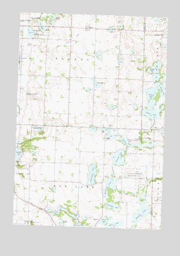
Erdahl, MN USGS Topographic Map
Click on map above to begin viewing in our Map Viewer.

This topographic map contains these locations and features:
Feature Name Type Latitude Longitude GNIS ID View Map
Albert LakeLakeN45.9427°W95.7617°639245View Map
Alvstad State Wildlife Management AreaParkN45.9258°W95.7642°639318View Map
Anderson State Wildlife Management AreaParkN45.9897°W95.7517°639361View Map
Barrett Covenant CemeteryCemeteryN45.9094°W95.8734°639645View Map
Berskow State Wildlife Management AreaParkN45.9869°W95.8637°639979View Map
Church LakeLakeN45.8793°W95.7988°641217View Map
Davidson LakeLakeN45.9682°W95.7593°642650View Map
Elk LakeLakeN45.9325°W95.7992°643262View Map
Ellingson LakeLakeN45.8848°W95.7672°643282View Map
ErdahlPopulated PlaceN45.9919°W95.8178°643390View Map
Erdahl (historical)LocaleN45.9931°W95.8175°2068494View Map
Erdahl Lutheran ChurchChurchN45.9925°W95.8156°2068495View Map
Erdahl Post Office (historical)Post OfficeN45.9925°W95.8172°2068493View Map
Hjermenrud LakeLakeN45.8992°W95.7947°645038View Map
Hubred LakeLakeN45.9575°W95.7541°645272View Map
Isaacson State Wildlife Management AreaParkN45.8769°W95.8676°645466View Map
Jenstad LakeLakeN45.9290°W95.7947°645629View Map
Lee LakeLakeN45.9940°W95.8561°646570View Map
Lee LakeLakeN45.9730°W95.8743°646574View Map
Lincoln CemeteryCemeteryN45.8792°W95.8053°2068491View Map
Lincoln ChurchChurchN45.8800°W95.8053°646674View Map
Mahla LakeLakeN45.9994°W95.7529°647383View Map
Malmgren LakeLakeN45.9588°W95.8085°647415View Map
Old Lincoln CemeteryCemeteryN45.8900°W95.7992°2068490View Map
Olson LakeLakeN45.8769°W95.7898°648959View Map
Peterson LakeLakeN45.9163°W95.7880°649331View Map
Retzloff LakeLakeN45.8767°W95.8339°649948View Map
Round LakeLakeN45.8817°W95.8227°650334View Map
Schmall MarshLakeN45.9979°W95.8458°651288View Map
School Number 3 (historical)SchoolN45.9989°W95.8672°2111060View Map
School Number 35 (historical)SchoolN45.9119°W95.8536°2111067View Map
School Number 43 (historical)SchoolN45.9558°W95.8517°2111062View Map
School Number 44 (historical)SchoolN45.9625°W95.8003°2111061View Map
School Number 47 (historical)SchoolN45.9333°W95.7892°2111069View Map
School Number 52 (historical)SchoolN45.9053°W95.7997°2111068View Map
Solberg LakeLakeN45.9482°W95.7618°652229View Map
Spring LakeLakeN45.8753°W95.8195°652478View Map
Sylvan LakeLakeN45.9261°W95.7823°652964View Map
Thompson LakeLakeN45.9062°W95.8099°653161View Map
Thorstad LakeLakeN45.9883°W95.8659°653180View Map
Torstenson LakeLakeN45.8882°W95.7920°653245View Map
Township of Elk LakeCivilN45.8901°W95.8200°664068View Map
Township of ErdahlCivilN45.9773°W95.8316°664103View Map
Turtle LakeLakeN45.8842°W95.8366°653377View Map
Willow SloughGutN45.8950°W95.7762°654208View Map
Zionsborg CemeteryCemeteryN45.9338°W95.7564°654498View Map

Note: Coordinates in the location and feature list above are referenced to NAD83 datum.


Copyright (C) 2008-2025 Ryan Niemi / Sunset Dynamics ... All Rights Reserved