TopoQuest Logo
Do you find TopoQuest useful?
Help keep TopoQuest running and adding new maps/features by donating!
Bitcoin:  19c7KJd3qBynnjoSw5npx9KScwjBe4ifkT
Litecoin:  LXs6TkuXGGXo1vDsWCkWVdjQX94eUKd6ui
Home View Maps Find Maps Find Places Resources & Links


Kincaid, Illinois Topographic Map

USGS Map Title: Kincaid, IL
USGS Map MRC: 39089E4
DRG (GeoTIFF) Download: o39089e4.tif


Neighboring USGS Topographic Map Quads:


  New City, IL  
39089F5
 

  Edinburg, IL  
39089F4
 

  Grove City, IL  
39089F3
 

  Pawnee, IL  
39089E5
 

  Kincaid, IL  
39089E4
 

  Taylorville, IL  
39089E3
 

  Raymond NE, IL  
39089D5
 

  Morrisonville, IL  
39089D4
 

  Clarksdale, IL  
39089D3


Map MRC Location:

N40°
W90°
N40°
W89°
H8 H7 H6 H5 H4 H3 H2 H1
G8 G7 G6 G5 G4 G3 G2 G1
F8 F7 F6 F5 F4 F3 F2 F1
E8 E7 E6 E5 E4 E3 E2 E1
D8 D7 D6 D5 D4 D3 D2 D1
C8 C7 C6 C5 C4 C3 C2 C1
B8 B7 B6 B5 B4 B3 B2 B1
A8 A7 A6 A5 A4 A3 A2 A1
N39°
W90°
N39°
W89°

Kincaid, IL USGS 1:24K Topographic Map Preview:
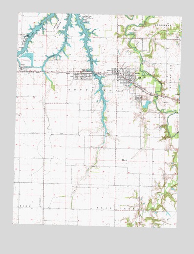
Kincaid, IL USGS Topographic Map
Click on map above to begin viewing in our Map Viewer.

This topographic map contains these locations and features:
Feature Name Type Latitude Longitude GNIS ID View Map
Achenback Lutheran CemeteryCemeteryN39.5539°W89.4293°1747909View Map
Bethany CemeteryCemeteryN39.6209°W89.4501°1747874View Map
Bethany Church (historical)ChurchN39.6212°W89.4501°404255View Map
Bloome FarmsLocaleN39.5238°W89.4749°2629388View Map
BulpittPopulated PlaceN39.5917°W89.4240°405184View Map
Cottonwood School (historical)SchoolN39.5392°W89.4773°406640View Map
Deal Landing Strip (historical)AirportN39.5139°W89.4793°1747888View Map
Goode CemeteryCemeteryN39.6120°W89.3765°1747895View Map
Hedge College School (historical)SchoolN39.5462°W89.4468°410022View Map
JeisyvillePopulated PlaceN39.5773°W89.4051°411081View Map
KincaidPopulated PlaceN39.5887°W89.4145°411477View Map
Kincaid Baptist ChurchChurchN39.5878°W89.4137°1984667View Map
Kincaid City Lake DamDamN39.5767°W89.3751°1691059View Map
Kincaid Consolidated Oil FieldOilfieldN39.6000°W89.4151°1747902View Map
Kincaid Elementary SchoolSchoolN39.5898°W89.4145°1811236View Map
Kincaid Police DepartmentBuildingN39.5866°W89.4125°2758894View Map
Kincaid Post OfficePost OfficeN39.5876°W89.4129°2788791View Map
Leigh School (historical)SchoolN39.5317°W89.4023°411933View Map
Maple Grove School (historical)SchoolN39.5026°W89.4568°412934View Map
Midland Fire Protection DistrictBuildingN39.5901°W89.4203°2640895View Map
Pleasant Hill Church (historical)ChurchN39.5970°W89.4976°415837View Map
Pleasant View School (historical)SchoolN39.5539°W89.4048°415927View Map
Rosedale School (historical)SchoolN39.5070°W89.4229°416955View Map
Sangchris LakeReservoirN39.5921°W89.4807°422257View Map
SicilyPopulated PlaceN39.5901°W89.4912°418489View Map
South Fork High SchoolSchoolN39.5881°W89.4123°1811260View Map
ToveyPopulated PlaceN39.5889°W89.4562°1669480View Map
Tovey Humphrey StationPopulated PlaceN39.5898°W89.4551°419789View Map
Tovey Post OfficePost OfficeN39.5898°W89.4498°2788454View Map
Township of South ForkCivilN39.5837°W89.4613°429766View Map
Village of BulpittCivilN39.5919°W89.4258°2397493View Map
Village of JeisyvilleCivilN39.5792°W89.4081°2398295View Map
Village of KincaidCivilN39.5868°W89.4165°2398347View Map
Village of ToveyCivilN39.5882°W89.4486°2399996View Map
Walnut Hill School (historical)SchoolN39.6064°W89.3870°420477View Map

Note: Coordinates in the location and feature list above are referenced to NAD83 datum.


Copyright (C) 2008-2025 Ryan Niemi / Sunset Dynamics ... All Rights Reserved