TopoQuest Logo
Do you find TopoQuest useful?
Help keep TopoQuest running and adding new maps/features by donating!
Bitcoin:  19c7KJd3qBynnjoSw5npx9KScwjBe4ifkT
Litecoin:  LXs6TkuXGGXo1vDsWCkWVdjQX94eUKd6ui
Home View Maps Find Maps Find Places Resources & Links


Grove City, Illinois Topographic Map

USGS Map Title: Grove City, IL
USGS Map MRC: 39089F3
DRG (GeoTIFF) Download: o39089f3.tif


Neighboring USGS Topographic Map Quads:


  Mechanicsburg, IL  
39089G4
 

  Mount Auburn, IL  
39089G3
 

  Niantic, IL  
39089G2
 

  Edinburg, IL  
39089F4
 

  Grove City, IL  
39089F3
 

  Stonington, IL  
39089F2
 

  Kincaid, IL  
39089E4
 

  Taylorville, IL  
39089E3
 

  Willeys, IL  
39089E2


Map MRC Location:

N40°
W90°
N40°
W89°
H8 H7 H6 H5 H4 H3 H2 H1
G8 G7 G6 G5 G4 G3 G2 G1
F8 F7 F6 F5 F4 F3 F2 F1
E8 E7 E6 E5 E4 E3 E2 E1
D8 D7 D6 D5 D4 D3 D2 D1
C8 C7 C6 C5 C4 C3 C2 C1
B8 B7 B6 B5 B4 B3 B2 B1
A8 A7 A6 A5 A4 A3 A2 A1
N39°
W90°
N39°
W89°

Grove City, IL USGS 1:24K Topographic Map Preview:
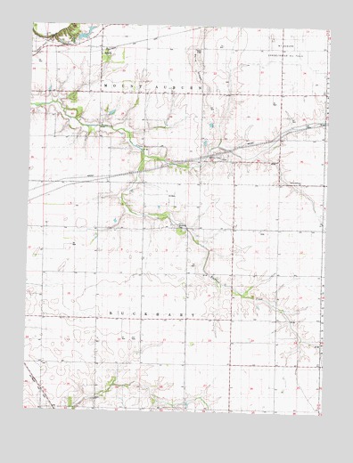
Grove City, IL USGS Topographic Map
Click on map above to begin viewing in our Map Viewer.

This topographic map contains these locations and features:
Feature Name Type Latitude Longitude GNIS ID View Map
Bethel Baptist CemeteryCemeteryN39.6284°W89.3465°1953213View Map
Bethel ChurchChurchN39.6289°W89.3454°1747875View Map
Blake School (historical)SchoolN39.7139°W89.3462°404548View Map
BoliviaPopulated PlaceN39.7423°W89.3470°404665View Map
Bolivia School (historical)SchoolN39.7498°W89.3462°404666View Map
Buckhart Dutch Reform CemeteryCemeteryN39.6850°W89.3118°1747878View Map
Buckhart School (historical)SchoolN39.6850°W89.3073°405123View Map
Central Point School (historical)SchoolN39.6556°W89.3081°405873View Map
Cleveland School (historical)SchoolN39.6559°W89.2706°406246View Map
Gardner School (historical)SchoolN39.6553°W89.3459°408887View Map
Grove CityPopulated PlaceN39.7067°W89.2970°409535View Map
Grove City Methodist CemeteryCemeteryN39.7070°W89.2929°1953218View Map
Hardy Airport (historical)AirportN39.7266°W89.2609°427573View Map
Hinckle CemeteryCemeteryN39.7431°W89.3581°1747897View Map
Holben School (historical)SchoolN39.6842°W89.3459°410372View Map
Illinois No Name Number 2030 DamDamN39.7450°W89.3568°1692197View Map
Liberty Mosquito ChurchChurchN39.6992°W89.2612°409137View Map
Montgomery School (historical)SchoolN39.7212°W89.2704°413749View Map
Mount Auburn Consolidated Oil FieldOilfieldN39.7473°W89.2667°1747965View Map
Perrine School (historical)SchoolN39.6848°W89.2704°415555View Map
Prairie Lea School (historical)SchoolN39.6264°W89.2704°416150View Map
Robinson FarmLocaleN39.6413°W89.2740°2629383View Map
Roby East Oil FieldOilfieldN39.7437°W89.3684°1747926View Map
Sand Ridge School (historical)SchoolN39.7398°W89.3045°417951View Map
Sharpsburg School (historical)SchoolN39.6267°W89.3448°418299View Map
Township of BuckhartCivilN39.6568°W89.3440°428727View Map
Township of Mount AuburnCivilN39.7375°W89.3257°429401View Map
Weiser School (historical)SchoolN39.6270°W89.3079°420714View Map

Note: Coordinates in the location and feature list above are referenced to NAD83 datum.


Copyright (C) 2008-2025 Ryan Niemi / Sunset Dynamics ... All Rights Reserved