TopoQuest Logo
Do you find TopoQuest useful?
Help keep TopoQuest running and adding new maps/features by donating!
Bitcoin:  19c7KJd3qBynnjoSw5npx9KScwjBe4ifkT
Litecoin:  LXs6TkuXGGXo1vDsWCkWVdjQX94eUKd6ui
Home View Maps Find Maps Find Places Resources & Links


Kirvin, Texas Topographic Map

USGS Map Title: Kirvin, TX
USGS Map MRC: 31096G3
DRG (GeoTIFF) Download: o31096g3.tif


Neighboring USGS Topographic Map Quads:


  Richland, TX  
31096H4
 

  Streetman, TX  
31096H3
 

  Winkler, TX  
31096H2
 

  Wortham, TX  
31096G4
 

  Kirvin, TX  
31096G3
 

  Stewards Mill, TX  
31096G2
 

  Mexia, TX  
31096F4
 

  Teague North, TX  
31096F3
 

  Fairfield, TX  
31096F2


Map MRC Location:

N32°
W97°
N32°
W96°
H8 H7 H6 H5 H4 H3 H2 H1
G8 G7 G6 G5 G4 G3 G2 G1
F8 F7 F6 F5 F4 F3 F2 F1
E8 E7 E6 E5 E4 E3 E2 E1
D8 D7 D6 D5 D4 D3 D2 D1
C8 C7 C6 C5 C4 C3 C2 C1
B8 B7 B6 B5 B4 B3 B2 B1
A8 A7 A6 A5 A4 A3 A2 A1
N31°
W97°
N31°
W96°

Kirvin, TX USGS 1:24K Topographic Map Preview:
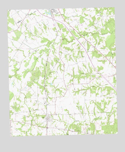
Kirvin, TX USGS Topographic Map
Click on map above to begin viewing in our Map Viewer.

This topographic map contains these locations and features:
Feature Name Type Latitude Longitude GNIS ID View Map
Cade ChapelChurchN31.8693°W96.3514°1331831View Map
Caney ChurchChurchN31.8004°W96.2997°1332072View Map
Cedar CreekStreamN31.8027°W96.2522°1332395View Map
Cedar CreekStreamN31.8241°W96.3591°1332407View Map
Cedar Grove CemeteryCemeteryN31.8529°W96.3155°1332429View Map
Dry CreekStreamN31.8160°W96.2589°1334662View Map
Hillery ChapelChurchN31.8702°W96.2683°1337811View Map
Jackson BranchStreamN31.8091°W96.3714°1338572View Map
KirvinPopulated PlaceN31.7666°W96.3303°1339166View Map
Kirvin Post OfficePost OfficeN31.7666°W96.3304°2731611View Map
Lebanon ChurchChurchN31.7593°W96.3747°1339765View Map
Little Tehuacana CreekStreamN31.8407°W96.3244°1374614View Map
Loper LakeReservoirN31.8010°W96.3260°1855596View Map
Loper Lake DamDamN31.8002°W96.3269°1855595View Map
Session CemeteryCemeteryN31.7707°W96.3219°1346905View Map
Shiloh ChurchChurchN31.7760°W96.3419°1347051View Map
Sloan CreekStreamN31.8496°W96.2647°1347240View Map
Streetman LakeReservoirN31.8710°W96.3266°1855606View Map
Streetman Lake DamDamN31.8735°W96.3269°1855605View Map
Tehuacana Grove ChurchChurchN31.8666°W96.2658°1348330View Map
Town of KirvinCivilN31.7671°W96.3300°2412841View Map
Webb-Branch CemeteryCemeteryN31.7991°W96.3344°1349589View Map
White Rock CreekStreamN31.7529°W96.3097°1376758View Map
Woodland CemeteryCemeteryN31.7841°W96.3419°1350526View Map
Wortham DivisionCivilN31.8147°W96.3454°1939340View Map

Note: Coordinates in the location and feature list above are referenced to NAD83 datum.


Copyright (C) 2008-2025 Ryan Niemi / Sunset Dynamics ... All Rights Reserved