TopoQuest Logo
Do you find TopoQuest useful?
Help keep TopoQuest running and adding new maps/features by donating!
Bitcoin:  19c7KJd3qBynnjoSw5npx9KScwjBe4ifkT
Litecoin:  LXs6TkuXGGXo1vDsWCkWVdjQX94eUKd6ui
Home View Maps Find Maps Find Places Resources & Links


Wortham, Texas Topographic Map

USGS Map Title: Wortham, TX
USGS Map MRC: 31096G4
DRG (GeoTIFF) Download: o31096g4.tif


Neighboring USGS Topographic Map Quads:


  Purdon, TX  
31096H5
 

  Richland, TX  
31096H4
 

  Streetman, TX  
31096H3
 

  Union High, TX  
31096G5
 

  Wortham, TX  
31096G4
 

  Kirvin, TX  
31096G3
 

  Tehuacana, TX  
31096F5
 

  Mexia, TX  
31096F4
 

  Teague North, TX  
31096F3


Map MRC Location:

N32°
W97°
N32°
W96°
H8 H7 H6 H5 H4 H3 H2 H1
G8 G7 G6 G5 G4 G3 G2 G1
F8 F7 F6 F5 F4 F3 F2 F1
E8 E7 E6 E5 E4 E3 E2 E1
D8 D7 D6 D5 D4 D3 D2 D1
C8 C7 C6 C5 C4 C3 C2 C1
B8 B7 B6 B5 B4 B3 B2 B1
A8 A7 A6 A5 A4 A3 A2 A1
N31°
W97°
N31°
W96°

Wortham, TX USGS 1:24K Topographic Map Preview:
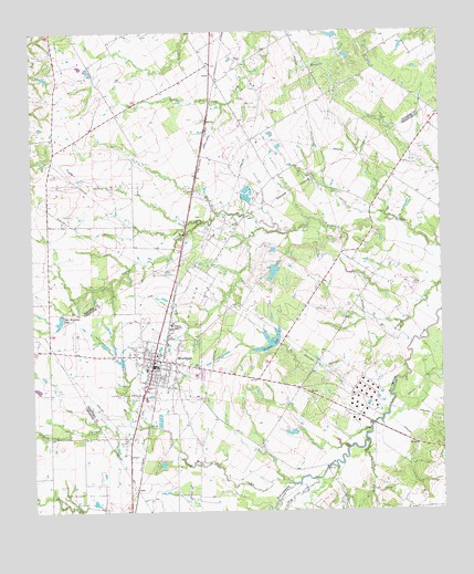
Wortham, TX USGS Topographic Map
Click on map above to begin viewing in our Map Viewer.

This topographic map contains these locations and features:
Feature Name Type Latitude Longitude GNIS ID View Map
CurriePopulated PlaceN31.8638°W96.4436°1378194View Map
Currie Oil FieldOilfieldN31.8560°W96.4319°1333823View Map
Elm CreekStreamN31.7582°W96.4144°1373643View Map
GudeLocaleN31.7563°W96.4689°1378393View Map
Long Bottom CemeteryCemeteryN31.7807°W96.4730°1340415View Map
Miller CemeteryCemeteryN31.8091°W96.3836°1341647View Map
New Wortham LakeReservoirN31.8012°W96.4914°1342545View Map
Red CemeteryCemeteryN31.8032°W96.4041°1344902View Map
Rocky BranchStreamN31.7679°W96.3978°1375797View Map
Tehuacana Oil FieldOilfieldN31.7566°W96.4841°1376410View Map
Town of WorthamCivilN31.7897°W96.4610°2413512View Map
Wheeler High SchoolSchoolN31.7991°W96.4575°1349902View Map
Wolf CreekStreamN31.7571°W96.4211°1350464View Map
WorthamPopulated PlaceN31.7879°W96.4625°1350596View Map
Wortham City HallBuildingN31.7881°W96.4625°2754011View Map
Wortham LakeReservoirN31.7938°W96.4274°1855600View Map
Wortham Lake Number 1 DamDamN31.7935°W96.4253°1855599View Map
Wortham Lake Number 2ReservoirN31.8126°W96.4263°1855598View Map
Wortham Lake Number 2 DamDamN31.8135°W96.4253°1855597View Map
Wortham Oil FieldOilfieldN31.8118°W96.4439°1350598View Map
Wortham Police DepartmentBuildingN31.7881°W96.4625°2739431View Map
Wortham Post OfficePost OfficeN31.7878°W96.4631°2731661View Map
Wortham Volunteer Fire DepartmentBuildingN31.7875°W96.4632°2552199View Map

Note: Coordinates in the location and feature list above are referenced to NAD83 datum.


Copyright (C) 2008-2025 Ryan Niemi / Sunset Dynamics ... All Rights Reserved