TopoQuest Logo
Do you find TopoQuest useful?
Help keep TopoQuest running and adding new maps/features by donating!
Bitcoin:  19c7KJd3qBynnjoSw5npx9KScwjBe4ifkT
Litecoin:  LXs6TkuXGGXo1vDsWCkWVdjQX94eUKd6ui
Home View Maps Find Maps Find Places Resources & Links


Knowles, California Topographic Map

USGS Map Title: Knowles, CA
USGS Map MRC: 37119B7
DRG (GeoTIFF) Download: o37119b7.tif


Neighboring USGS Topographic Map Quads:


  Ben Hur, CA  
37119C8
 

  Horsecamp Mountain, CA  
37119C7
 

  Ahwahnee, CA  
37119C6
 

  Raymond, CA  
37119B8
 

  Knowles, CA  
37119B7
 

  O'Neals, CA  
37119B6
 

  Daulton, CA  
37119A8
 

  Little Table Mountain, CA  
37119A7
 

  Millerton Lake West, CA  
37119A6


Map MRC Location:

N38°
W120°
N38°
W119°
H8 H7 H6 H5 H4 H3 H2 H1
G8 G7 G6 G5 G4 G3 G2 G1
F8 F7 F6 F5 F4 F3 F2 F1
E8 E7 E6 E5 E4 E3 E2 E1
D8 D7 D6 D5 D4 D3 D2 D1
C8 C7 C6 C5 C4 C3 C2 C1
B8 B7 B6 B5 B4 B3 B2 B1
A8 A7 A6 A5 A4 A3 A2 A1
N37°
W120°
N37°
W119°

Knowles, CA USGS 1:24K Topographic Map Preview:
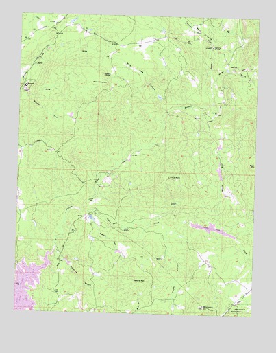
Knowles, CA USGS Topographic Map
Click on map above to begin viewing in our Map Viewer.

This topographic map contains these locations and features:
Feature Name Type Latitude Longitude GNIS ID View Map
Adkins MountainSummitN37.1380°W119.8107°217984View Map
Ashbrook CreekStreamN37.1672°W119.8382°218431View Map
Bean GulchValleyN37.2383°W119.7746°218783View Map
Black Hawk 687 DamDamN37.1633°W119.7843°1664015View Map
Black Hawk LakeReservoirN37.1617°W119.7748°1812707View Map
Buford MountainSummitN37.2211°W119.8418°1658165View Map
Buzzard CanyonValleyN37.1497°W119.8563°220313View Map
Coarse Gold CreekStreamN37.1688°W119.8460°253589View Map
Daulton SpringSpringN37.1715°W119.7921°222036View Map
Dennis School (historical)SchoolN37.1277°W119.8696°1666150View Map
Eighteenmile House (historical)BuildingN37.1277°W119.8704°1666152View Map
Fresno CrossingPopulated PlaceN37.2372°W119.7752°252679View Map
Happy HollowValleyN37.1513°W119.7960°224899View Map
KnowlesPopulated PlaceN37.2199°W119.8740°1658917View Map
Lilley MountainSummitN37.1816°W119.7957°1658959View Map
Long HollowValleyN37.1613°W119.7743°227571View Map
Madera CountyCivilN37.2180°W119.7626°277284View Map
Madera County Fire Department Station 10 Yosemite Lake Park Volunteer Fire DepartmentBuildingN37.1757°W119.7654°2624571View Map
Madera QuarryMineN37.2169°W119.8711°2678964View Map
Madera QuarryMineN37.1483°W119.7990°227913View Map
Middle Lake 1681 DamDamN37.1416°W119.8343°1664433View Map
Pecan SpringSpringN37.1602°W119.8199°230456View Map
Polk School (historical)SchoolN37.2291°W119.7640°1670202View Map
Raymond QuarryMineN37.2186°W119.8729°231295View Map
Red Top LookoutLocaleN37.1280°W119.7768°231393View Map
Rogers SpringSpringN37.2250°W119.8286°255051View Map
Savage Monument (historical)ParkN37.1427°W119.8690°232606View Map
Spangle Gold CreekStreamN37.2383°W119.7746°235144View Map
Spring 687-002 DamDamN37.1816°W119.7693°1664016View Map
Vichy SpringSpringN37.1594°W119.7938°1670205View Map
Water GulchValleyN37.2227°W119.7752°237328View Map
Wild Hog CanyonValleyN37.2102°W119.7988°237752View Map
Yosemite LakesPopulated PlaceN37.1911°W119.7727°1867075View Map
Yosemite Lakes Census Designated PlaceCensusN37.1886°W119.7723°2409637View Map
Yosemite Lakes DivisionCivilN37.2005°W119.8219°2583205View Map
Yosemite Lakes Golf CourseLocaleN37.2133°W119.7693°1812737View Map
Yosemite Lakes ParkPopulated PlaceN37.1819°W119.7682°1812738View Map
Zebra RanchLocaleN37.1436°W119.7524°1670207View Map

Note: Coordinates in the location and feature list above are referenced to NAD83 datum.


Copyright (C) 2008-2025 Ryan Niemi / Sunset Dynamics ... All Rights Reserved