TopoQuest Logo
Do you find TopoQuest useful?
Help keep TopoQuest running and adding new maps/features by donating!
Bitcoin:  19c7KJd3qBynnjoSw5npx9KScwjBe4ifkT
Litecoin:  LXs6TkuXGGXo1vDsWCkWVdjQX94eUKd6ui
Home View Maps Find Maps Find Places Resources & Links


Horsecamp Mountain, California Topographic Map

USGS Map Title: Horsecamp Mountain, CA
USGS Map MRC: 37119C7
DRG (GeoTIFF) Download: o37119c7.tif


Neighboring USGS Topographic Map Quads:


  Mariposa, CA  
37119D8
 

  Stumpfield Mountain, CA  
37119D7
 

  Fish Camp, CA  
37119D6
 

  Ben Hur, CA  
37119C8
 

  Horsecamp Mountain, CA  
37119C7
 

  Ahwahnee, CA  
37119C6
 

  Raymond, CA  
37119B8
 

  Knowles, CA  
37119B7
 

  O'Neals, CA  
37119B6


Map MRC Location:

N38°
W120°
N38°
W119°
H8 H7 H6 H5 H4 H3 H2 H1
G8 G7 G6 G5 G4 G3 G2 G1
F8 F7 F6 F5 F4 F3 F2 F1
E8 E7 E6 E5 E4 E3 E2 E1
D8 D7 D6 D5 D4 D3 D2 D1
C8 C7 C6 C5 C4 C3 C2 C1
B8 B7 B6 B5 B4 B3 B2 B1
A8 A7 A6 A5 A4 A3 A2 A1
N37°
W120°
N37°
W119°

Horsecamp Mountain, CA USGS 1:24K Topographic Map Preview:
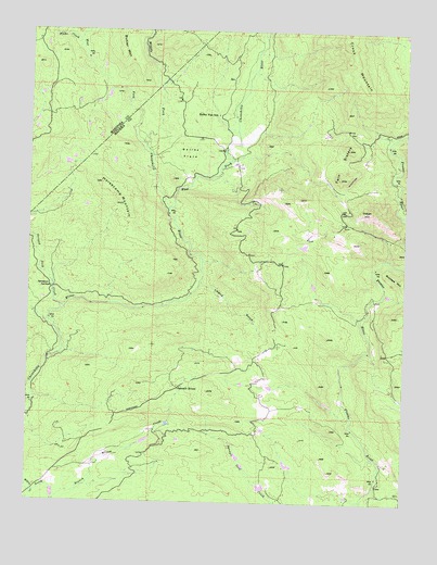
Horsecamp Mountain, CA USGS Topographic Map
Click on map above to begin viewing in our Map Viewer.

This topographic map contains these locations and features:
Feature Name Type Latitude Longitude GNIS ID View Map
Bailey Flat SchoolSchoolN37.3522°W119.8135°218527View Map
Bailey FlatsFlatN37.3422°W119.8232°218528View Map
Bailey Flats (historical)Populated PlaceN37.3430°W119.8121°1812611View Map
Blade CreekStreamN37.3716°W119.8593°257189View Map
East Fork Chowchilla RiverStreamN37.3280°W119.8293°259723View Map
Grub GulchBasinN37.3238°W119.7715°224685View Map
Grub Gulch (historical)Populated PlaceN37.3247°W119.7707°1812618View Map
Grupe Ranch AirportAirportN37.3407°W119.8604°1653725View Map
Horsecamp MountainSummitN37.3288°W119.8452°225630View Map
Indian HillSummitN37.3274°W119.7640°1658813View Map
Leland GulchValleyN37.3086°W119.8188°227015View Map
Middle Fork Chowchilla RiverStreamN37.3444°W119.8377°263522View Map
North Branch Willow CreekStreamN37.2524°W119.8727°229613View Map
Specimen SpringsSpringN37.3069°W119.8683°235181View Map
Striped Rock CreekStreamN37.3013°W119.8640°235600View Map
Summit HouseLocaleN37.2797°W119.8254°235747View Map
Twin SistersSummitN37.3358°W119.7727°236717View Map
West Fork Chowchilla RiverStreamN37.3436°W119.8382°268891View Map
Windy GapGapN37.3480°W119.7699°238017View Map

Note: Coordinates in the location and feature list above are referenced to NAD83 datum.


Copyright (C) 2008-2024 Ryan Niemi / Sunset Dynamics ... All Rights Reserved