TopoQuest Logo
Do you find TopoQuest useful?
Help keep TopoQuest running and adding new maps/features by donating!
Bitcoin:  19c7KJd3qBynnjoSw5npx9KScwjBe4ifkT
Litecoin:  LXs6TkuXGGXo1vDsWCkWVdjQX94eUKd6ui
Home View Maps Find Maps Find Places Resources & Links


Ahwahnee, California Topographic Map

USGS Map Title: Ahwahnee, CA
USGS Map MRC: 37119C6
DRG (GeoTIFF) Download: o37119c6.tif


Neighboring USGS Topographic Map Quads:


  Stumpfield Mountain, CA  
37119D7
 

  Fish Camp, CA  
37119D6
 

  White Chief Mountain, CA  
37119D5
 

  Horsecamp Mountain, CA  
37119C7
 

  Ahwahnee, CA  
37119C6
 

  Bass Lake, CA  
37119C5
 

  Knowles, CA  
37119B7
 

  O'Neals, CA  
37119B6
 

  North Fork, CA  
37119B5


Map MRC Location:

N38°
W120°
N38°
W119°
H8 H7 H6 H5 H4 H3 H2 H1
G8 G7 G6 G5 G4 G3 G2 G1
F8 F7 F6 F5 F4 F3 F2 F1
E8 E7 E6 E5 E4 E3 E2 E1
D8 D7 D6 D5 D4 D3 D2 D1
C8 C7 C6 C5 C4 C3 C2 C1
B8 B7 B6 B5 B4 B3 B2 B1
A8 A7 A6 A5 A4 A3 A2 A1
N37°
W120°
N37°
W119°

Ahwahnee, CA USGS 1:24K Topographic Map Preview:
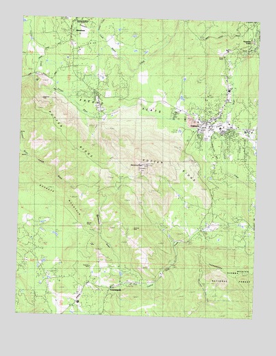
Ahwahnee, CA USGS Topographic Map
Click on map above to begin viewing in our Map Viewer.

This topographic map contains these locations and features:
Feature Name Type Latitude Longitude GNIS ID View Map
AhwahneePopulated PlaceN37.3655°W119.7263°256142View Map
Ahwahnee Census Designated PlaceCensusN37.3652°W119.7193°2628702View Map
Ahwahnee Country ClubLocaleN37.3652°W119.7040°1812608View Map
Ahwahnee EstatesPopulated PlaceN37.3708°W119.7038°1812609View Map
Ahwahnee Hills Continuation High SchoolSchoolN37.3744°W119.7274°1812610View Map
Ahwahnee Post OfficePost OfficeN37.3723°W119.7273°1667652View Map
Ahwahnee Post OfficePost OfficeN37.3723°W119.7273°2789112View Map
Ahwahnee Post Office (historical)Post OfficeN37.3655°W119.7263°2026836View Map
Bass Lake Ranger StationLocaleN37.3594°W119.6446°276376View Map
Bissetts Ranch (historical)LocaleN37.3669°W119.6574°1652838View Map
Buckeye MountainSummitN37.3013°W119.7260°257605View Map
California Highway Patrol Central Division - OakhurstBuildingN37.3370°W119.6680°2770065View Map
Carter CreekStreamN37.3699°W119.7118°258012View Map
China CreekStreamN37.3297°W119.6568°253439View Map
Christ Episcopal ChurchChurchN37.3333°W119.6554°1812612View Map
CoarsegoldPopulated PlaceN37.2622°W119.7010°258494View Map
Coarsegold Census Designated PlaceCensusN37.2526°W119.7000°2628719View Map
Coarsegold Elementary SchoolSchoolN37.2555°W119.7185°1812613View Map
Coarsegold Post OfficePost OfficeN37.2644°W119.6921°1667655View Map
Crooks CreekStreamN37.3502°W119.7457°1652858View Map
Deadwood GulchValleyN37.2627°W119.6946°259154View Map
Deadwood PeakSummitN37.3136°W119.6859°259157View Map
Department of Forestry and Fire Protection Ahwahnee StationBuildingN37.3740°W119.7291°2623921View Map
Department of Forestry and Fire Protection Coarsegold StationBuildingN37.2509°W119.7047°2624568View Map
Enterprise MineMineN37.3408°W119.7402°259948View Map
French GulchValleyN37.3163°W119.7471°260386View Map
Fresno FlatsFlatN37.3388°W119.6979°223935View Map
Fresno Flats Historic ParkParkN37.3299°W119.6399°1812615View Map
Gateway Christian SchoolSchoolN37.3436°W119.6415°253088View Map
Gaylord Borrow PitMineN37.3636°W119.6447°2677532View Map
Hawkeye MineMineN37.2866°W119.6907°261160View Map
Laramore-Lyman HouseBuildingN37.3302°W119.6438°1812620View Map
Lewis ForkStreamN37.3619°W119.6326°262428View Map
Lily MineMineN37.2799°W119.7127°262464View Map
Madera County Fire Department Station 12 Oakhurst Volunteer Fire DepartmentBuildingN37.3308°W119.6534°2623706View Map
Madera County Fire Department Station 13 Coarsegold Volunteer Fire DepartmentBuildingN37.2641°W119.6859°2623820View Map
Madera County Fire Department Station 16BuildingN37.3637°W119.7252°2623961View Map
Madera County Sheriff's Office OakhurstBuildingN37.3410°W119.6671°2755914View Map
Miami CreekStreamN37.3427°W119.7282°263485View Map
Nelder CreekStreamN37.3619°W119.6326°264039View Map
OakhurstPopulated PlaceN37.3280°W119.6493°277565View Map
Oakhurst Census Designated PlaceCensusN37.3343°W119.6482°2408967View Map
Oakhurst Elementary SchoolSchoolN37.3297°W119.6457°1812622View Map
Oakhurst High SchoolSchoolN37.3291°W119.6315°1812623View Map
Oakhurst Post OfficePost OfficeN37.3311°W119.6603°1667659View Map
Peterson CreekStreamN37.3638°W119.7071°267120View Map
Potter RidgeRidgeN37.3083°W119.7049°265004View Map
Rich Hill MinesMineN37.2880°W119.7157°265404View Map
Sierra Ambulance Service Oakhurst StationBuildingN37.3404°W119.6427°2662239View Map
Sierra Meadows Emergi-CareHospitalN37.3358°W119.6601°1812624View Map
Texas Flat MineMineN37.2708°W119.7132°268164View Map
Wassama Round House State Historic ParkParkN37.3744°W119.7218°253089View Map
Wassamma (historical)LocaleN37.3666°W119.7260°252232View Map
Wasuma Elementary SchoolSchoolN37.3702°W119.7252°1812628View Map
Wasuma SchoolSchoolN37.3744°W119.7277°253090View Map
Yosemite ForksPopulated PlaceN37.3672°W119.6318°269365View Map
Yosemite High SchoolSchoolN37.3288°W119.6313°1812629View Map

Note: Coordinates in the location and feature list above are referenced to NAD83 datum.


Copyright (C) 2008-2024 Ryan Niemi / Sunset Dynamics ... All Rights Reserved