TopoQuest Logo
Do you find TopoQuest useful?
Help keep TopoQuest running and adding new maps/features by donating!
Bitcoin:  19c7KJd3qBynnjoSw5npx9KScwjBe4ifkT
Litecoin:  LXs6TkuXGGXo1vDsWCkWVdjQX94eUKd6ui
Home View Maps Find Maps Find Places Resources & Links


O'Neals, California Topographic Map

USGS Map Title: O'Neals, CA
USGS Map MRC: 37119B6
DRG (GeoTIFF) Download: o37119b6.tif


Neighboring USGS Topographic Map Quads:


  Horsecamp Mountain, CA  
37119C7
 

  Ahwahnee, CA  
37119C6
 

  Bass Lake, CA  
37119C5
 

  Knowles, CA  
37119B7
 

  O'Neals, CA  
37119B6
 

  North Fork, CA  
37119B5
 

  Little Table Mountain, CA  
37119A7
 

  Millerton Lake West, CA  
37119A6
 

  Millerton Lake East, CA  
37119A5


Map MRC Location:

N38°
W120°
N38°
W119°
H8 H7 H6 H5 H4 H3 H2 H1
G8 G7 G6 G5 G4 G3 G2 G1
F8 F7 F6 F5 F4 F3 F2 F1
E8 E7 E6 E5 E4 E3 E2 E1
D8 D7 D6 D5 D4 D3 D2 D1
C8 C7 C6 C5 C4 C3 C2 C1
B8 B7 B6 B5 B4 B3 B2 B1
A8 A7 A6 A5 A4 A3 A2 A1
N37°
W120°
N37°
W119°

O'Neals, CA USGS 1:24K Topographic Map Preview:
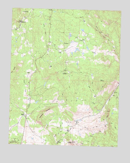
O'Neals, CA USGS Topographic Map
Click on map above to begin viewing in our Map Viewer.

This topographic map contains these locations and features:
Feature Name Type Latitude Longitude GNIS ID View Map
101 RanchLocaleN37.1477°W119.6729°1664803View Map
Bigelow RanchLocaleN37.1383°W119.6835°233503View Map
Blackhawk MountainSummitN37.1463°W119.7135°233514View Map
California Youth Authority CampLocaleN37.2372°W119.7402°1654443View Map
Carnation MineMineN37.2369°W119.6629°1670191View Map
Carter CreekStreamN37.1727°W119.6335°266541View Map
Coarse Gold Fire StationLocaleN37.2486°W119.7040°233694View Map
Coon CreekStreamN37.1461°W119.6379°266595View Map
Ecker RanchLocaleN37.2269°W119.6674°1670194View Map
Fine Gold CemeteryCemeteryN37.1744°W119.6298°233877View Map
Green School (historical)SchoolN37.1458°W119.7402°1670196View Map
House RanchLocaleN37.1711°W119.6521°234046View Map
Indian Lakes EstatesPopulated PlaceN37.2111°W119.6801°1812715View Map
Indian Lakes ParkParkN37.2127°W119.6754°1812716View Map
Kelshaw CornersLocaleN37.1516°W119.7343°234107View Map
Ladd CreekStreamN37.1644°W119.6390°234121View Map
Ladd RanchLocaleN37.1588°W119.6454°1670198View Map
Lewis RanchLocaleN37.1966°W119.7060°234156View Map
Madera County Fire Department Station 17 O'Neals Volunteer Fire DepartmentBuildingN37.1279°W119.6953°2624573View Map
Madera County Fire Department Station 8BuildingN37.2120°W119.6899°2623933View Map
Magnet (historical)Populated PlaceN37.1522°W119.6615°1812718View Map
Mercer MountainSummitN37.1277°W119.6788°234278View Map
Narbo (historical)Populated PlaceN37.2172°W119.7013°1812721View Map
O'NealsPopulated PlaceN37.1283°W119.6943°234396View Map
O'Neals Post OfficePost OfficeN37.1281°W119.6952°2789144View Map
Picayune CemeteryCemeteryN37.2102°W119.6938°234457View Map
Picayune CreekStreamN37.2199°W119.7110°234458View Map
Picayune RancheriaCivilN37.2115°W119.7007°1670201View Map
Quartz MineMineN37.1941°W119.6896°234525View Map
Quartz MountainSummitN37.1908°W119.6863°234526View Map
Revis MountainSummitN37.1944°W119.7460°1659788View Map
Rosedale RanchLocaleN37.1905°W119.7324°234590View Map
Sierra Ambulance Service Coarsegold StationBuildingN37.2180°W119.7047°2662303View Map
State of CaliforniaCivilN37.2153°W119.6638°1779778View Map
Trabuco MountainSummitN37.2469°W119.7377°268369View Map
Veater RanchLocaleN37.2402°W119.6696°237041View Map
Ward MountainSummitN37.1858°W119.6482°237229View Map
Willow Glen (historical)Populated PlaceN37.2119°W119.7082°1812734View Map
Yosemite South CampLocaleN37.2447°W119.7071°1812739View Map

Note: Coordinates in the location and feature list above are referenced to NAD83 datum.


Copyright (C) 2008-2025 Ryan Niemi / Sunset Dynamics ... All Rights Reserved