TopoQuest Logo
Do you find TopoQuest useful?
Help keep TopoQuest running and adding new maps/features by donating!
Bitcoin:  19c7KJd3qBynnjoSw5npx9KScwjBe4ifkT
Litecoin:  LXs6TkuXGGXo1vDsWCkWVdjQX94eUKd6ui
Home View Maps Find Maps Find Places Resources & Links


Knoxville, California Topographic Map

USGS Map Title: Knoxville, CA
USGS Map MRC: 38122G3
DRG (GeoTIFF) Download: o38122g3.tif


Neighboring USGS Topographic Map Quads:


  Wilson Valley, CA  
38122H4
 

  Glascock Mountain, CA  
38122H3
 

  Rumsey, CA  
38122H2
 

  Jericho Valley, CA  
38122G4
 

  Knoxville, CA  
38122G3
 

  Guinda, CA  
38122G2
 

  Aetna Springs, CA  
38122F4
 

  Walter Springs, CA  
38122F3
 

  Brooks, CA  
38122F2


Map MRC Location:

N39°
W123°
N39°
W122°
H8 H7 H6 H5 H4 H3 H2 H1
G8 G7 G6 G5 G4 G3 G2 G1
F8 F7 F6 F5 F4 F3 F2 F1
E8 E7 E6 E5 E4 E3 E2 E1
D8 D7 D6 D5 D4 D3 D2 D1
C8 C7 C6 C5 C4 C3 C2 C1
B8 B7 B6 B5 B4 B3 B2 B1
A8 A7 A6 A5 A4 A3 A2 A1
N38°
W123°
N38°
W122°

Knoxville, CA USGS 1:24K Topographic Map Preview:
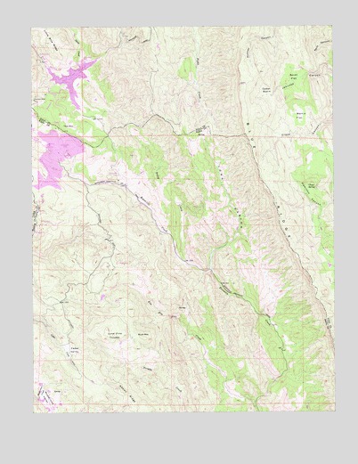
Knoxville, CA USGS Topographic Map
Click on map above to begin viewing in our Map Viewer.

This topographic map contains these locations and features:
Feature Name Type Latitude Longitude GNIS ID View Map
Adams RidgeRidgeN38.7516°W122.3344°217976View Map
Blue RidgeRidgeN38.8277°W122.2822°233525View Map
Buck MountainSummitN38.7741°W122.3308°1658152View Map
Cedar BasinBasinN38.8541°W122.2794°220752View Map
Cedar ValleyBasinN38.7707°W122.3614°220803View Map
Clapp SpringSpringN38.8224°W122.2616°221143View Map
Foley CreekStreamN38.7988°W122.3144°223646View Map
Harrison MineMineN38.8513°W122.3750°224968View Map
KnoxvillePopulated PlaceN38.8277°W122.3405°1658918View Map
Knoxville CreekStreamN38.7955°W122.3025°226665View Map
Lone Pine ThicketWoodsN38.7749°W122.3425°227511View Map
Long CanyonValleyN38.7966°W122.3028°227547View Map
Martin FlatFlatN38.8457°W122.2653°228172View Map
McLaughlin MineMineN38.8380°W122.3650°228012View Map
Mysterious ValleyValleyN38.7546°W122.3736°234349View Map
Mysterious Valley AirportAirportN38.7518°W122.3687°1653838View Map
Reed MineMineN38.8649°W122.3716°231485View Map
Royal MineMineN38.8430°W122.3630°231992View Map
Smith FlatFlatN38.8580°W122.2653°233332View Map
Zim Zim CreekStreamN38.7538°W122.2839°238320View Map
Zim Zim Ranch (historical)LocaleN38.7535°W122.2850°1670262View Map

Note: Coordinates in the location and feature list above are referenced to NAD83 datum.


Copyright (C) 2008-2025 Ryan Niemi / Sunset Dynamics ... All Rights Reserved