TopoQuest Logo
Do you find TopoQuest useful?
Help keep TopoQuest running and adding new maps/features by donating!
Bitcoin:  19c7KJd3qBynnjoSw5npx9KScwjBe4ifkT
Litecoin:  LXs6TkuXGGXo1vDsWCkWVdjQX94eUKd6ui
Home View Maps Find Maps Find Places Resources & Links


Kokomo East, Indiana Topographic Map

USGS Map Title: Kokomo East, IN
USGS Map MRC: 40086D1
DRG (GeoTIFF) Download: o40086d1.tif


Neighboring USGS Topographic Map Quads:


  Galveston, IN  
40086E2
 

  Miami, IN  
40086E1
 

  Amboy, IN  
40085E8
 

  Kokomo West, IN  
40086D2
 

  Kokomo East, IN  
40086D1
 

  Greentown, IN  
40085D8
 

  Kempton, IN  
40086C2
 

  Tipton, IN  
40086C1
 

  Windfall, IN  
40085C8


Map MRC Location:

N41°
W87°
N41°
W86°
H8 H7 H6 H5 H4 H3 H2 H1
G8 G7 G6 G5 G4 G3 G2 G1
F8 F7 F6 F5 F4 F3 F2 F1
E8 E7 E6 E5 E4 E3 E2 E1
D8 D7 D6 D5 D4 D3 D2 D1
C8 C7 C6 C5 C4 C3 C2 C1
B8 B7 B6 B5 B4 B3 B2 B1
A8 A7 A6 A5 A4 A3 A2 A1
N40°
W87°
N40°
W86°

Kokomo East, IN USGS 1:24K Topographic Map Preview:
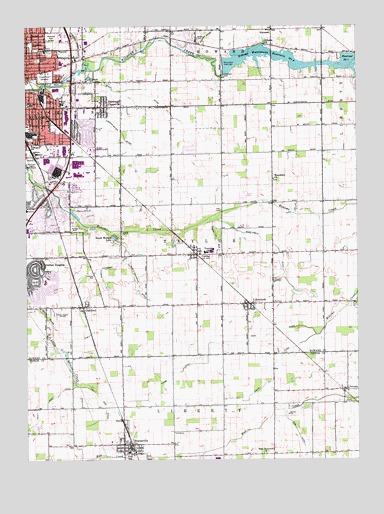
Kokomo East, IN USGS Topographic Map
Click on map above to begin viewing in our Map Viewer.

This topographic map contains these locations and features:
Feature Name Type Latitude Longitude GNIS ID View Map
Albright CemeteryCemeteryN40.4414°W86.1055°430047View Map
American Legion Golf CourseLocaleN40.4592°W86.1228°452280View Map
Cannon-Goyer DitchCanalN40.4692°W86.0883°432114View Map
CenterPopulated PlaceN40.4345°W86.0605°449634View Map
Copper DitchCanalN40.4959°W86.0583°432956View Map
Crown Point CemeteryCemeteryN40.4855°W86.1184°433218View Map
Darrough ChapelPopulated PlaceN40.4786°W86.0955°433322View Map
East Hopewell ChurchChurchN40.3767°W86.0358°433912View Map
East Taylor Township Fire RescueBuildingN40.4337°W86.0532°2625577View Map
Elwood Haynes Elementary SchoolSchoolN40.4778°W86.1108°435925View Map
Finn DitchCanalN40.4114°W86.0330°434494View Map
HemlockPopulated PlaceN40.4200°W86.0414°436002View Map
Hillsdale ChurchChurchN40.4945°W86.0342°436219View Map
Hopewell CemeteryCemeteryN40.4858°W86.0500°436452View Map
Howard CountyCivilN40.4836°W86.1169°450360View Map
Indian Heights Census Designated Place (historical)CensusN40.4248°W86.1176°2393062View Map
Jefferson SchoolSchoolN40.4659°W86.1228°436972View Map
Kelly East DitchCanalN40.3964°W86.0953°437226View Map
Kokomo Fire Department Station 2BuildingN40.4337°W86.1234°2701437View Map
Kokomo Fire Department Station 6BuildingN40.4622°W86.1092°2626502View Map
Kokomo MallLocaleN40.4542°W86.1094°449437View Map
Kokomo Memorial ParkCemeteryN40.4973°W86.1161°438994View Map
Kokomo Reservoir Number OneReservoirN40.4904°W86.0033°441906View Map
Kokomo Waterworks Dam Number 2DamN40.4898°W86.0505°447077View Map
Kokomo Waterworks Reservoir Number TwoReservoirN40.4886°W86.0196°437428View Map
Macedonia ChurchChurchN40.4559°W86.0317°438455View Map
Martin-Youngman DitchCanalN40.4314°W86.0908°438679View Map
Medallion Field (historical)AirportN40.4803°W86.0372°449233View Map
Mugg-Ingels DitchCanalN40.4361°W86.0300°439863View Map
NevadaPopulated PlaceN40.3953°W86.0042°440011View Map
North CreekStreamN40.3773°W86.0578°440240View Map
OakfordPopulated PlaceN40.4192°W86.1042°440462View Map
Poff CemeteryCemeteryN40.4469°W86.0512°441385View Map
Ross DitchCanalN40.3828°W86.0228°442322View Map
Saint Joan of Arc SchoolSchoolN40.4781°W86.1236°442554View Map
Salem CemeteryCemeteryN40.4966°W86.0599°442889View Map
Salsbery AirportAirportN40.3850°W86.0620°2677066View Map
Scott-Youngman DitchCanalN40.4264°W86.0836°443157View Map
SharpsvillePopulated PlaceN40.3795°W86.0886°443313View Map
Sharpsville Community Ambulance ServiceBuildingN40.3787°W86.0868°2719379View Map
Sharpsville Police DepartmentBuildingN40.3789°W86.0861°2758085View Map
Sharpsville Volunteer Fire DepartmentBuildingN40.3788°W86.0868°2625501View Map
Sharpville-Prairie Elementary SchoolSchoolN40.3770°W86.0869°447584View Map
Somers ParkParkN40.4909°W86.1203°443763View Map
Stahl DitchCanalN40.4789°W86.0792°444049View Map
Studebaker ParkParkN40.4950°W86.1230°444294View Map
Sycamore PlazaLocaleN40.4889°W86.1111°449438View Map
Taylor Elementary SchoolSchoolN40.4348°W86.0568°447058View Map
Taylor High SchoolSchoolN40.4357°W86.0547°447059View Map
Taylor RunStreamN40.4448°W86.0558°444605View Map
Tolle DitchCanalN40.4109°W86.0158°444803View Map
Town of SharpsvilleCivilN40.3795°W86.0869°2397653View Map
Township of TaylorCivilN40.4351°W86.0521°453891View Map
Tri Central Junior-Senior High SchoolSchoolN40.3753°W86.0536°447585View Map
VermontPopulated PlaceN40.4992°W86.0319°445252View Map
WIOU-AM (Kokomo)TowerN40.4167°W86.1136°448432View Map
WWKI-FM (Kokomo)TowerN40.4511°W86.0367°449002View Map
Zauss DitchCanalN40.4028°W86.0592°446427View Map

Note: Coordinates in the location and feature list above are referenced to NAD83 datum.


Copyright (C) 2008-2024 Ryan Niemi / Sunset Dynamics ... All Rights Reserved