TopoQuest Logo
Do you find TopoQuest useful?
Help keep TopoQuest running and adding new maps/features by donating!
Bitcoin:  19c7KJd3qBynnjoSw5npx9KScwjBe4ifkT
Litecoin:  LXs6TkuXGGXo1vDsWCkWVdjQX94eUKd6ui
Home View Maps Find Maps Find Places Resources & Links


Kokomo West, Indiana Topographic Map

USGS Map Title: Kokomo West, IN
USGS Map MRC: 40086D2
DRG (GeoTIFF) Download: o40086d2.tif


Neighboring USGS Topographic Map Quads:


  Young America, IN  
40086E3
 

  Galveston, IN  
40086E2
 

  Miami, IN  
40086E1
 

  Russiaville, IN  
40086D3
 

  Kokomo West, IN  
40086D2
 

  Kokomo East, IN  
40086D1
 

  Hillisburg, IN  
40086C3
 

  Kempton, IN  
40086C2
 

  Tipton, IN  
40086C1


Map MRC Location:

N41°
W87°
N41°
W86°
H8 H7 H6 H5 H4 H3 H2 H1
G8 G7 G6 G5 G4 G3 G2 G1
F8 F7 F6 F5 F4 F3 F2 F1
E8 E7 E6 E5 E4 E3 E2 E1
D8 D7 D6 D5 D4 D3 D2 D1
C8 C7 C6 C5 C4 C3 C2 C1
B8 B7 B6 B5 B4 B3 B2 B1
A8 A7 A6 A5 A4 A3 A2 A1
N40°
W87°
N40°
W86°

Kokomo West, IN USGS 1:24K Topographic Map Preview:
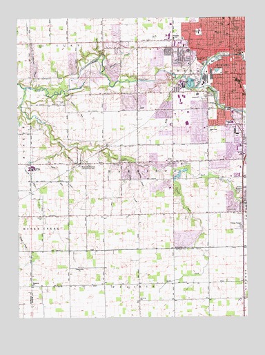
Kokomo West, IN USGS Topographic Map
Click on map above to begin viewing in our Map Viewer.

This topographic map contains these locations and features:
Feature Name Type Latitude Longitude GNIS ID View Map
AltoPopulated PlaceN40.4400°W86.1655°430122View Map
American Legion Golf CourseLocaleN40.4573°W86.1258°452281View Map
Americare Ambulance Service - KokomoBuildingN40.4738°W86.1423°2719424View Map
Butler DitchCanalN40.4275°W86.2175°431902View Map
Central SchoolSchoolN40.4861°W86.1278°432370View Map
City of KokomoCivilN40.4639°W86.1277°2395560View Map
Claw CreekStreamN40.4409°W86.1897°432582View Map
Columbian Elementary SchoolSchoolN40.4978°W86.1367°432824View Map
Community Howard Regional Health HospitalHospitalN40.4469°W86.1257°437427View Map
Community Howard Specialty HospitalHospitalN40.4972°W86.1658°2660487View Map
East Fork Little Wildcat CreekStreamN40.4378°W86.1664°433893View Map
Edwards DitchCanalN40.4867°W86.1875°434032View Map
Foster ParkParkN40.4842°W86.1394°434704View Map
Glenndale AirportAirportN40.4277°W86.2020°449385View Map
Hallihan DitchCanalN40.4928°W86.2442°435619View Map
Harrison Township Fire DepartmentBuildingN40.4389°W86.1645°2625541View Map
Highland ParkParkN40.4664°W86.1405°436169View Map
Howard County Sheriff's OfficeBuildingN40.4770°W86.1566°2758182View Map
Howard Regional Health System Behavioral Health HospitalBuildingN40.4890°W86.1309°2660499View Map
Indian HeightsPopulated PlaceN40.4273°W86.1255°436762View Map
Indian Hills Flying FieldAirportN40.4177°W86.1546°2676899View Map
Kelly West DitchCanalN40.3820°W86.1289°437229View Map
Kitty RunStreamN40.4764°W86.1655°437371View Map
KokomoPopulated PlaceN40.4864°W86.1336°437425View Map
Kokomo CreekStreamN40.4706°W86.1525°437426View Map
Kokomo Fire DepartmentBuildingN40.4852°W86.1330°2701438View Map
Kokomo Fire Department Station 1BuildingN40.4852°W86.1329°2625675View Map
Kokomo Fire Department Station 4BuildingN40.4454°W86.1645°2626500View Map
Kokomo Fire Department Station 5BuildingN40.4881°W86.1762°2626501View Map
Kokomo High SchoolSchoolN40.4850°W86.1283°447063View Map
Lafayette Elementary-Middle SchoolSchoolN40.4942°W86.1508°437506View Map
Lincoln Elementary SchoolSchoolN40.4895°W86.1392°437933View Map
Little Wildcat CreekStreamN40.4709°W86.2469°438176View Map
Lynn ChurchChurchN40.4167°W86.2375°438431View Map
Lynn RunStreamN40.4420°W86.2336°438434View Map
Maple Crest ChurchChurchN40.4528°W86.1453°438543View Map
Maple Crest Elementary and Middle SchoolSchoolN40.4559°W86.1333°438544View Map
Mount Zion ChurchChurchN40.4392°W86.1944°439769View Map
Palmer Elementary SchoolSchoolN40.4770°W86.1369°440847View Map
Personal Care Ambulance TransportBuildingN40.4421°W86.1296°2719314View Map
Pettit Park Elementary SchoolSchoolN40.4936°W86.1417°447062View Map
Pettit Park SchoolSchoolN40.4942°W86.1414°452249View Map
Prairieville ChurchChurchN40.3959°W86.2172°441564View Map
R and M FarmsLocaleN40.3778°W86.1678°2650297View Map
Reed DitchCanalN40.4273°W86.1997°441852View Map
Reserve ChurchChurchN40.3886°W86.2431°441905View Map
Ruzicka Airport (historical)AirportN40.4334°W86.1833°449232View Map
Ruzicka DrainStreamN40.4384°W86.1847°442428View Map
Saint Elizabeth Ann Seton Hospital KokomoHospitalN40.4864°W86.1562°2718865View Map
Saint Vincent Kokomo HospitalHospitalN40.4861°W86.1566°2660492View Map
Shambaugh RunStreamN40.4753°W86.1603°443274View Map
Shambaugh SidingPopulated PlaceN40.4828°W86.1528°443276View Map
Shiloh ChurchChurchN40.4892°W86.2389°443403View Map
Spring RunStreamN40.4678°W86.2242°444000View Map
Sunset Memory GardensCemeteryN40.4392°W86.1583°444428View Map
Taylor Township Fire and RescueBuildingN40.4296°W86.1252°2625767View Map
Taylor Township Fire DepartmentBuildingN40.4296°W86.1253°2701436View Map
Township of CenterCivilN40.4833°W86.1364°453182View Map
Township of HarrisonCivilN40.4352°W86.1872°453389View Map
Trinity Temple ChurchChurchN40.4134°W86.1283°444911View Map
Twin Springs CemeteryCemeteryN40.4649°W86.2244°445023View Map
Villa RunStreamN40.4848°W86.2042°445292View Map
Wallace Elementary SchoolSchoolN40.4917°W86.1647°445396View Map
Washington Elementary SchoolSchoolN40.4692°W86.1333°447057View Map
West Fork Little Wildcat CreekStreamN40.4378°W86.1664°445755View Map
West MiddletonPopulated PlaceN40.4395°W86.2161°445790View Map
Western Elementary SchoolSchoolN40.4367°W86.2422°447056View Map
Western High SchoolSchoolN40.4379°W86.2415°445831View Map
WHSK-FM (Kokomo)TowerN40.4567°W86.1567°448999View Map
William Vogus DitchCanalN40.4253°W86.2383°446055View Map
WZWZ-FM (Kokomo)TowerN40.4717°W86.1644°449001View Map
Yeoman Stone QuarryMineN40.4731°W86.1722°2649821View Map

Note: Coordinates in the location and feature list above are referenced to NAD83 datum.


Copyright (C) 2008-2024 Ryan Niemi / Sunset Dynamics ... All Rights Reserved