TopoQuest Logo
Do you find TopoQuest useful?
Help keep TopoQuest running and adding new maps/features by donating!
Bitcoin:  19c7KJd3qBynnjoSw5npx9KScwjBe4ifkT
Litecoin:  LXs6TkuXGGXo1vDsWCkWVdjQX94eUKd6ui
Home View Maps Find Maps Find Places Resources & Links


Miami, Indiana Topographic Map

USGS Map Title: Miami, IN
USGS Map MRC: 40086E1
DRG (GeoTIFF) Download: o40086e1.tif


Neighboring USGS Topographic Map Quads:


  Onward, IN  
40086F2
 

  Bunker Hill, IN  
40086F1
 

  Peoria, IN  
40085F8
 

  Galveston, IN  
40086E2
 

  Miami, IN  
40086E1
 

  Amboy, IN  
40085E8
 

  Kokomo West, IN  
40086D2
 

  Kokomo East, IN  
40086D1
 

  Greentown, IN  
40085D8


Map MRC Location:

N41°
W87°
N41°
W86°
H8 H7 H6 H5 H4 H3 H2 H1
G8 G7 G6 G5 G4 G3 G2 G1
F8 F7 F6 F5 F4 F3 F2 F1
E8 E7 E6 E5 E4 E3 E2 E1
D8 D7 D6 D5 D4 D3 D2 D1
C8 C7 C6 C5 C4 C3 C2 C1
B8 B7 B6 B5 B4 B3 B2 B1
A8 A7 A6 A5 A4 A3 A2 A1
N40°
W87°
N40°
W86°

Miami, IN USGS 1:24K Topographic Map Preview:
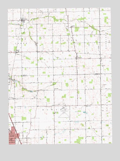
Miami, IN USGS Topographic Map
Click on map above to begin viewing in our Map Viewer.

This topographic map contains these locations and features:
Feature Name Type Latitude Longitude GNIS ID View Map
Bennetts SwitchPopulated PlaceN40.5850°W86.1128°430817View Map
Bon Air Elementary and Middle SchoolSchoolN40.5139°W86.1247°431311View Map
Bon Air ParkParkN40.5114°W86.1239°431310View Map
CassvillePopulated PlaceN40.5600°W86.1228°432221View Map
Chitick CemeteryCemeteryN40.5911°W86.0899°432484View Map
Climer CemeteryCemeteryN40.6079°W86.0521°432664View Map
Copper CreekStreamN40.6034°W86.0142°432955View Map
Coucher DitchCanalN40.6042°W86.1050°433025View Map
Dorflingers Airport (historical)AirportN40.5737°W86.1036°449297View Map
Grinslade DitchCanalN40.5812°W86.0686°435512View Map
Hershberger CemeteryCemeteryN40.5720°W86.0119°436064View Map
Hochstedler CemeteryCemeteryN40.5539°W86.0102°436265View Map
Hudson CemeteryCemeteryN40.5425°W86.0933°436572View Map
Jenkins DitchCanalN40.6245°W86.0867°436985View Map
Klise DitchCanalN40.6245°W86.0697°437377View Map
Kokomo Municipal AirportAirportN40.5334°W86.0577°449235View Map
Kokomo Zion ChurchChurchN40.5353°W86.0311°437429View Map
Mast-Hensler CemeteryCemeteryN40.5303°W86.0128°438706View Map
Matthew Anaker DitchCanalN40.5564°W86.0678°438728View Map
MiamiPopulated PlaceN40.6142°W86.1064°439066View Map
Miller DitchCanalN40.5953°W86.0289°439202View Map
Rich Valley ChurchChurchN40.5498°W86.0697°441948View Map
Riley SchoolSchoolN40.5042°W86.1236°442034View Map
Shrock DitchCanalN40.6006°W86.0500°443461View Map
Township of ClayCivilN40.6071°W86.0518°453214View Map
Township of HowardCivilN40.5244°W86.0623°453419View Map
W N Henderson DitchCanalN40.5428°W86.1150°445324View Map
WawpecongPopulated PlaceN40.5784°W86.0422°445571View Map
Wise DitchCanalN40.5884°W86.0905°446208View Map

Note: Coordinates in the location and feature list above are referenced to NAD83 datum.


Copyright (C) 2008-2024 Ryan Niemi / Sunset Dynamics ... All Rights Reserved