TopoQuest Logo
Do you find TopoQuest useful?
Help keep TopoQuest running and adding new maps/features by donating!
Bitcoin:  19c7KJd3qBynnjoSw5npx9KScwjBe4ifkT
Litecoin:  LXs6TkuXGGXo1vDsWCkWVdjQX94eUKd6ui
Home View Maps Find Maps Find Places Resources & Links


Kempton, Indiana Topographic Map

USGS Map Title: Kempton, IN
USGS Map MRC: 40086C2
DRG (GeoTIFF) Download: o40086c2.tif


Neighboring USGS Topographic Map Quads:


  Russiaville, IN  
40086D3
 

  Kokomo West, IN  
40086D2
 

  Kokomo East, IN  
40086D1
 

  Hillisburg, IN  
40086C3
 

  Kempton, IN  
40086C2
 

  Tipton, IN  
40086C1
 

  Kirklin, IN  
40086B3
 

  Sheridan, IN  
40086B2
 

  Arcadia, IN  
40086B1


Map MRC Location:

N41°
W87°
N41°
W86°
H8 H7 H6 H5 H4 H3 H2 H1
G8 G7 G6 G5 G4 G3 G2 G1
F8 F7 F6 F5 F4 F3 F2 F1
E8 E7 E6 E5 E4 E3 E2 E1
D8 D7 D6 D5 D4 D3 D2 D1
C8 C7 C6 C5 C4 C3 C2 C1
B8 B7 B6 B5 B4 B3 B2 B1
A8 A7 A6 A5 A4 A3 A2 A1
N40°
W87°
N40°
W86°

Kempton, IN USGS 1:24K Topographic Map Preview:
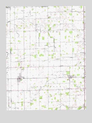
Kempton, IN USGS Topographic Map
Click on map above to begin viewing in our Map Viewer.

This topographic map contains these locations and features:
Feature Name Type Latitude Longitude GNIS ID View Map
Barr DitchCanalN40.3261°W86.1830°430520View Map
Bethel ChurchChurchN40.3461°W86.1836°430937View Map
Broad CreekStreamN40.3634°W86.1272°431540View Map
Carter DitchCanalN40.3667°W86.2122°432188View Map
Collier DitchCanalN40.3625°W86.2139°432787View Map
Cox DitchCanalN40.2503°W86.1367°433065View Map
Crum DitchCanalN40.2759°W86.1969°433223View Map
Fernung FarmsLocaleN40.2919°W86.1253°2650344View Map
Floyd DitchCanalN40.2925°W86.2478°430146View Map
GoldsmithPopulated PlaceN40.2895°W86.1492°435162View Map
GroomsvillePopulated PlaceN40.3459°W86.2028°435519View Map
Hopewell ChurchChurchN40.3178°W86.1264°436462View Map
Kemp DitchCanalN40.2920°W86.1750°437232View Map
KemptonPopulated PlaceN40.2884°W86.2297°437234View Map
Kempton CemeteryCemeteryN40.2989°W86.2258°437235View Map
Kempton Fire and Rescue DepartmentBuildingN40.2851°W86.2297°2626408View Map
Kempton Police DepartmentBuildingN40.2868°W86.2289°2758370View Map
Kigin DitchCanalN40.2525°W86.1697°437291View Map
Liberty ChurchChurchN40.3528°W86.2042°437838View Map
Lydy-Fillenworth DitchCanalN40.3478°W86.2325°434478View Map
Magnet DitchCanalN40.2614°W86.2097°438475View Map
Mott DitchCanalN40.3175°W86.2297°439508View Map
Mount Lebanon ChurchChurchN40.3700°W86.1461°439596View Map
Mount Olive ChurchChurchN40.3695°W86.2222°439629View Map
NormandaPopulated PlaceN40.3025°W86.1647°440204View Map
Normanda CemeteryCemeteryN40.3110°W86.1688°440205View Map
R Hog FarmLocaleN40.3558°W86.2036°2710724View Map
Shanty CreekStreamN40.3570°W86.2433°443289View Map
TetersburgPopulated PlaceN40.2753°W86.1511°444655View Map
Town of KemptonCivilN40.2877°W86.2297°2397013View Map
Township of JeffersonCivilN40.2632°W86.1849°453500View Map
Township of PrairieCivilN40.3565°W86.1849°453771View Map
Tucker CemeteryCemeteryN40.2730°W86.1278°444938View Map
Wolford CemeteryCemeteryN40.2867°W86.1522°446261View Map
Yazel DitchCanalN40.3131°W86.2497°446371View Map

Note: Coordinates in the location and feature list above are referenced to NAD83 datum.


Copyright (C) 2008-2024 Ryan Niemi / Sunset Dynamics ... All Rights Reserved